MyTopo
Bakers Mills New York US Topo Map
Couldn't load pickup availability
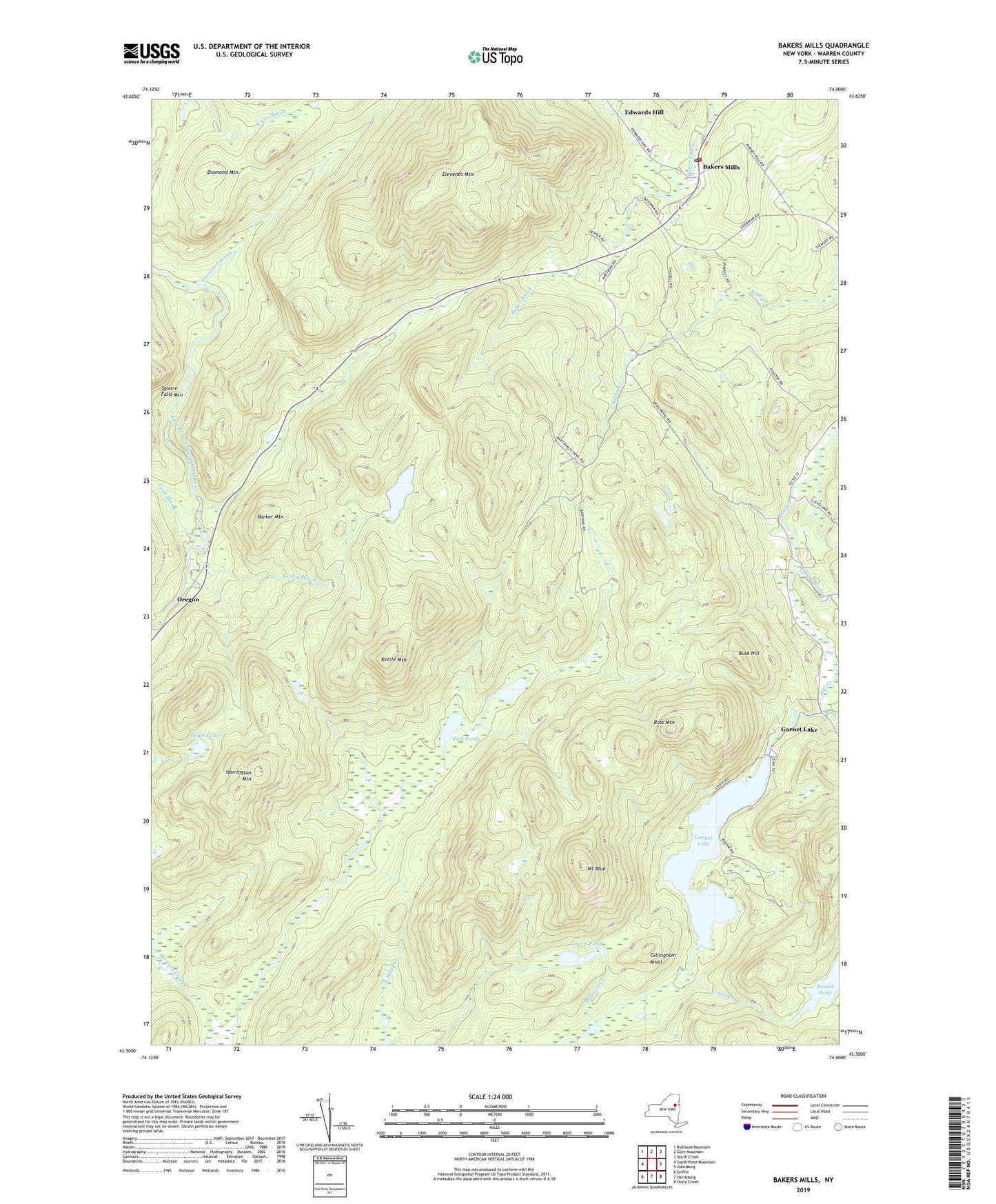
2023 topographic map quadrangle Bakers Mills in the state of New York. Scale: 1:24000. Based on the newly updated USGS 7.5' US Topo map series, this map is in the following counties: Warren. The map contains contour data, water features, and other items you are used to seeing on USGS maps, but also has updated roads and other features. This is the next generation of topographic maps. Printed on high-quality waterproof paper with UV fade-resistant inks.
Quads adjacent to this one:
West: South Pond Mountain
Northwest: Bullhead Mountain
North: Gore Mountain
Northeast: North Creek
East: Johnsburg
Southeast: Stony Creek
South: Harrisburg
Southwest: Griffin
This map covers the same area as the classic USGS quad with code k43074e1.
Contains the following named places: Baker Mills - Sodom Volunteer Fire Department, Bakers Mills, Bakers Mills Post Office, Barker Mountain, Buck Hill, Cook Brook, Diamond Brook, Diamond Mountain, Eagle Pond, Eleventh Mountain, Fish Ponds, Garnet Lake, Gillingham Knoll, Harrington Mountain, Kettle Mountain, Kibby Brook, Kibby Pond, Lizard Pond, Mount Blue, Oregon, Oregon Trail, Pine Ridge Brook, Putnam Brook, Ross Mountain, Round Pond, ZIP Code: 12811