MyTopo
Highland Lake New York US Topo Map
Couldn't load pickup availability
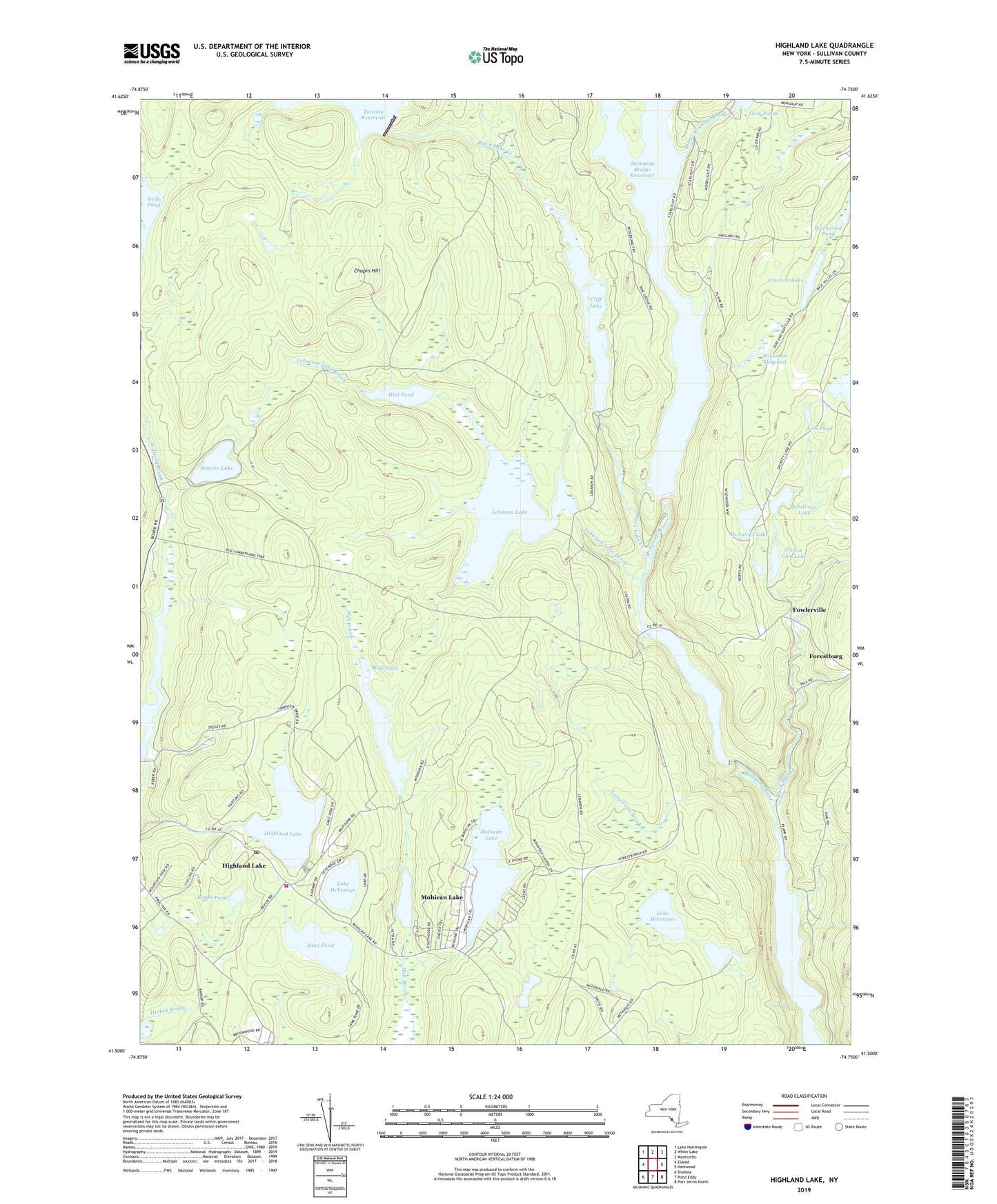
2019 topographic map quadrangle Highland Lake in the state of New York. Scale: 1:24000. Based on the newly updated USGS 7.5' US Topo map series, this map is in the following counties: Sullivan. The map contains contour data, water features, and other items you are used to seeing on USGS maps, but also has updated roads and other features. This is the next generation of topographic maps. Printed on high-quality waterproof paper with UV fade-resistant inks.
Quads adjacent to this one:
West: Eldred
Northwest: Lake Huntington
North: White Lake
Northeast: Monticello
East: Hartwood
Southeast: Port Jervis North
South: Pond Eddy
Southwest: Shohola
Contains the following named places: Beaver Pond, Birchwood Pond, Black Brook, Black Lake Creek, Boyds Pond, Burnt Meadow Brook, Chapin Hill, Cliff Lake, Cordes Chapel, Crescent Lake, Forest Glen Lake, Forestburg, Fowlerville, Hemp Meadow Brook, Highland Lake, Highland Lake Post Office, Highland Lake Volunteer Fire Department, Hull Pond, Lake Champion, Lake DeVenoge, Lake Metauque, Lebanon Lake, Lebanon Lake Brook, Lees Pond, Long Falls Brook, McAuleys Lake, Mohican Lake, Mongaup Falls Reservoir, Mud Pond, Saint Bernadine Church, Saint Thomas Aquinas Church, Sand Pond, Schillings Lake, Sidwell Lake, Sunrise Lake, Swinging Bridge Reservoir, Twin Ponds, Wells Pond, White Lake Brook, Wickman Millpond, ZIP Codes: 12732, 12737, 12743