MyTopo
Pond Eddy New York US Topo Map
Couldn't load pickup availability
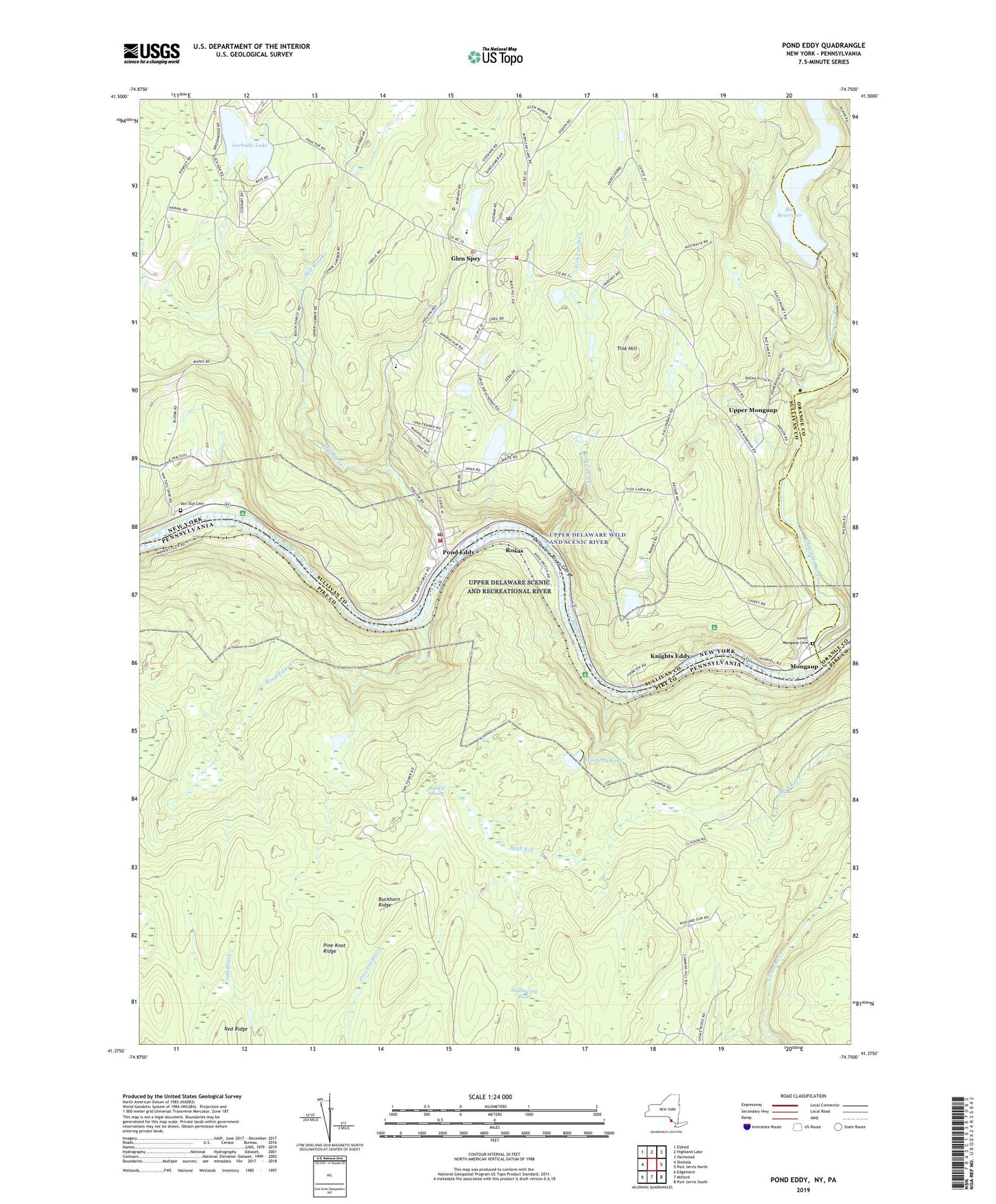
2023 topographic map quadrangle Pond Eddy in the states of New York, Pennsylvania. Scale: 1:24000. Based on the newly updated USGS 7.5' US Topo map series, this map is in the following counties: Sullivan, Pike, Orange. The map contains contour data, water features, and other items you are used to seeing on USGS maps, but also has updated roads and other features. This is the next generation of topographic maps. Printed on high-quality waterproof paper with UV fade-resistant inks.
Quads adjacent to this one:
West: Shohola
Northwest: Eldred
North: Highland Lake
Northeast: Hartwood
East: Port Jervis North
South: Milford
Southwest: Edgemere
Contains the following named places: Buckhorn Natural Area, Buckhorn Ridge, Buckhorn Ridge Fire Tower, Bush Kill, Bushkill Swamp, Fish Cabin Creek, George Ross MacKenzie Elementary School, Glen Spey, Glen Spey Post Office, Homestead School, Knights Eddy, Lochada Lake, Lost Cabin Trail, Lower Mongaup Cemetery, Lumberland Volunteer Fire Department Station 1, Lumberland Volunteer Fire Department Station 2, Mill Brook, Mongaup, Mongaup River, Mongaup Station, Pine Knot Ridge, Pond Eddy, Pond Eddy Creek, Pond Eddy Post Office, Rio Reservoir, Rosas, Sacred Heart Church, Stairway Hunt Club Dam, Stairway Lake, State Game Lands Number 209, Tink Hill, Town of Lumberland, Township of Westfall, Upper Mongaup, Van Tuyl Cemetery, Wallowing Hole, ZIP Codes: 12770, 18340