MyTopo
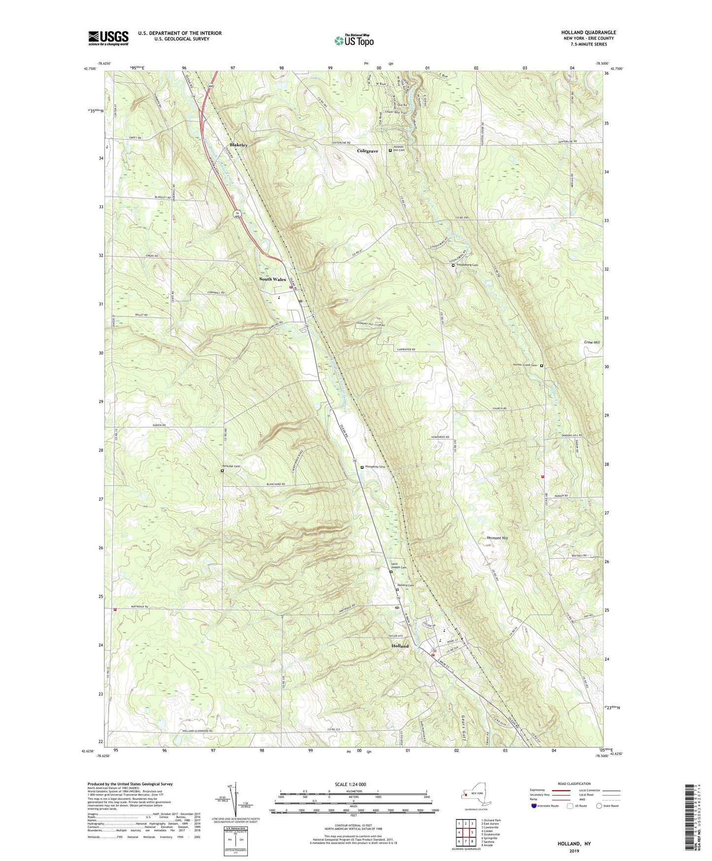
Holland New York US Topo Map
Couldn't load pickup availability
2019 topographic map quadrangle Holland in the state of New York. Scale: 1:24000. Based on the newly updated USGS 7.5' US Topo map series, this map is in the following counties: Erie. The map contains contour data, water features, and other items you are used to seeing on USGS maps, but also has updated roads and other features. This is the next generation of topographic maps. Printed on high-quality waterproof paper with UV fade-resistant inks.
Quads adjacent to this one:
West: Colden
Northwest: Orchard Park
North: East Aurora
Northeast: Cowlesville
East: Strykersville
Southeast: Arcade
South: Sardinia
Southwest: Springville
Contains the following named places: Aurora Mobile Home Park, Blakeley, Circle B Courts Mobile Home Park, Colden Fire District, Colegrave, East Aurora High School, Emery Park, Field Of Dreams Farm, First Baptist Church of Holland, Gears Gulf, Goodleberg Cemetery, Gow School, Harold O Brumsted Elementary School, Holland, Holland Cemetery, Holland Census Designated Place, Holland Fire District Station 1, Holland High School, Holland Hills Country Club, Holland Middle School, Holland Post Office, Holland Town Hall, Holland United Methodist Church, Holland Volunteer Fire Department, Holmes Hill Cemetery, Humphrey Cemetery, Hunter Creek Cemetery, Hunters Creek Bible Baptist Church, Kingdom Hall of Jehovah's Witnesses, Kramer Farms, Mountain Meadow Park Sewage Treatment Plant, Neischel Cemetery, New York State Police Troop A Zone 2 Holland Station, Poplar Corners, Saint Joseph Cemetery, Saint Joseph Roman Catholic Church, South Wales, South Wales Post Office, South Wales Presbyterian Church, South Wales Volunteer Fire Company, Town of Holland, Town of Wales, Vermont Hill, WGR-FM (Buffalo), WGRZ-TV (Buffalo), WKBW-TV (Buffalo), ZIP Codes: 14080, 14139