MyTopo
Sardinia New York US Topo Map
Couldn't load pickup availability
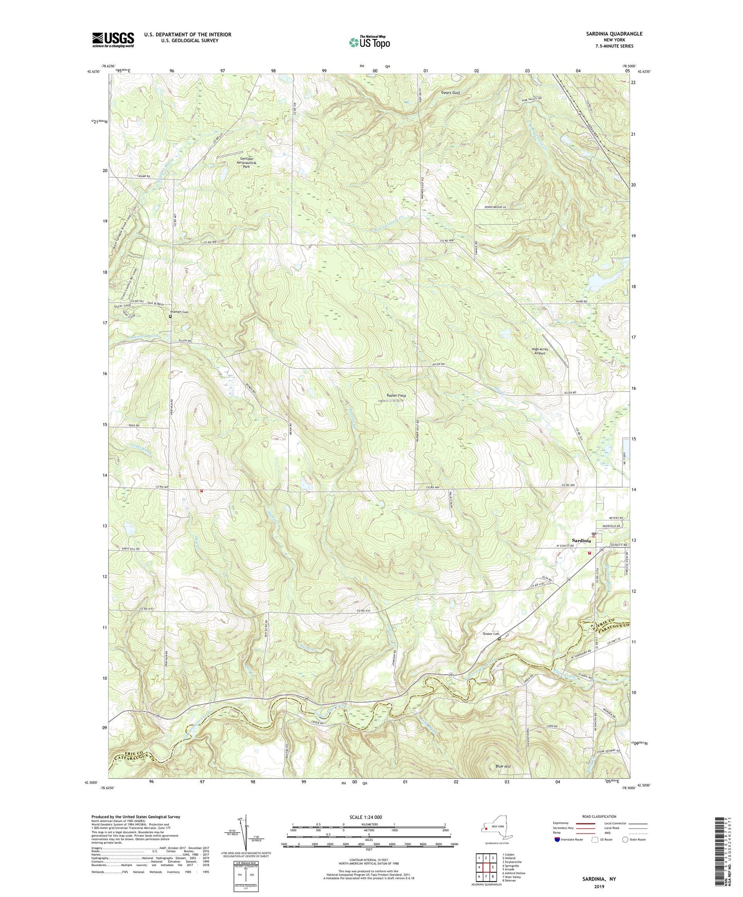
2023 topographic map quadrangle Sardinia in the state of New York. Scale: 1:24000. Based on the newly updated USGS 7.5' US Topo map series, this map is in the following counties: Erie, Cattaraugus. The map contains contour data, water features, and other items you are used to seeing on USGS maps, but also has updated roads and other features. This is the next generation of topographic maps. Printed on high-quality waterproof paper with UV fade-resistant inks.
Quads adjacent to this one:
West: Springville
Northwest: Colden
North: Holland
Northeast: Strykersville
East: Arcade
Southeast: Delevan
South: West Valley
Southwest: Ashford Hollow
This map covers the same area as the classic USGS quad with code o42078e5.
Contains the following named places: Basher Field, Blue Hill, Bray Farms, Camp Duffield, Camp Seven Hills, Camp Ti-Wa-Ya-Ee, Chaffee Sardinia Volunteer Fire Company Station 2, Chaffee Sardinia Volunteer Fire Company Station 3, Covenant Community Church, Dresser Creek, Dry Creek, Elton Creek, Erie County Reforestation Area, Gentzke Aeronautical Park, Gunbarrel Gulf, High Acres Airport, Hosmer Brook, Hyler Creek, Johnstons Corners, King Brook, Knox Landing, Otis Creek, Palmer Farms, Pratham Cemetery, Quaker Cemetery, Richmond Gulf, Saint Johns Church, Sardinia, Sardinia Church of Christ, Sardinia Post Office, Sardinia Town Hall, Sardinia United Methodist Church, Scott Corners, Shepards Corners, Sillimans Corners, Stony Creek, The Forks, Town of Sardinia, Tru-Blue Church, ZIP Codes: 14030, 14055, 14134