MyTopo
Johnsonburg New York US Topo Map
Couldn't load pickup availability
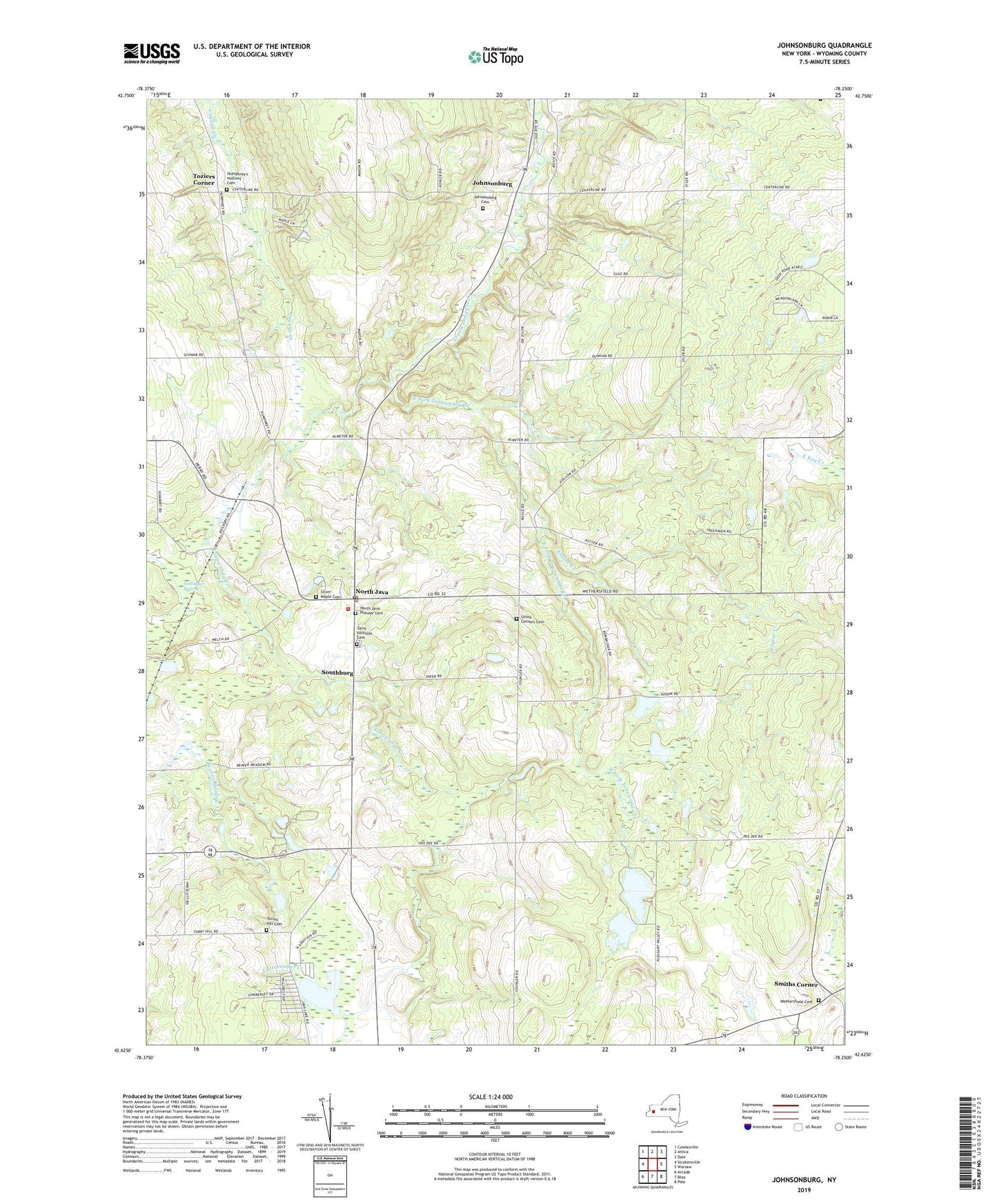
2019 topographic map quadrangle Johnsonburg in the state of New York. Scale: 1:24000. Based on the newly updated USGS 7.5' US Topo map series, this map is in the following counties: Wyoming. The map contains contour data, water features, and other items you are used to seeing on USGS maps, but also has updated roads and other features. This is the next generation of topographic maps. Printed on high-quality waterproof paper with UV fade-resistant inks.
Quads adjacent to this one:
West: Strykersville
Northwest: Cowlesville
North: Attica
Northeast: Dale
East: Warsaw
Southeast: Pike
South: Bliss
Southwest: Arcade
Contains the following named places: Camp Hickory Hill, East Fork Tonawanda Creek, Eastman Corners, Engine Creek, Faun Lake, Five Corners, Gallagher Swamp, Humphrey's Hollows Cemetery, Java Lake, Johnsonburg, Johnsonburg Cemetery, North Java, North Java Fire Department Station 1, North Java Pioneer Cemetery, North Java Post Office, North Java Station, Poplar Tree Corners, Roberts Roost Airport, Saint Nicholas Cemetery, Silver Maple Cemetery, Smiths Corner, Southburg, Torrey Hill Cemetery, Toziers Corner, Union Corners, Union Corners Cemetery, Wethersfield Cemetery, ZIP Codes: 14113, 14167