MyTopo
Jones Inlet New York US Topo Map
Couldn't load pickup availability
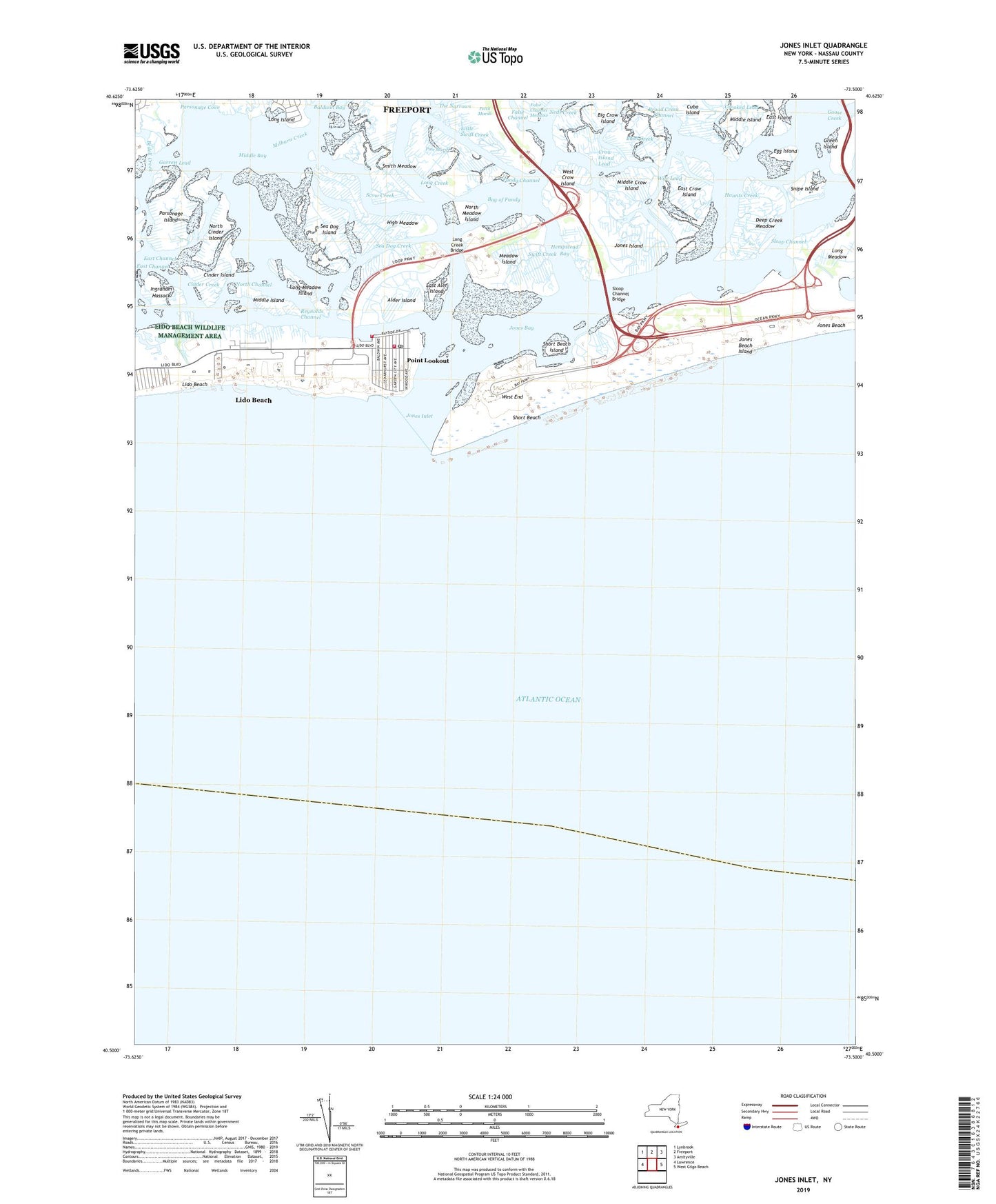
2019 topographic map quadrangle Jones Inlet in the state of New York. Scale: 1:24000. Based on the newly updated USGS 7.5' US Topo map series, this map is in the following counties: Nassau. The map contains contour data, water features, and other items you are used to seeing on USGS maps, but also has updated roads and other features. This is the next generation of topographic maps. Printed on high-quality waterproof paper with UV fade-resistant inks.
Quads adjacent to this one:
West: Lawrence
Northwest: Lynbrook
North: Freeport
Northeast: Amityville
East: West Gilgo Beach
Contains the following named places: Alder Island, Bay of Fundy, Bedell Creek, Big Crow Island, Broad Creek Channel, Bush Creek, Cinder Creek, Cinder Island, Coast Guard Station Jones Beach Freeport, Crooked Lead, Crow Island Lead, Cuba Island, Deep Creek Meadow, East Aler Island, East Crow Island, Egg Island, False Channel, Fundy Channel, Goose Creek, Goose Creek Bridge, Great Sand Creek, Green Island, Haunts Creek, Hempstead Bay, Hempstead Town Park, High Meadow, Ingraham Hassock, Jones Bay, Jones Beach, Jones Beach State Park, Jones Inlet, Jones Island, Lido and Point Lookout Fire District Action Engine Company 1, Lido and Point Lookout Fire District Ye Olde Firehouse, Lido Beach, Lido Beach Census Designated Place, Lido Beach Wildlife Management Area, Lido Boulevard Park, Long Creek, Long Creek Bridge, Long Meadow, Long Meadow Island, Marine Theater, Meadow Island, Middle Bay, Middle Crow Island, Middle Island, Nike Site NY-29/30L, North Channel, North Cinder Island, North Meadow Island, Our Lady of the Miraculous Medal Roman Catholic Church, Parsonage Island, Pettit Marsh, Pine Marsh, Point Lookout, Point Lookout Census Designated Place, Point Lookout Post Office, Renegade Hook and Ladder Company 2, Scow Creek, Sea Dog Creek, Sea Dog Island, Short Beach, Short Beach Island, Sloop Channel, Sloop Channel Bridge, Smith Meadow, Snipe Island, Swift Creek, The Community Church, West Crow Island, West End, Wife Lead, Zachs Bay, ZIP Code: 11569