MyTopo
West Gilgo Beach New York US Topo Map
Couldn't load pickup availability
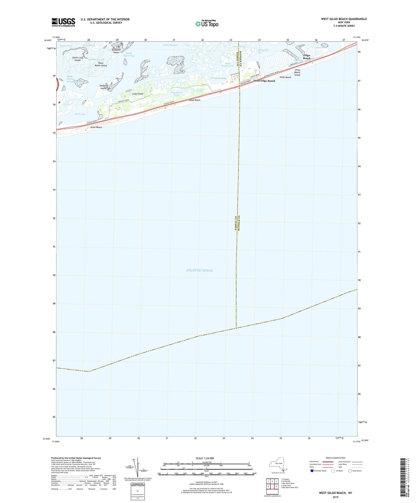
2023 topographic map quadrangle West Gilgo Beach in the state of New York. Scale: 1:24000. Based on the newly updated USGS 7.5' US Topo map series, this map is in the following counties: Nassau, Suffolk. The map contains contour data, water features, and other items you are used to seeing on USGS maps, but also has updated roads and other features. This is the next generation of topographic maps. Printed on high-quality waterproof paper with UV fade-resistant inks.
Quads adjacent to this one:
West: Jones Inlet
Northwest: Freeport
North: Amityville
Northeast: Bay Shore West
East: Bay Shore West OE S
This map covers the same area as the classic USGS quad with code o40073e4.
Contains the following named places: Amityville Cut, Beach Thatch, Black Banks Island, Cheshires Creek, Diamond Shoals, Gilgo Beach, Gilgo Heading, Gugenheim Pond, Jonas Creek, Jones Beach Island, Jones Beach Life Boat Station, Jones Beach Life Saving Station, Middle Line Island, NEW York State Boat Channel, Sanford Island, South Line Island, Stone Creek, Tobay Beach, Tobay Beach Bird and Game Sanctuary, Tobay Beach Park, Tobay Beach Park Heliport, Tobay Heading, West Gilgo Beach, Zachs Inlet Life Saving Station