MyTopo
Kennedy New York US Topo Map
Couldn't load pickup availability
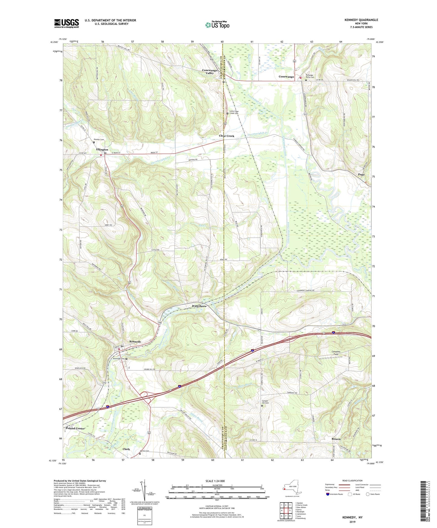
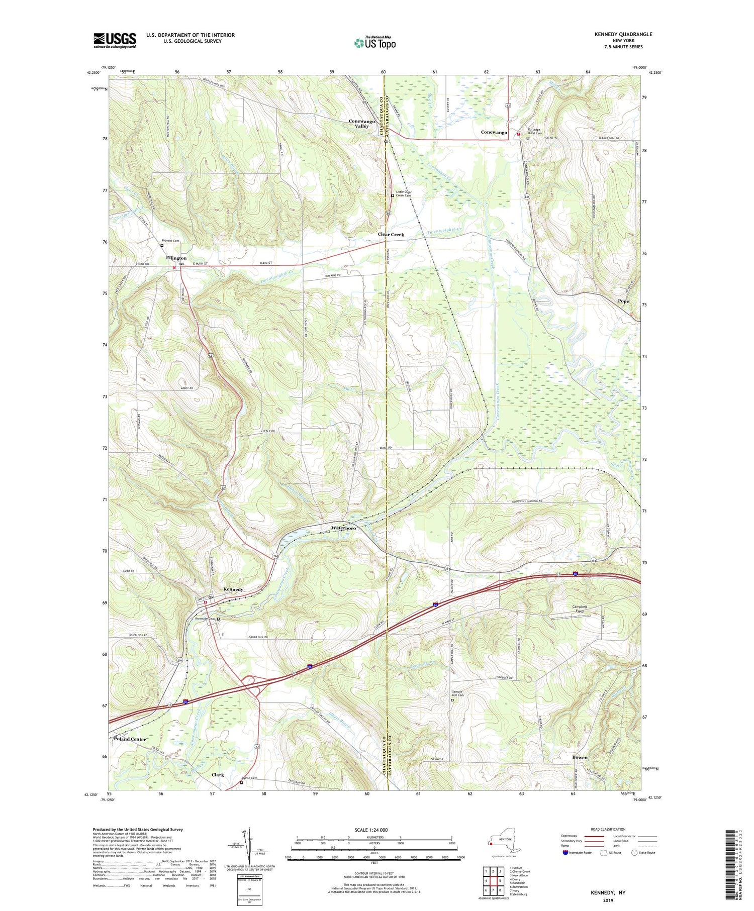
2019 topographic map quadrangle Kennedy in the state of New York. Scale: 1:24000. Based on the newly updated USGS 7.5' US Topo map series, this map is in the following counties: Chautauqua, Cattaraugus. The map contains contour data, water features, and other items you are used to seeing on USGS maps, but also has updated roads and other features. This is the next generation of topographic maps. Printed on high-quality waterproof paper with UV fade-resistant inks.
Quads adjacent to this one:
West: Gerry
Northwest: Hamlet
North: Cherry Creek
Northeast: New Albion
East: Randolph
Southeast: Steamburg
South: Ivory
Southwest: Jamestown
Contains the following named places: Abers Acres, Allen Brook, Beavers Dairy Farm, Bowen, Campbell Field, Clear Creek, Conewango, Conewango Fire Department, Conewango Valley, Conewango Valley Post Office, Davis Brook, Dry Brook, Elkins Brook, Ellington, Ellington Congregational Church, Ellington Fire Department, Ellington Post Office, Ellington United Methodist Church, Farman Free Library, Fly Creek, Harris Brook, Indian Brook, Kennedy, Kennedy Baptist Church, Kennedy Census Designated Place, Kennedy Fire Department, Kennedy First United Methodist Church, Kennedy Free Library, Kennedy Post Office, Little Clear Creek Cemetery, Little Conewango Creek, Mill Creek, Mud Creek, Myrtle Cemetery, Ormond Farm, Paul B D Temple Elementary School, Pioneer Cemetery, Poland Center, Pope, Pope Haven Campground, Riverside Cemetery, Rutledge Rural Cemetery, Sample Hill Cemetery, Schermerhorn Corners, Town of Conewango, Town of Ellington, Town of Poland, Town of Randolph, Twentyeighth Creek, Waterboro, ZIP Codes: 14732, 14747