MyTopo
Gerry New York US Topo Map
Couldn't load pickup availability
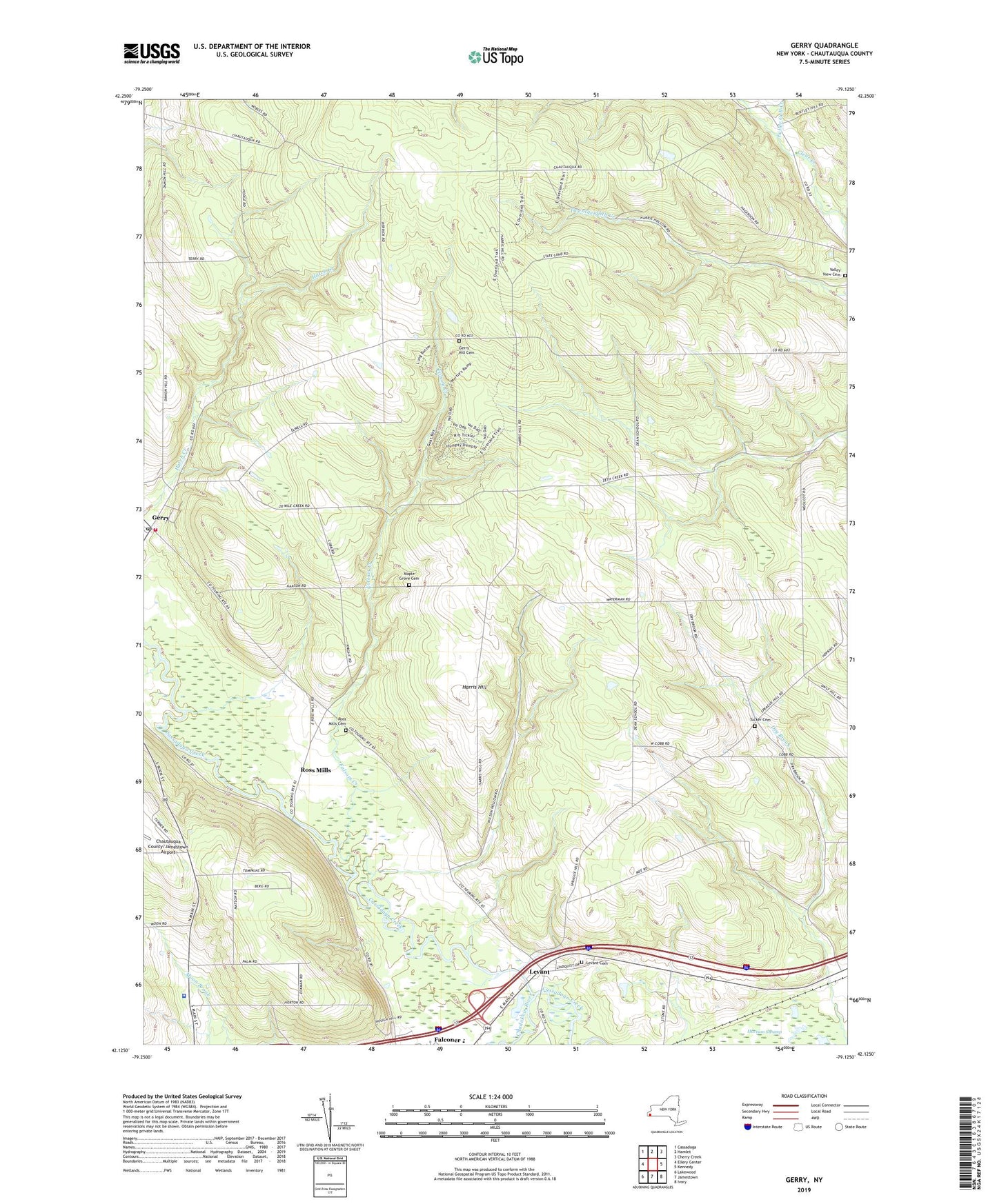
2023 topographic map quadrangle Gerry in the state of New York. Scale: 1:24000. Based on the newly updated USGS 7.5' US Topo map series, this map is in the following counties: Chautauqua. The map contains contour data, water features, and other items you are used to seeing on USGS maps, but also has updated roads and other features. This is the next generation of topographic maps. Printed on high-quality waterproof paper with UV fade-resistant inks.
Quads adjacent to this one:
West: Ellery Center
Northwest: Cassadaga
North: Hamlet
Northeast: Cherry Creek
East: Kennedy
Southeast: Ivory
South: Jamestown
Southwest: Lakewood
This map covers the same area as the classic USGS quad with code o42079b2.
Contains the following named places: Airport Hill Farm, Bower And Bower Nursery Farm, Breezewood Golf Links, Chadakoin River, Dean School, Falconer Drive-In, Falconer Immanuel Methodist Church, Folsom Creek, Fuller Gulf Creek, Gerry, Gerry Hill Cemetery, Gerry Post Office, Harris Hill, Harvey C Fenner Elementary School, Jamestown Optimist Boys Camp, Kimvale Farms, Levant, Levant Cemetery, Levant School, Levant Wesleyan Church, Maple Grove Cemetery, Maple Hollow Farm, New York State Police Troop A Zone 3 Jamestown Station, North Main Street School, Roberts Nursery, Ross Mills, Ross Mills Cemetery, Ross Mills Church of God, State Reforestation Area Number 10, Town of Ellicott, Town of Gerry, Tucker Cemetery, Valley View Cemetery, WHUG-FM (Jamestown), ZIP Codes: 14733, 14740