MyTopo
Lake Titus New York US Topo Map
Couldn't load pickup availability
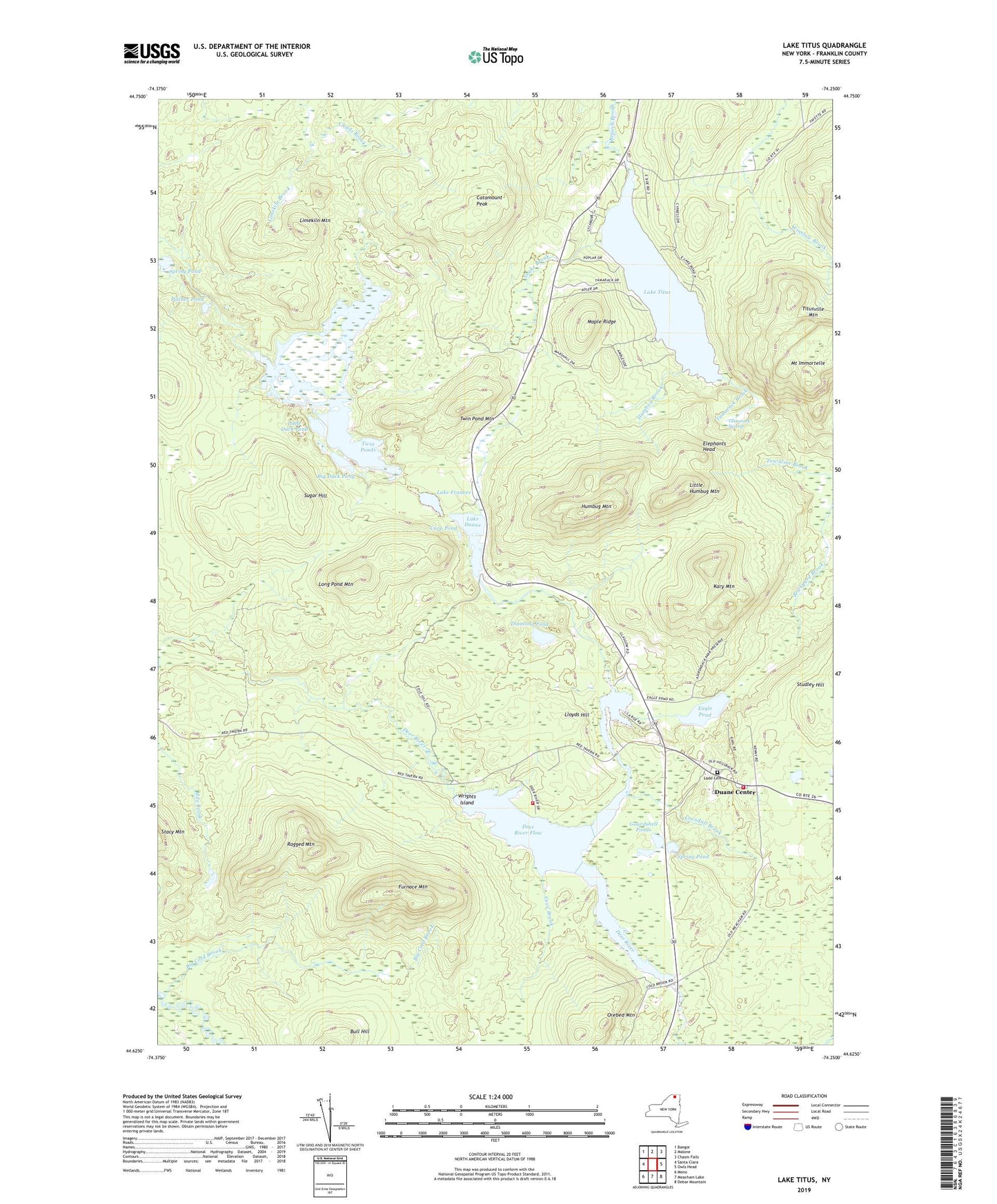
2019 topographic map quadrangle Lake Titus in the state of New York. Scale: 1:24000. Based on the newly updated USGS 7.5' US Topo map series, this map is in the following counties: Franklin. The map contains contour data, water features, and other items you are used to seeing on USGS maps, but also has updated roads and other features. This is the next generation of topographic maps. Printed on high-quality waterproof paper with UV fade-resistant inks.
Quads adjacent to this one:
West: Santa Clara
Northwest: Bangor
North: Malone
Northeast: Chasm Falls
East: Owls Head
Southeast: Debar Mountain
South: Meacham Lake
Southwest: Meno
Contains the following named places: Big Cold Brook, Big Duck Pond, Carp Pond, Catamount Peak, Childs Brook, Cove Brook, Crandall Brook, Deer River Campsite, Deer River Flow, Diamond Pond, Duane Center, Duane Fire Volunteer Fire Company, Duane Methodist Episcopal Church, Eagle Pond, Elephants Head, Fayetteville School, Franklin State Forest Number Three, Furnace Mountain, Gourdshell Ponds, Harmony Hills Farmstead, Horseshoe Pond, Humbug Brook, Humbug Mountain, Kary Mountain, Ladd Cemetery, Lake Duane, Lake Frances, Lake Titus, Limekiln Mountain, Little Duck Pond, Little Humbug Mountain, Lloyds Hill, Long Pond Mountain, Maple Ridge, Mount Immortelle, Orebed Mountain, Pitcher Pond, Ragged Mountain, Saint Marys Church, School Number 2, School Number 25, Snake Brook, Spring Pond, Sugar Hill, Tamarack Brook, Tamarack Swamp, Twin Pond Mountain, Twin Ponds, Wrights Island, ZIP Code: 12953