MyTopo
Chasm Falls New York US Topo Map
Couldn't load pickup availability
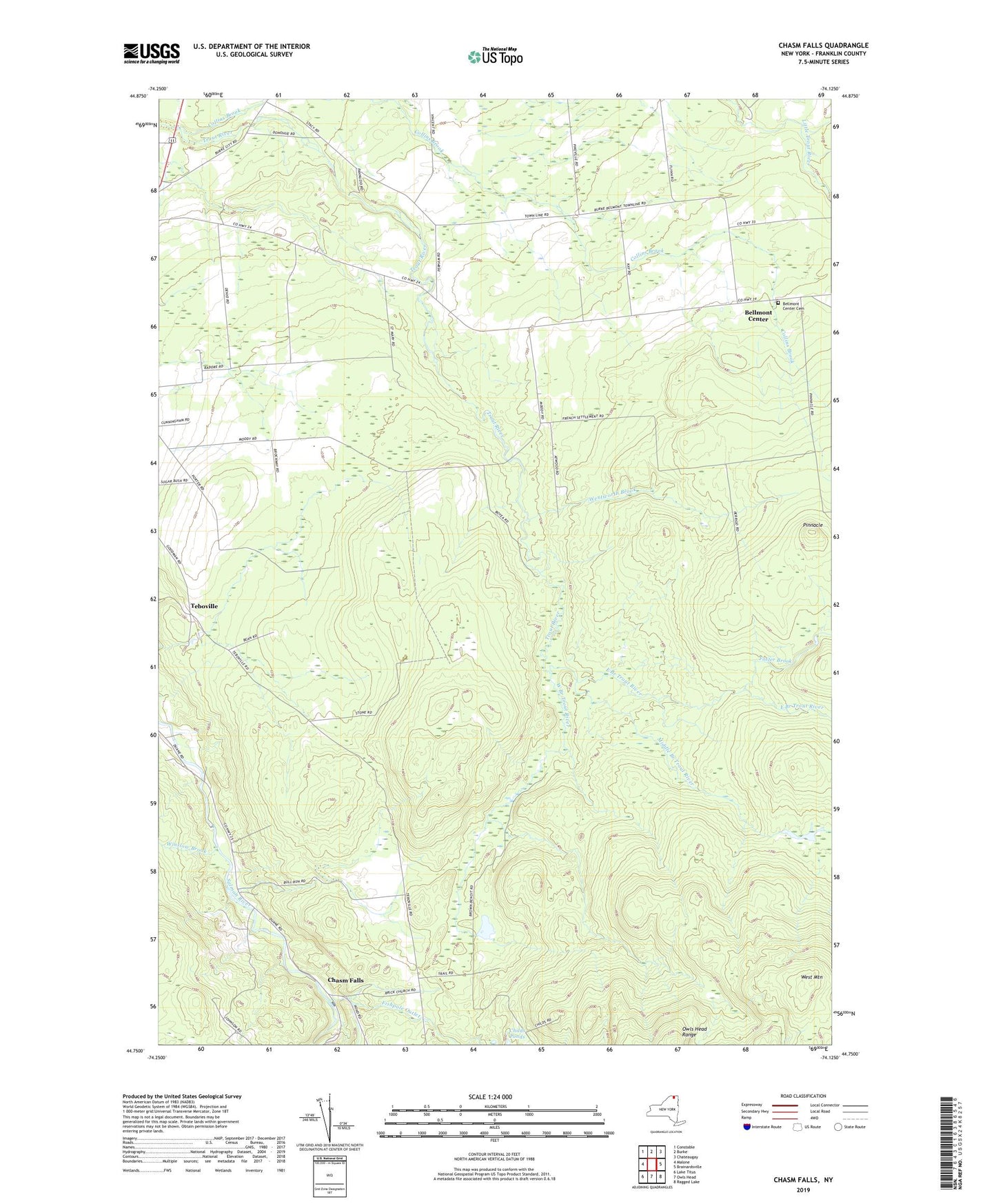
2023 topographic map quadrangle Chasm Falls in the state of New York. Scale: 1:24000. Based on the newly updated USGS 7.5' US Topo map series, this map is in the following counties: Franklin. The map contains contour data, water features, and other items you are used to seeing on USGS maps, but also has updated roads and other features. This is the next generation of topographic maps. Printed on high-quality waterproof paper with UV fade-resistant inks.
Quads adjacent to this one:
West: Malone
Northwest: Constable
North: Burke
Northeast: Chateaugay
East: Brainardsville
Southeast: Ragged Lake
South: Owls Head
Southwest: Lake Titus
This map covers the same area as the classic USGS quad with code o44074g2.
Contains the following named places: Adirondack Quarry, Bellmont Center, Bellmont Center Cemetery, Boyce Mill, Chasm Falls, Chasm Falls Station, Collins Brook, Coughlin School, East Branch Trout River, Fishpole Outlet, Foot School, Foster Brook, Franklin Drive-In, Kingdom Hall of Jehovahs Witnesses, Middle Branch Trout River, Moody School, Pinnacle, River Street School, School Number 11, School Number 12, School Number 13, School Number 21, School Number 6, School Number 7, Teboville, Wentworth Brook, West Branch Trout River, West Mountain, White Church, Winslow Brook