MyTopo
Lysander New York US Topo Map
Couldn't load pickup availability
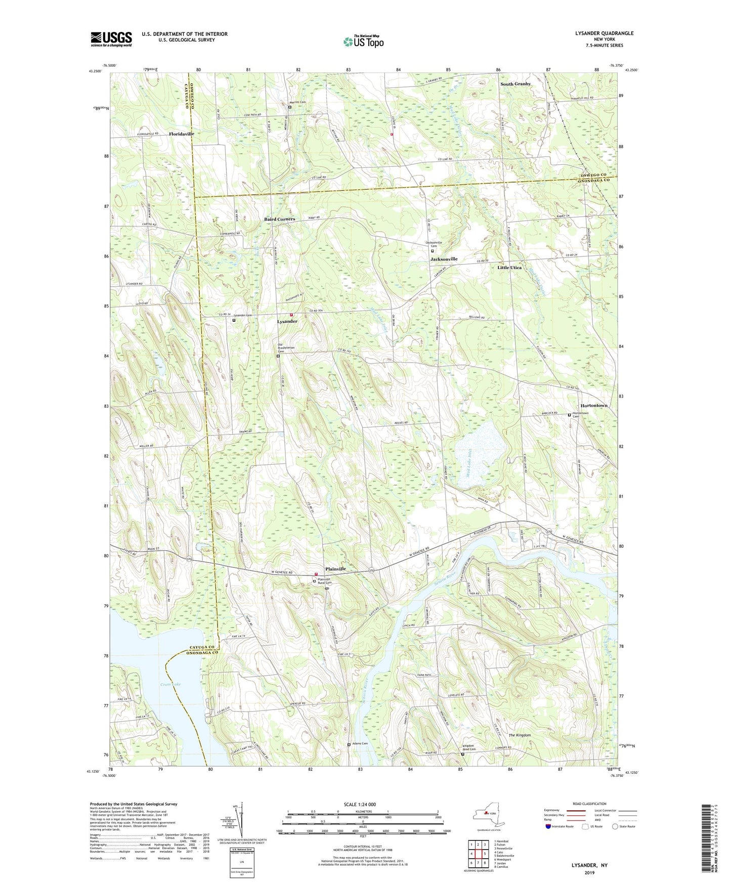
2019 topographic map quadrangle Lysander in the state of New York. Scale: 1:24000. Based on the newly updated USGS 7.5' US Topo map series, this map is in the following counties: Onondaga, Cayuga, Oswego. The map contains contour data, water features, and other items you are used to seeing on USGS maps, but also has updated roads and other features. This is the next generation of topographic maps. Printed on high-quality waterproof paper with UV fade-resistant inks.
Quads adjacent to this one:
West: Cato
Northwest: Hannibal
North: Fulton
Northeast: Pennellville
East: Baldwinsville
Southeast: Camillus
South: Jordan
Southwest: Weedsport
Contains the following named places: Adams Cemetery, Baird Corners, Brook, Cody Fire Department Station 1, Dead Creek, Destiny Farms, Floridaville, Hahn Family Farm, Hortontown, Hortontown Cemetery, Jacksonville, Jacksonville Cemetery, Kingdom Road Cemetery, Little Utica, Little Utica Methodist Church, Lysander, Lysander Cemetery, Lysander Fire Department, Maloney Island, Merritt Cemetery, Mud Lake, Mud Lake Inlet, Mud Lake Outlet, Old Presbyterian Cemetery, Plainville, Plainville Fire District Station 1, Plainville Post Office, Plainville Rural Cemetery, Potters Tree Farm, School Number 1, School Number 10, School Number 11, School Number 17, School Number 2, School Number 3, School Number 4, School Number 5, School Number 6, School Number 7, School Number 8, School Number 9, WKFM-FM (Fulton)