MyTopo
Hannibal New York US Topo Map
Couldn't load pickup availability
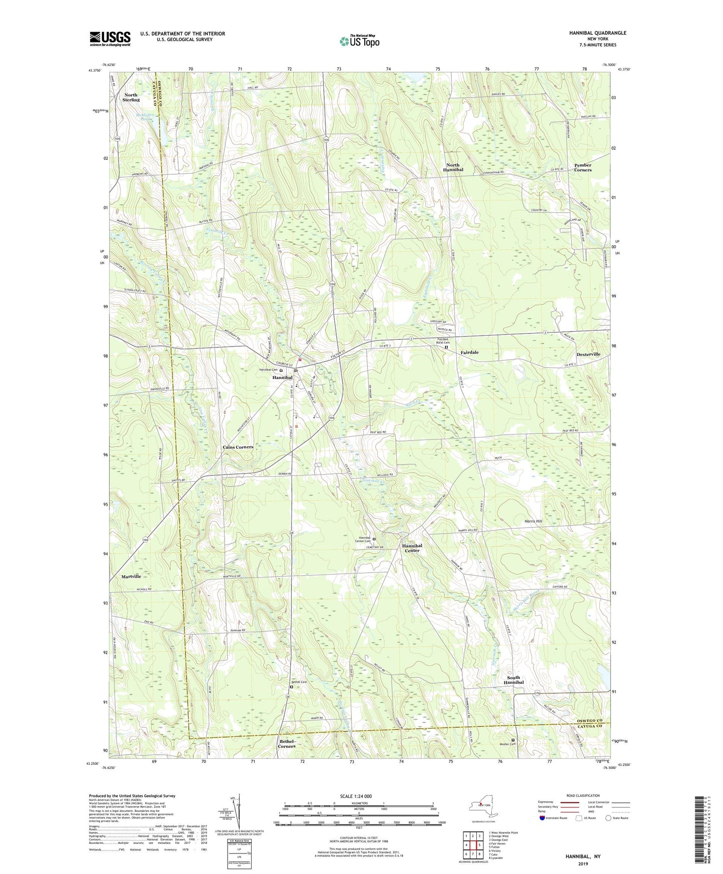
2023 topographic map quadrangle Hannibal in the state of New York. Scale: 1:24000. Based on the newly updated USGS 7.5' US Topo map series, this map is in the following counties: Oswego, Cayuga. The map contains contour data, water features, and other items you are used to seeing on USGS maps, but also has updated roads and other features. This is the next generation of topographic maps. Printed on high-quality waterproof paper with UV fade-resistant inks.
Quads adjacent to this one:
West: Fair Haven
Northwest: West Ninemile Point
North: Oswego West
Northeast: Oswego East
East: Fulton
Southeast: Lysander
South: Cato
Southwest: Victory
This map covers the same area as the classic USGS quad with code o43076c5.
Contains the following named places: Bethel Cemetery, Cains Corners, Carter School, Country Haven Mobile Home Park, Crestview Mobile Home Park, Dexterville, Enchantment Acres Flower Farm, Fairdale, Fairdale Rural Cemetery, Fairley School, Hannibal, Hannibal Cemetery, Hannibal Center, Hannibal Center Cemetery, Hannibal Community Church, Hannibal Free Library, Hannibal High School, Hannibal Hills Mobile Home Park, Hannibal Post Office, Hannibal Volunteer Fire Company, Harris Hill, Harris Hill Brook, Kenney Middle School, Kinney Corners, Locus Grove Mobile Home Park, McMullen Pond, Meadowbrook Manor Assisted Living Facility, Metcalf Siding, Mosher Cemetery, Muck Creek, North Hannibal, North Sterling, Our Lady of the Rosary Church, Pember Corners, Powell Mobile Home Park, School Number 1, School Number 10, School Number 11, School Number 12, School Number 13, School Number 14, School Number 15, School Number 2, School Number 3, School Number 5, School Number 7, School Number 9, South Hannibal, Town of Hannibal, Village of Hannibal, Wiltse's Fruit Farm, Woodland Mobile Home Park, ZIP Codes: 13074, 13111