MyTopo
Marathon New York US Topo Map
Couldn't load pickup availability
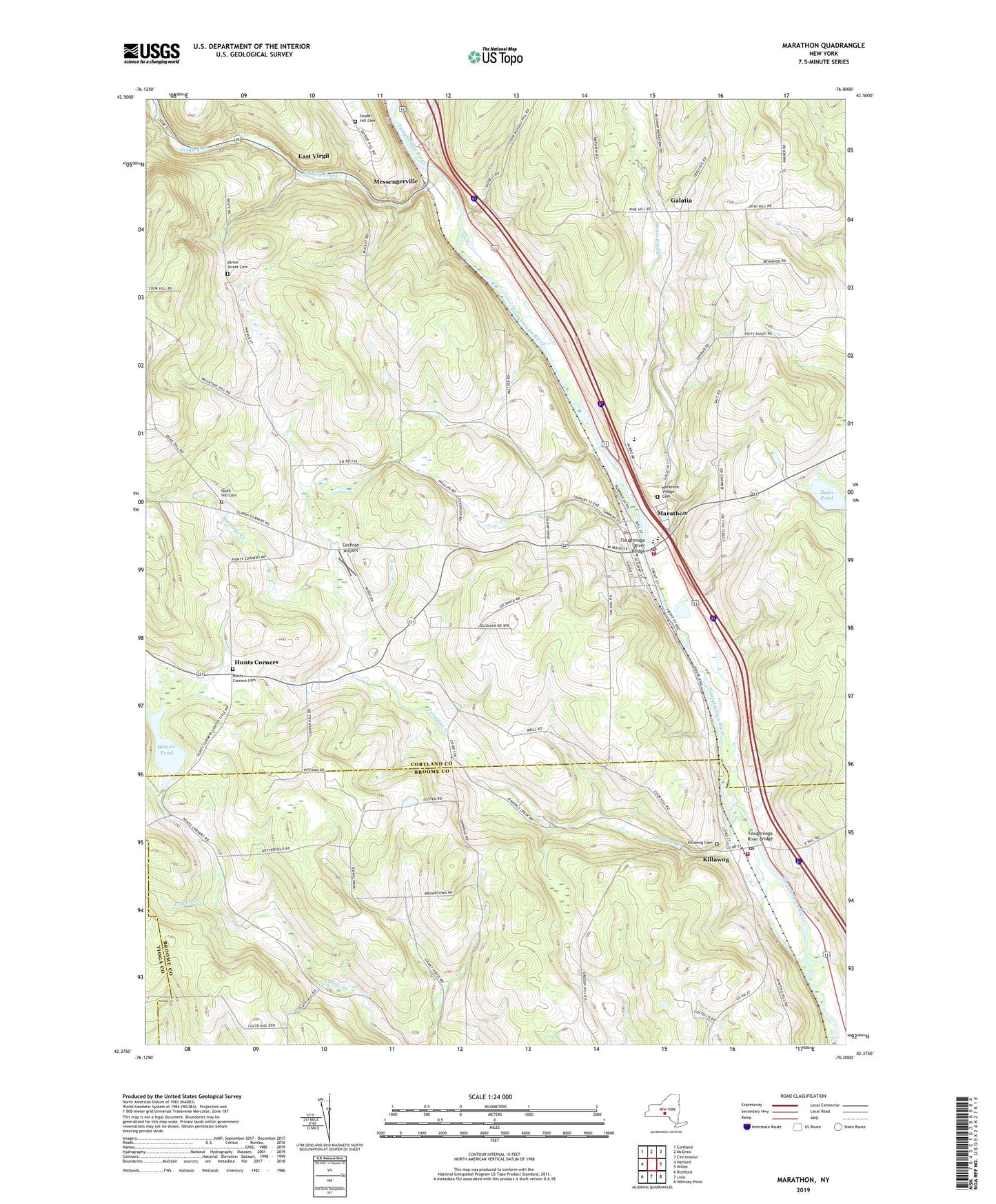
2019 topographic map quadrangle Marathon in the state of New York. Scale: 1:24000. Based on the newly updated USGS 7.5' US Topo map series, this map is in the following counties: Cortland, Broome, Tioga. The map contains contour data, water features, and other items you are used to seeing on USGS maps, but also has updated roads and other features. This is the next generation of topographic maps. Printed on high-quality waterproof paper with UV fade-resistant inks.
Quads adjacent to this one:
West: Harford
Northwest: Cortland
North: McGraw
Northeast: Cincinnatus
East: Willet
Southeast: Whitney Point
South: Lisle
Southwest: Richford
Contains the following named places: Beaver Pond, Cochran Airport, Country Hills Campground, Dean Pond, East Virgil, First Baptist Church, Galatia, Gridley Creek, Hunts Corners, Hunts Corners Cemetery, Hunts Creek, Jennings Creek, Killawog, Killawog Cemetery, Killawog Post Office, Killawog Volunteer Fire Company, Kingdom Hall of Jehovahs Witnesses, Lapeer, Lapeer Church, Lapeer Flyer Airport, Maple Hill Golf Club, Marathon, Marathon Area Volunteer Ambulance Corps, Marathon Fire Department, Marathon High School, Marathon Methodist Church, Marathon Post Office, Marathon Presbyterian Church, Marathon Town Hall, Marathon Village Cemetery, Messengerville, Parker Street Cemetery, Peck Memorial Library, Quail Hill Cemetery, Riverside Manor, Saint Stephen's Catholic Church, Snyder Hill Cemetery, Tarbell Building, Tioughnioga River Bridge, Town of Lapeer, Town of Marathon, Village of Marathon, William Appleby Elementary School, ZIP Codes: 13794, 13803