MyTopo
Richford New York US Topo Map
Couldn't load pickup availability
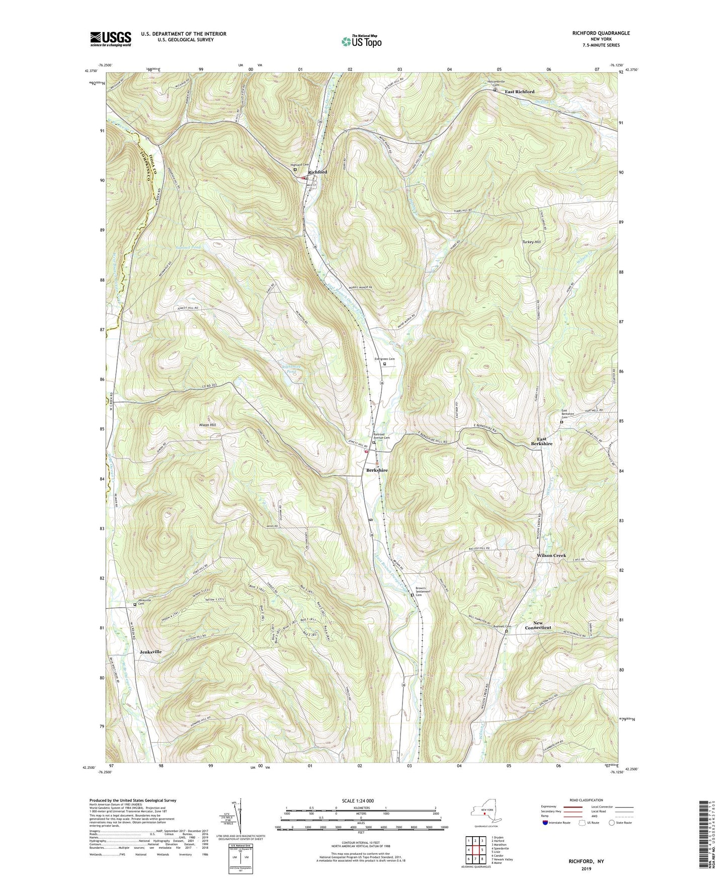
2023 topographic map quadrangle Richford in the state of New York. Scale: 1:24000. Based on the newly updated USGS 7.5' US Topo map series, this map is in the following counties: Tioga, Tompkins. The map contains contour data, water features, and other items you are used to seeing on USGS maps, but also has updated roads and other features. This is the next generation of topographic maps. Printed on high-quality waterproof paper with UV fade-resistant inks.
Quads adjacent to this one:
West: Speedsville
Northwest: Dryden
North: Harford
Northeast: Marathon
East: Lisle
Southeast: Maine
South: Newark Valley
Southwest: Candor
This map covers the same area as the classic USGS quad with code o42076c2.
Contains the following named places: Berkshire, Berkshire Fire Department, Berkshire Free Library, Berkshire Post Office, Boyer Creek, Brown's Settlement Cemetery, Bushnell Cemetery, Church of Christian Gospel Faith, East Berkshire, East Berkshire Cemetery, East Berkshire United Methodist Church, East Richford, Evergreen Cemetery, First Congregational Church, Highland Cemetery, Highland Chapel, Hocumville Church, Holcombville Cemetery, Hubby Creek, Jenksville, Jenksville Cemetery, Kingbird Farm, New Connecticut, Newark Valley Golf Club, Nixon Hill, Railroad Avenue Cemetery, Rawson Hollow, Richford, Richford Congregational Church, Richford Fire Department, Richford Post Office, Rightmire Pond, School Number 8, Stoughton Farm, Summit Pond, Town of Berkshire, Town of Richford, Turkey Hill, Wilson Creek, ZIP Code: 13736