MyTopo
Meno New York US Topo Map
Couldn't load pickup availability
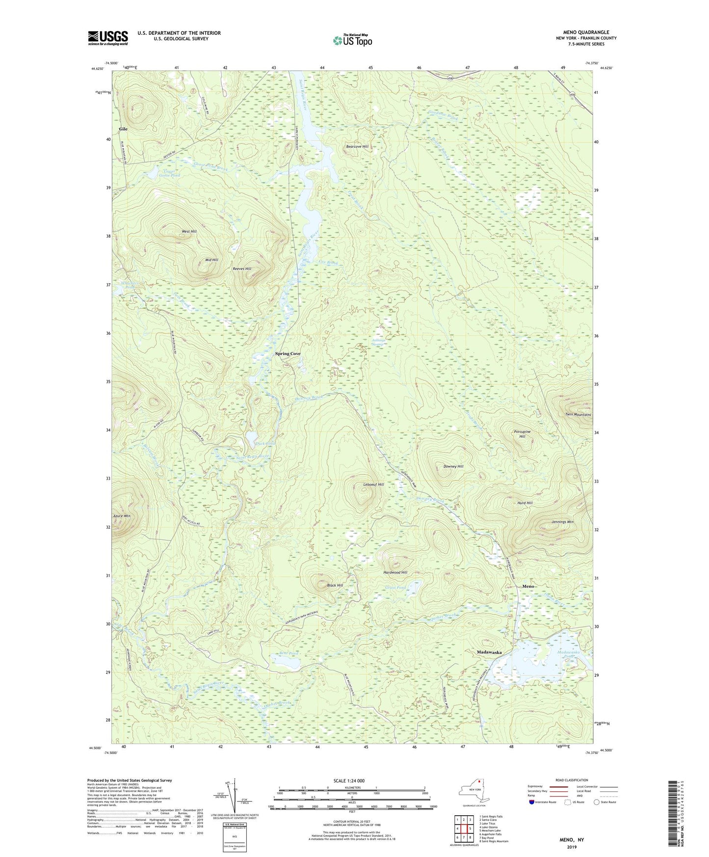
2019 topographic map quadrangle Meno in the state of New York. Scale: 1:24000. Based on the newly updated USGS 7.5' US Topo map series, this map is in the following counties: Franklin. The map contains contour data, water features, and other items you are used to seeing on USGS maps, but also has updated roads and other features. This is the next generation of topographic maps. Printed on high-quality waterproof paper with UV fade-resistant inks.
Quads adjacent to this one:
West: Lake Ozonia
Northwest: Saint Regis Falls
North: Santa Clara
Northeast: Lake Titus
East: Meacham Lake
Southeast: Saint Regis Mountain
South: Bay Pond
Southwest: Augerhole Falls
Contains the following named places: Alder Brook, Balsam Brook, Bearcove Hill, Beaver Brook, Benz Pond, Black Hill, Cox Brook, Downey Brook, Downey Hill, Duck Pond, Gile, Goodnow Brook, Goose Pond Brook, Grass Pond, Hardwood Hill, Hurd Hill, Jennings Mountain, Jennings Swamp, Leboeuf Hill, Lower Goose Pond, Madawaska, Madawaska Pond, Meno, Middle Hill, Onion River, Porcupine Hill, Quebec Brook, Reeves Hill, Spring Cove, Trout Brook, Twin Brook, West Hill, Whackers Pond