MyTopo
Lake Ozonia New York US Topo Map
Couldn't load pickup availability
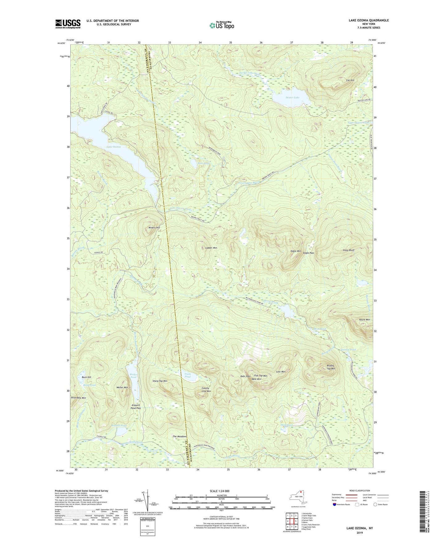
2023 topographic map quadrangle Lake Ozonia in the state of New York. Scale: 1:24000. Based on the newly updated USGS 7.5' US Topo map series, this map is in the following counties: Franklin, St. Lawrence. The map contains contour data, water features, and other items you are used to seeing on USGS maps, but also has updated roads and other features. This is the next generation of topographic maps. Printed on high-quality waterproof paper with UV fade-resistant inks.
Quads adjacent to this one:
West: Sylvan Falls
Northwest: Nicholville
North: Saint Regis Falls
Northeast: Santa Clara
East: Meno
Southeast: Bay Pond
South: Augerhole Falls
Southwest: Carry Falls Reservoir
This map covers the same area as the classic USGS quad with code o44074e5.
Contains the following named places: Alder Brook, Arquett Pond, Arquett Pond Pass, Azure Mountain, Bens Pond, Blind Pond, Blind Pond Outlet, Brushy Top Mountain, Buck Hill, Cat Hill, Center Camp, County Line Mountain, Deer Pass, Dexter Lake, Eagle Mountain, Eagle Pass, East Pond, Flat Top Mountain, Ladder Mountain, Lake Ozonia, Leach Pine Brook, Lost Mountain, McCavanaugh Pond, Miners Hill, Mud Pond, Riverdale Mountain, Sharp Top Mountain, Stacy Bluff, Swamp Pond, The Meadows, Town of Waverly, Train Pond, Upper Goose Pond, Weller Mountain, Weller Pond, Weller Pond Outlet, West Mountain, ZIP Code: 12980