MyTopo
Owasco New York US Topo Map
Couldn't load pickup availability
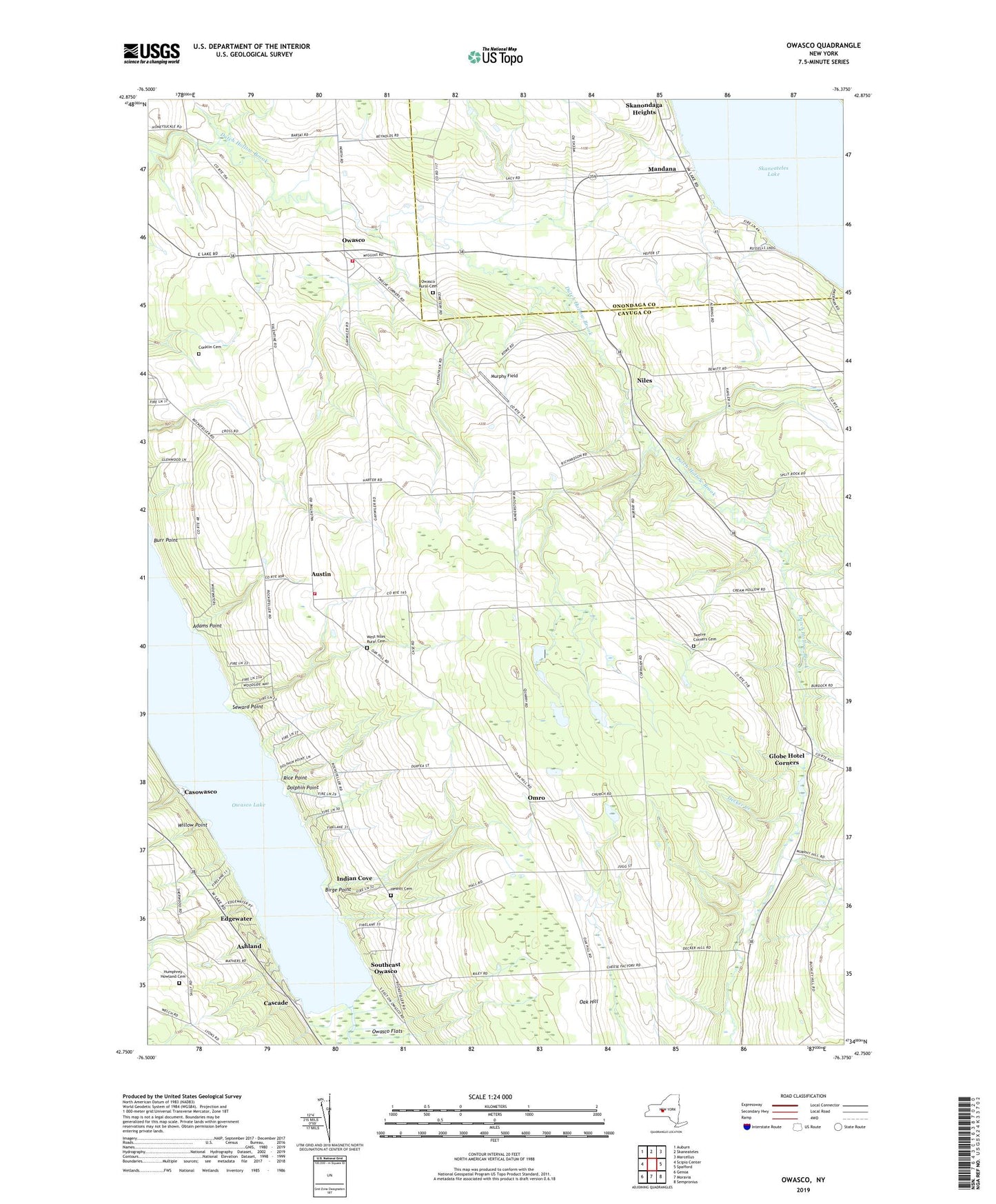
2019 topographic map quadrangle Owasco in the state of New York. Scale: 1:24000. Based on the newly updated USGS 7.5' US Topo map series, this map is in the following counties: Cayuga, Onondaga. The map contains contour data, water features, and other items you are used to seeing on USGS maps, but also has updated roads and other features. This is the next generation of topographic maps. Printed on high-quality waterproof paper with UV fade-resistant inks.
Quads adjacent to this one:
West: Scipio Center
Northwest: Auburn
North: Skaneateles
Northeast: Marcellus
East: Spafford
Southeast: Sempronius
South: Moravia
Southwest: Genoa
Contains the following named places: Adams Point, Ashland, Austin, Birge Point, Burr Point, Cascade, Casowasco, Conklin Cemetery, Courtright Corners, Dolphin Point, Dutch Hollow Country Club, Edgewater, Folls Flower Farm, Globe Hotel Corners, Hewitt Cemetery, Humphrey Howland Cemetery, Indian Cove, Mandana, Murphy Field, Niles, Oak Hill, Omro, Owasco, Owasco Fire Department Station 2, Owasco Inlet, Owasco Reformed Church, Owasco Rural Cemetery, Rice Point, School Number 1, School Number 10, School Number 13, School Number 2, School Number 3, School Number 4, School Number 5, School Number 6, School Number 7, School Number 9, Seward Point, Southeast Owasco, Town of Niles, Twelve Corners, Twelve Corners Cemetery, Twin Birch Farms, Valentine Corners, West Niles Fire Department, West Niles Rural Cemetery, Willow Point, WPCX-FM (Auburn), ZIP Code: 13118