MyTopo
Pine Bush New York US Topo Map
Couldn't load pickup availability
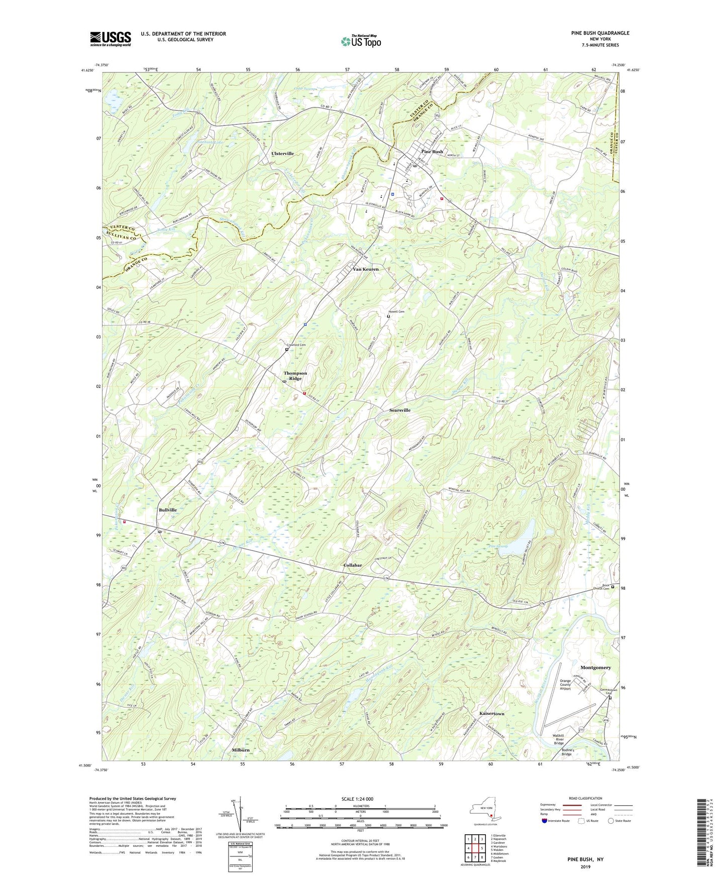
2019 topographic map quadrangle Pine Bush in the state of New York. Scale: 1:24000. Based on the newly updated USGS 7.5' US Topo map series, this map is in the following counties: Orange, Ulster, Sullivan. The map contains contour data, water features, and other items you are used to seeing on USGS maps, but also has updated roads and other features. This is the next generation of topographic maps. Printed on high-quality waterproof paper with UV fade-resistant inks.
Quads adjacent to this one:
West: Wurtsboro
Northwest: Ellenville
North: Napanoch
Northeast: Gardiner
East: Walden
Southeast: Maybrook
South: Goshen
Southwest: Middletown
Contains the following named places: Amazing Grace Fellowship, Baldwin Vineyards, Bodine's Bridge, Brick Church Cemetery, Brimestone School, Bullville, Bullville Fire Volunteer Fire Company, Bullville Post Office, Bullville School, Burleigh Farms, Cedar Swamp, Church of the Infant Survivor, Collabar, Collabar School, Comfort Trail, Crawford Cemetery, Crawford Town Park, Crispell Middle School, Denman Farm, Dickerson School, E J Russell Elementary School, Germantown Cemetery, Good Shepherd Bible Church, Grahams Church, Graney Tree Farm, Hopewell Presbyterian Church, Howell Cemetery, J And E Ranch, Jucas Stables, Kaisertown, Kaisertown Nursery, Kaisertown School, Milburn, Muddy Kill, New Prospect Church, Orange County Airport, Our Lady of the Valley Church, Pakanasink Creek, Patrick E Matazara Field, Pine Bush, Pine Bush Area Volunteer Ambulance, Pine Bush Area Volunteer Ambulance Corps, Pine Bush Census Designated Place, Pine Bush Elementary School, Pine Bush Hook and Ladder Company 1 Station 1, Pine Bush Hook and Ladder Company 1 Station 2, Pine Bush Post Office, Pine Bush Senior High School, Pine Bush United Methodist Church, Pine Swamp, Pinebush Lake, Platte Kill, Saint Pauls Church, Searsville, Searsville School, South Branch Pakanasink Creek, Stonehenge Farm Market, Thompson Ridge, Thompson Ridge Post Office, Tomy Kill, Town of Crawford, Town of Crawford Free Library, Tri-State Airport, Ulsterville, Ulsterville School, Union School, Valley Supreme Plaza Shopping Center, Van Keuren, Verkeerder Kill, Wallkill River Bridge, West Hopewell School, Winding Hills County Park, Winding Hills Golf Club, ZIP Codes: 10915, 10985, 12549, 12722