MyTopo
Napanoch New York US Topo Map
Couldn't load pickup availability
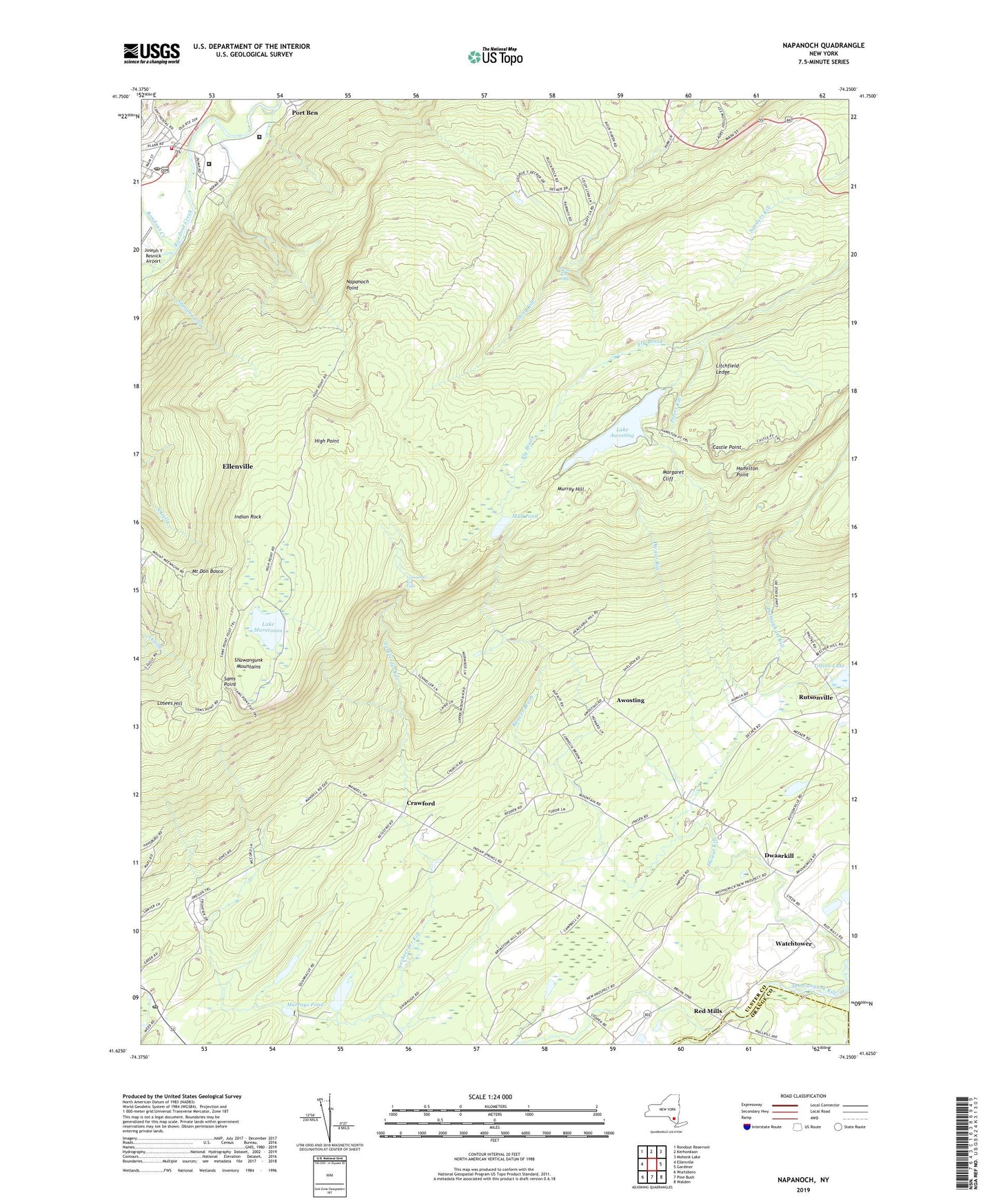
2023 topographic map quadrangle Napanoch in the state of New York. Scale: 1:24000. Based on the newly updated USGS 7.5' US Topo map series, this map is in the following counties: Ulster, Orange. The map contains contour data, water features, and other items you are used to seeing on USGS maps, but also has updated roads and other features. This is the next generation of topographic maps. Printed on high-quality waterproof paper with UV fade-resistant inks.
Quads adjacent to this one:
West: Ellenville
Northwest: Rondout Reservoir
North: Kerhonkson
Northeast: Mohonk Lake
East: Gardiner
Southeast: Walden
South: Pine Bush
Southwest: Wurtsboro
This map covers the same area as the classic USGS quad with code o41074f3.
Contains the following named places: Awosting, Beaver Brook, Brimstone Hill Vineyards, Camp Laurel, Camp Ridge-Ho, Castle Point, Crawford, Crawford Church, Crawford School, Don Bosco Church, Dwaar Kill, Dwaarkill, East Wawarsing School, Eastern New York Correctional Facility, Fly Brook, Hamilton Point, High Point, Indian Rock, Lake Awosting, Lake Maratanza, Litchfield Ledge, Losees Hill, Margaret Cliff, Mount Don Bosco, Mud Pond, Murray Hill, Murrays Pond, Napanoch, Napanoch Point, Napanoch Post Office, Napanoch Volunteer Fire Department Station 1, Palmaghatt Kill, Pearl Street School, Port Ben, Quannacut YMCA Camp, Red Mills, Rutsonville, Sams Point, Sandburg Creek, Shiloh Baptist Church, Shingle Gully, State Institution for Male Defective Delinquents, Stony Kill Falls, Town of Shawangunk, Ulster Correctional Facility, Union District School, Verkeerder Kill Falls, Village of Ellenville, Walker Valley Golf Course, Walker Valley Post Office, Walker Valley School, Watchtower, Watchtower Census Designated Place, Watchtower Farms, Witches Hole, WWWK-FM (Ellenville), ZIP Codes: 12420, 12566