MyTopo
Stanley New York US Topo Map
Couldn't load pickup availability
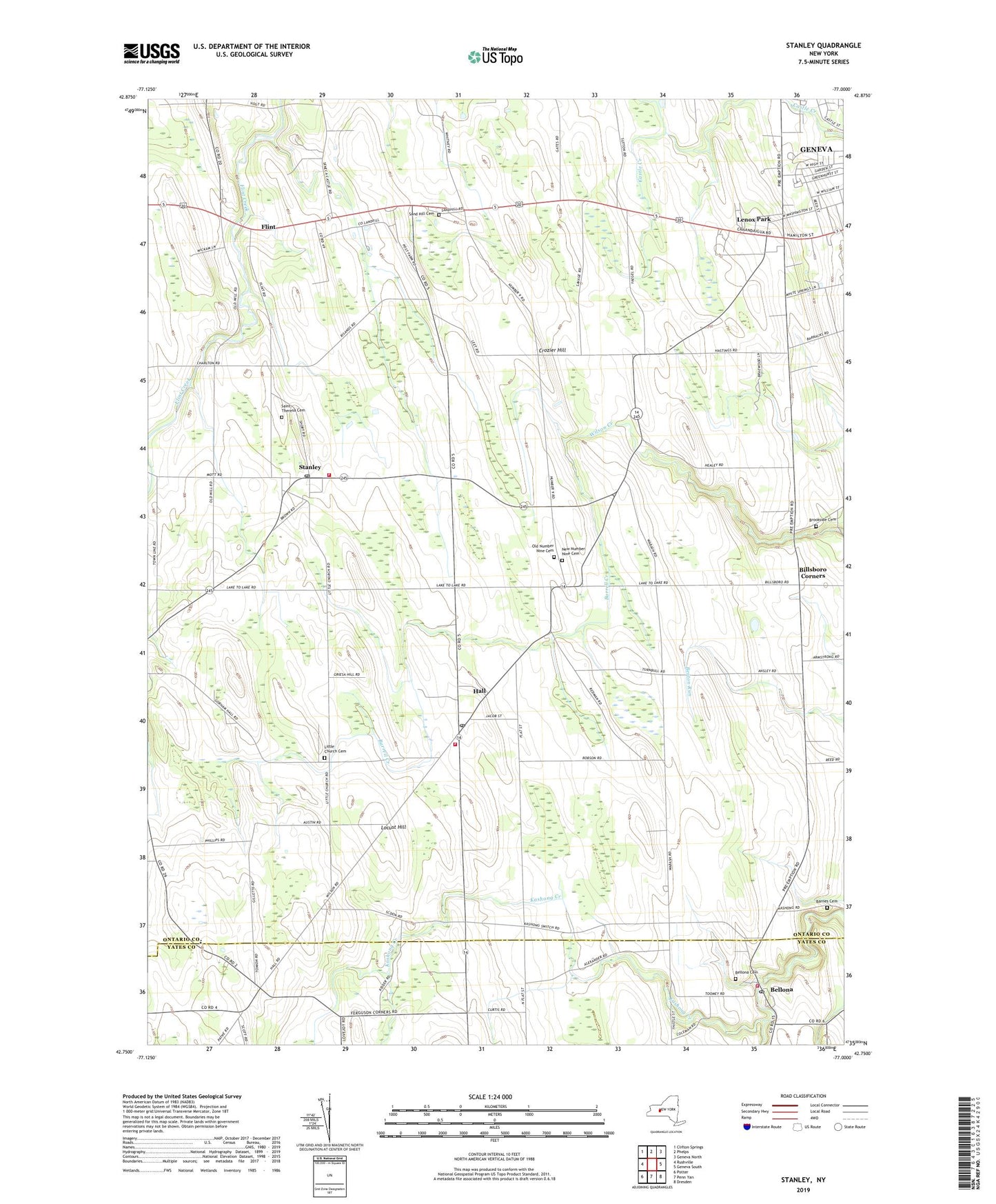
2019 topographic map quadrangle Stanley in the state of New York. Scale: 1:24000. Based on the newly updated USGS 7.5' US Topo map series, this map is in the following counties: Ontario, Yates. The map contains contour data, water features, and other items you are used to seeing on USGS maps, but also has updated roads and other features. This is the next generation of topographic maps. Printed on high-quality waterproof paper with UV fade-resistant inks.
Quads adjacent to this one:
West: Rushville
Northwest: Clifton Springs
North: Phelps
Northeast: Geneva North
East: Geneva South
Southeast: Dresden
South: Penn Yan
Southwest: Potter
Contains the following named places: Amberg Wine Cellars, Barnes Cemetery, Bellona, Bellona Cemetery, Bellona Fire District, Bellona Post Office, Billsboro Corners, Brookside Cemetery, Burrell Creek, Crozier Hill, Ferguson Corners, Flint, Hall, Hall Census Designated Place, Hall Fire Department, Hall Post Office, Hansen Farms Landing Strip, Lawnhurst Farms, Lenox Park, Little Church, Little Church Cemetery, Locust Hill, Mc Bride's Airport, New Number Nine Cemetery, Old Number 9 Church, Old Number Nine Cemetery, Ontario County Landfill, Red Jacket Orchards, Saint Theresa Cemetery, Sand Hill Cemetery, School Number 10, School Number 12, School Number 2, School Number 3, School Number 4, School Number 5, School Number 7, School Number 9, Stanley, Stanley Fire Department, Stanley Post Office, Stape Field, Tomion Farms, Town of Seneca, V And W Farms, WECQ-FM (Geneva), WGVA-AM (Geneva), ZIP Code: 14415