MyTopo
Potter New York US Topo Map
Couldn't load pickup availability
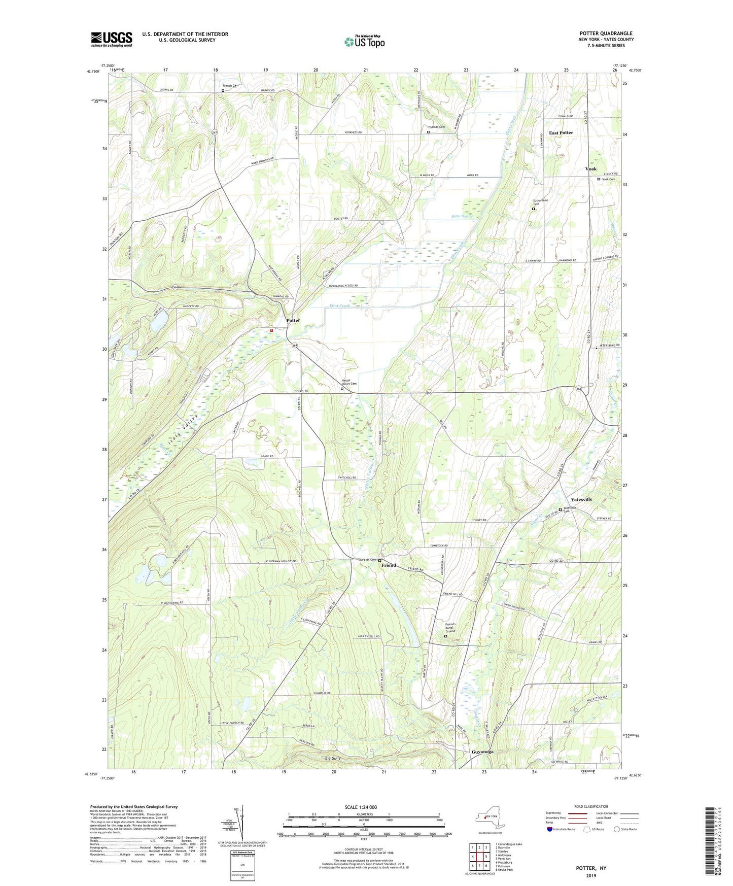
2023 topographic map quadrangle Potter in the state of New York. Scale: 1:24000. Based on the newly updated USGS 7.5' US Topo map series, this map is in the following counties: Yates. The map contains contour data, water features, and other items you are used to seeing on USGS maps, but also has updated roads and other features. This is the next generation of topographic maps. Printed on high-quality waterproof paper with UV fade-resistant inks.
Quads adjacent to this one:
West: Middlesex
Northwest: Canandaigua Lake
North: Rushville
Northeast: Stanley
East: Penn Yan
Southeast: Keuka Park
South: Pulteney
Southwest: Prattsburg
This map covers the same area as the classic USGS quad with code o42077f2.
Contains the following named places: Big Gully, East Potter, Flint Creek Campgrounds, French Cemetery, Friend, Friend United Methodist Church, Friend's Burial Ground, Italy Valley, Nettle Valley Cemetery, Nettle Valley Creek, Old Fort Cemetery, Pendleton Farms, Potter, Potter Swamp, Potter Volunteer Fire Department, Saint John's Lutheran Church, School Number 10, School Number 12, School Number 16, School Number 2, School Number 6, School Number 8, Sherman Hollow, Sugar Shack Blueberry Farm, Sutherland Cemetery, Thomas Cemetery, Town of Potter, Valley View School, Voak, Voak Cemetery, White Clover Sheep Farm, Yatesville, Yatesville Cemetery