
MyTopo
Thousand Island Park New York US Topo Map
Couldn't load pickup availability
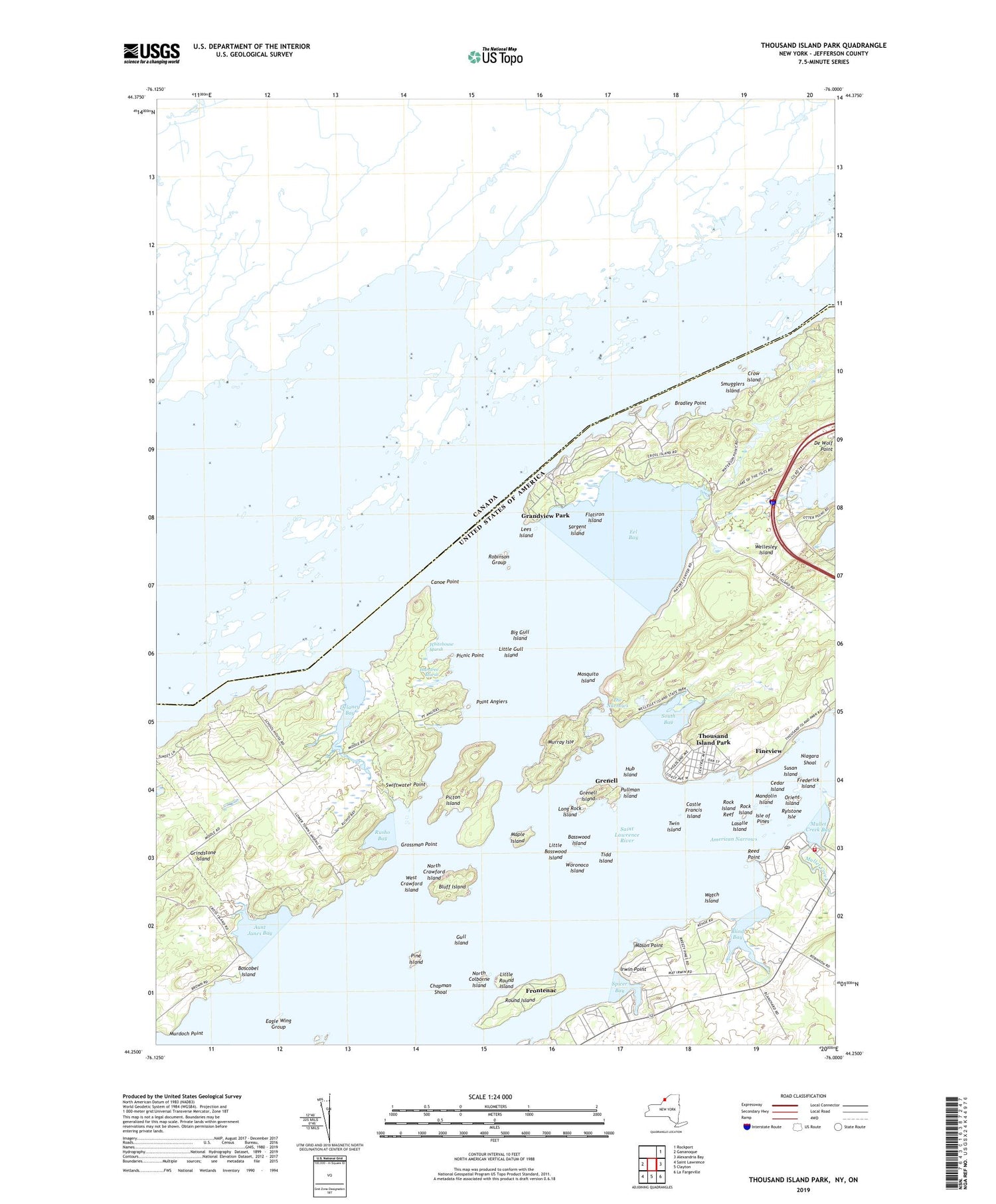
2019 topographic map quadrangle Thousand Island Park in the state of New York. Scale: 1:24000. Based on the newly updated USGS 7.5' US Topo map series, this map is in the following counties: Jefferson. The map contains contour data, water features, and other items you are used to seeing on USGS maps, but also has updated roads and other features. This is the next generation of topographic maps. Printed on high-quality waterproof paper with UV fade-resistant inks.
Quads adjacent to this one:
Northeast: Rockport
East: Alexandria Bay
Southeast: La Fargeville
South: Clayton
Southwest: Saint Lawrence
Contains the following named places: Aunt Janes Bay, Basswood Island, Big Gull Island, Bill and Jacks Marina, Blind Bay, Bluff Island, Boscobel Island, Bradley Point, Calumet Island, Canoe Point, Canoe Point and Picnic Point State Park, Castle Francis Island, Cedar Island, Chapman Shoal, Chapman Shoal Lighthouse, Crow Island, Delaney Bay, Eagle Wing Group, Eel Bay, Fineview, Fishers Landing, Fishers Landing Census Designated Place, Fishers Landing Fire Department, Fishers Landing Light, Fishers Landing Post Office, Flatiron Island, Frederick Island, Frontenac, Grandview Park, Granite State Shoal Light, Grass Point, Grenell, Grenell Island, Grindstone Island, Grossman Point, Gull Island, Hub Island, Irwin Point, Isle of Pines, Lasalle Island, Lees Island, Little Basswood Island, Little Gull Island, Little Round Island, Long Rock Island, Lower Town Landing, Mandolin Island, Maple Island, Mason Point, Minna Anthony Common Nature Center, Moore Dock Post Light, Mosquito Island, Mullet Creek, Mullet Creek Bay, Murdoch Point, Murray Isle, Niagara Shoal, North Colborne Island, North Crawford Island, Orient Island, Picnic Point, Picton Island, Pine Island, Plumtree Marsh, Point Angiers, Pullman Island, Rainbow Shores Mobile Home Park, Reed Point, Robinson Group, Rock Island, Rock Island Reef, Round Island, Rusho Bay, Rylstone Isle, Sargent Island, School Number 1, School Number 8, Shady Bay Mobile Home Park, Smugglers Island, South Bay, Spicer Bay, Spicer Bay Marina, Spicer Bay School, Spicer Marine Basin, Susan Island, Swiftwater Point, The Narrows, Thousand Island Park, Thousand Island Park Census Designated Place, Thousand Island Park Marina, Tidd Island, Twin Island, Upper Town Landing, Vanderbilt Island, Watch Island, Waterson Point Park, Wellesley Island, Wellesley Island State Park, Wellesley Island State Park Golf Course, West Crawford Island, Whitehouse Marsh, Winter Island, Woronoco Island, ZIP Codes: 13640, 13641, 13692


