MyTopo
Saint Lawrence New York US Topo Map
Couldn't load pickup availability
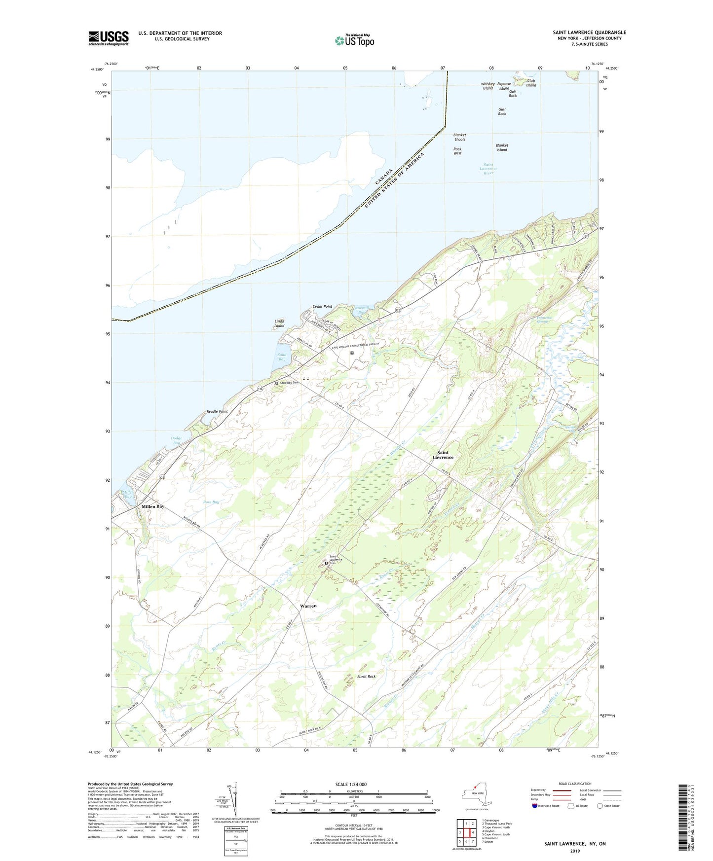
2023 topographic map quadrangle Saint Lawrence in the state of New York. Scale: 1:24000. Based on the newly updated USGS 7.5' US Topo map series, this map is in the following counties: Jefferson. The map contains contour data, water features, and other items you are used to seeing on USGS maps, but also has updated roads and other features. This is the next generation of topographic maps. Printed on high-quality waterproof paper with UV fade-resistant inks.
Quads adjacent to this one:
West: Cape Vincent North
Northeast: Thousand Island Park
East: Clayton
Southeast: Dexter
South: Chaumont
Southwest: Cape Vincent South
This map covers the same area as the classic USGS quad with code o44076b2.
Contains the following named places: Beadle Point, Blanket Island, Blanket Shoals, Burnt Rock, Cape Vincent Correctional Facility, Cedar Point, Cedar Point State Park, Club Island, Cummings Point, Dodge Bay, Frontenac Springs, Gull Rock, Gull Rock Island, Gull Rock Light, Lazy Acres Mobile Home Park, Linda Island, Merry Knoll Campground, Millen Bay, Millen Bay Marina, Millen Bay Yacht Club, Papoose Island, Rock West, Rock West Island, Rose Bay, Saint Lawrence, Saint Lawrence Cemetery, Sand Bay, Sand Bay Cemetery, Sawmill Bay, School Number 11, School Number 14, School Number 15, School Number 17, School Number 19, School Number 3, School Number 6, Sperrys Falls, Warren, Wheeler Creek, Whiskey Island, Wood Farms