
MyTopo
Treadwell New York US Topo Map
Couldn't load pickup availability
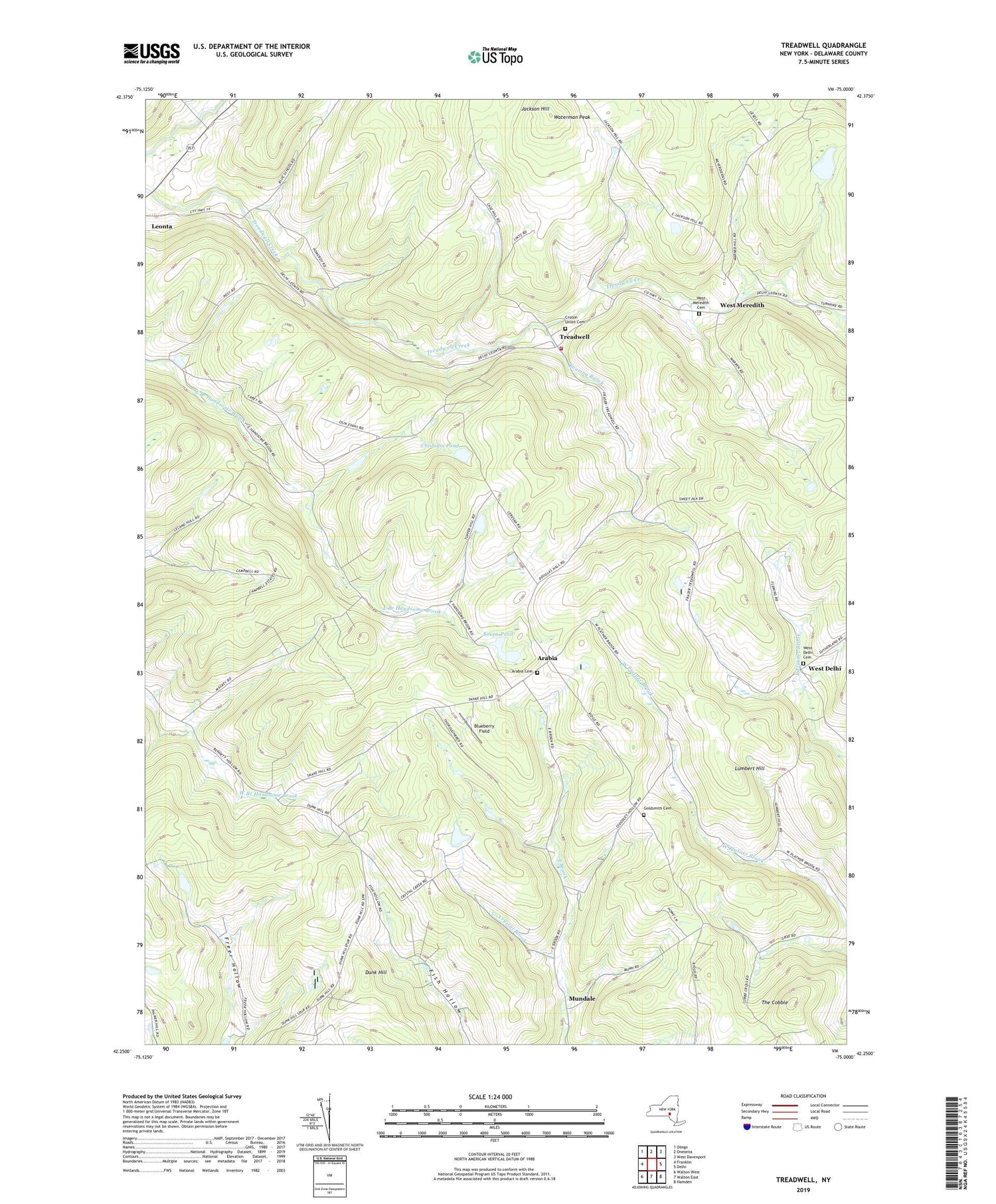
2019 topographic map quadrangle Treadwell in the state of New York. Scale: 1:24000. Based on the newly updated USGS 7.5' US Topo map series, this map is in the following counties: Delaware. The map contains contour data, water features, and other items you are used to seeing on USGS maps, but also has updated roads and other features. This is the next generation of topographic maps. Printed on high-quality waterproof paper with UV fade-resistant inks.
Quads adjacent to this one:
West: Franklin
Northwest: Otego
North: Oneonta
Northeast: West Davenport
East: Delhi
Southeast: Hamden
South: Walton East
Southwest: Walton West
Contains the following named places: Arabia, Arabia Cemetery, Bennett Hollow School, Blue School, Blueberry Field, Bourn Pond, Chisholm Pond, Croton Union Cemetery, Crystal Brook, Dunk Hill, Freer Hollow School, Goldsmith Cemetery, Jackson Hill, Lumbert Hill, Milk And Maple Farm, Mundale, North Hamden School, Poverty Hollow, Roaring Brook, School Number 11, School Number 5, Stony Creek Farm, Stoodley Hollow School, The Cobble, Town of Franklin, Treadwell, Treadwell Fire Department, Treadwell United Methodist Church, Waterman Peak, West Delhi, West Delhi Cemetery, West Delhi Presbyterian Church, West Meredith, West Meredith Cemetery, ZIP Code: 13846


