MyTopo
Hamden New York US Topo Map
Couldn't load pickup availability
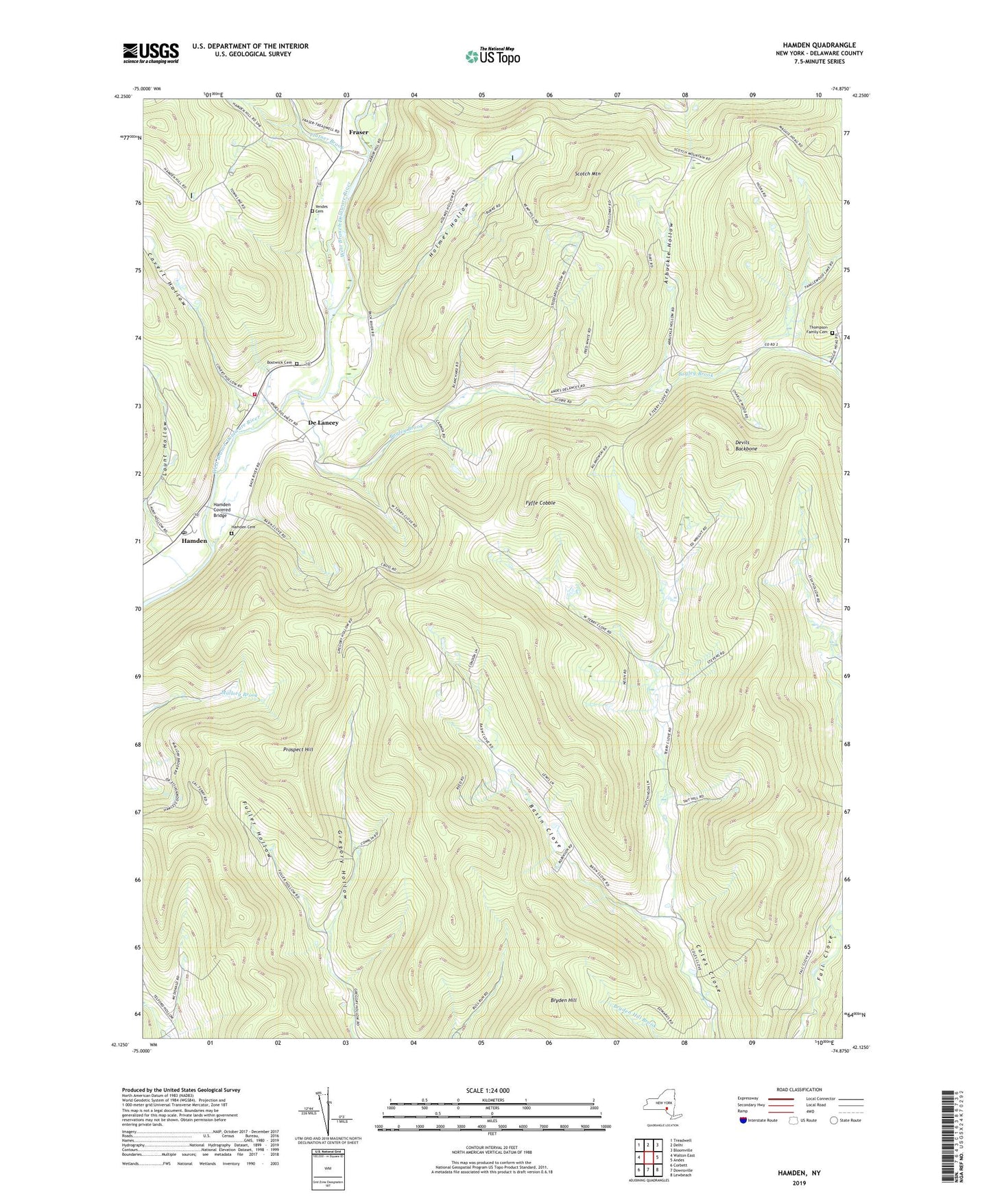
2023 topographic map quadrangle Hamden in the state of New York. Scale: 1:24000. Based on the newly updated USGS 7.5' US Topo map series, this map is in the following counties: Delaware. The map contains contour data, water features, and other items you are used to seeing on USGS maps, but also has updated roads and other features. This is the next generation of topographic maps. Printed on high-quality waterproof paper with UV fade-resistant inks.
Quads adjacent to this one:
West: Walton East
Northwest: Treadwell
North: Delhi
Northeast: Bloomville
East: Andes
Southeast: Lewbeach
South: Downsville
Southwest: Corbett
This map covers the same area as the classic USGS quad with code o42074b8.
Contains the following named places: Arbuckle Hollow, Bagley Brook, Basin Clove, Bostwick Cemetery, Bryden Hill, Covert Hollow, De Lancey, Delaware County, Delhi Volunteer Fire Department Station 2, Devils Backbone, Fraser, Fuller Hollow, Fyffe Cobble, Hamden, Hamden Cemetery, Hamden Covered Bridge, Hamden Post Office, Holmes Hollow, Launt Hollow, Lucky Dog Farm, Platner Brook, Prospect Hill, Scotch Mountain, Stoddard Hollow, Terry Clove, The Bullet Hole, Thompson Family Cemetery, Town of Hamden, Yendes Cemetery, ZIP Codes: 13752, 13782