
MyTopo
Trout Creek New York US Topo Map
Couldn't load pickup availability
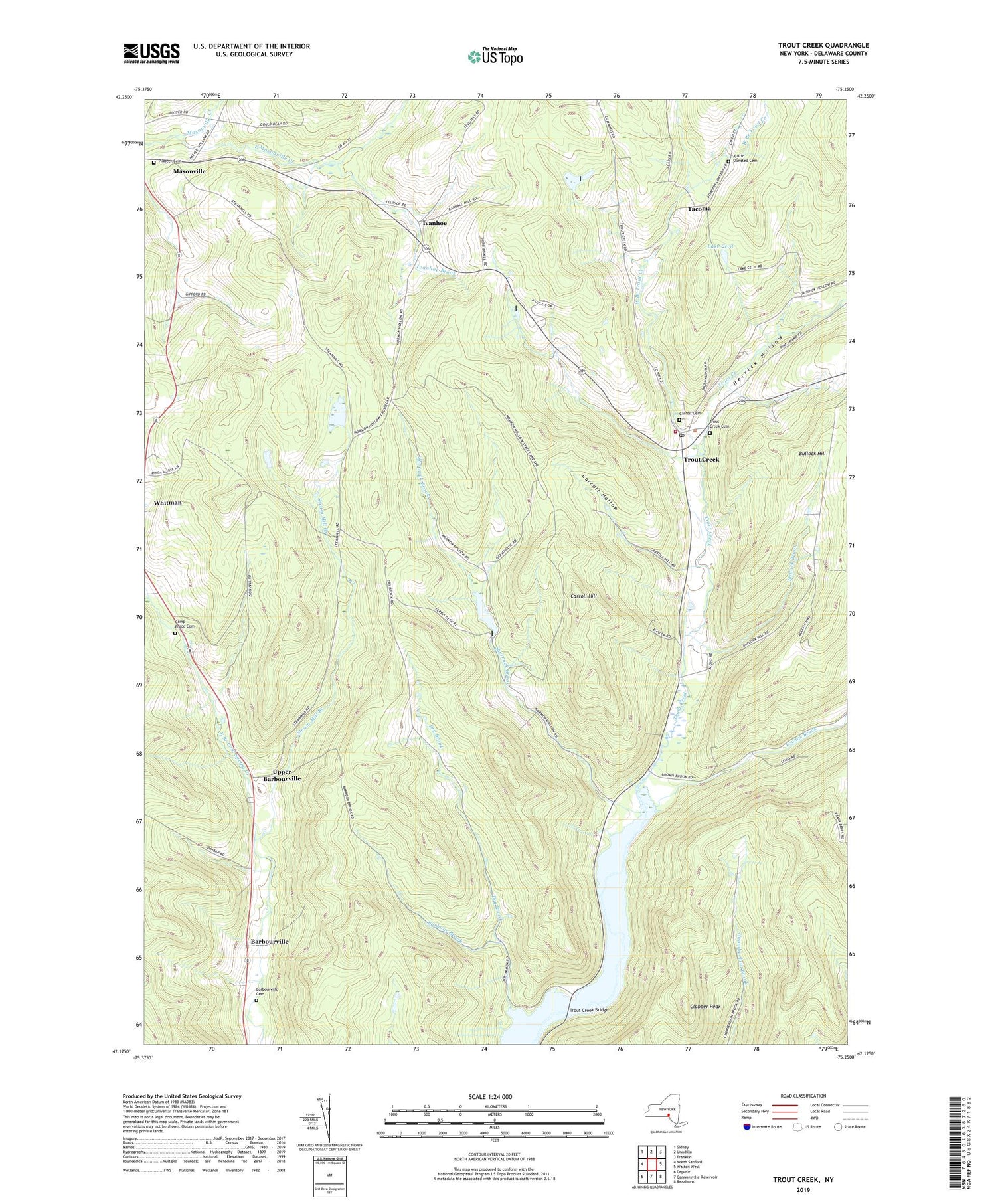
2019 topographic map quadrangle Trout Creek in the state of New York. Scale: 1:24000. Based on the newly updated USGS 7.5' US Topo map series, this map is in the following counties: Delaware. The map contains contour data, water features, and other items you are used to seeing on USGS maps, but also has updated roads and other features. This is the next generation of topographic maps. Printed on high-quality waterproof paper with UV fade-resistant inks.
Quads adjacent to this one:
West: North Sanford
Northwest: Sidney
North: Unadilla
Northeast: Franklin
East: Walton West
Southeast: Readburn
South: Cannonsville Reservoir
Southwest: Deposit
Contains the following named places: Austin Olmsted Cemetery, Barbour Brook, Barbourville, Barbourville Cemetery, Brace Youth Camp, Bullock Brook, Bullock Hill, Camp Brace Cemetery, Carroll Cemetery, Carroll Hill, Carroll Hollow, Clabber Peak, Delaware State Forest, Dry Brook, East Masonville Creek, Hardwood Hills Golf Course, Herrick Hollow, Ivanhoe, Ivanhoe Brook, Lake Cecil, Loomis Brook, Masonville Quarry, Mormon Hollow, Pioneer Cemetery, Sherruck Brook, Steam Mill Branch, Tacoma, Town of Masonville, Trout Creek, Trout Creek Bridge, Trout Creek Cemetery, Trout Creek Fire Company, Trout Creek Post Office, Upper Barbourville, West Branch Trout Creek, ZIP Code: 13847


