MyTopo
North Sanford New York US Topo Map
Couldn't load pickup availability
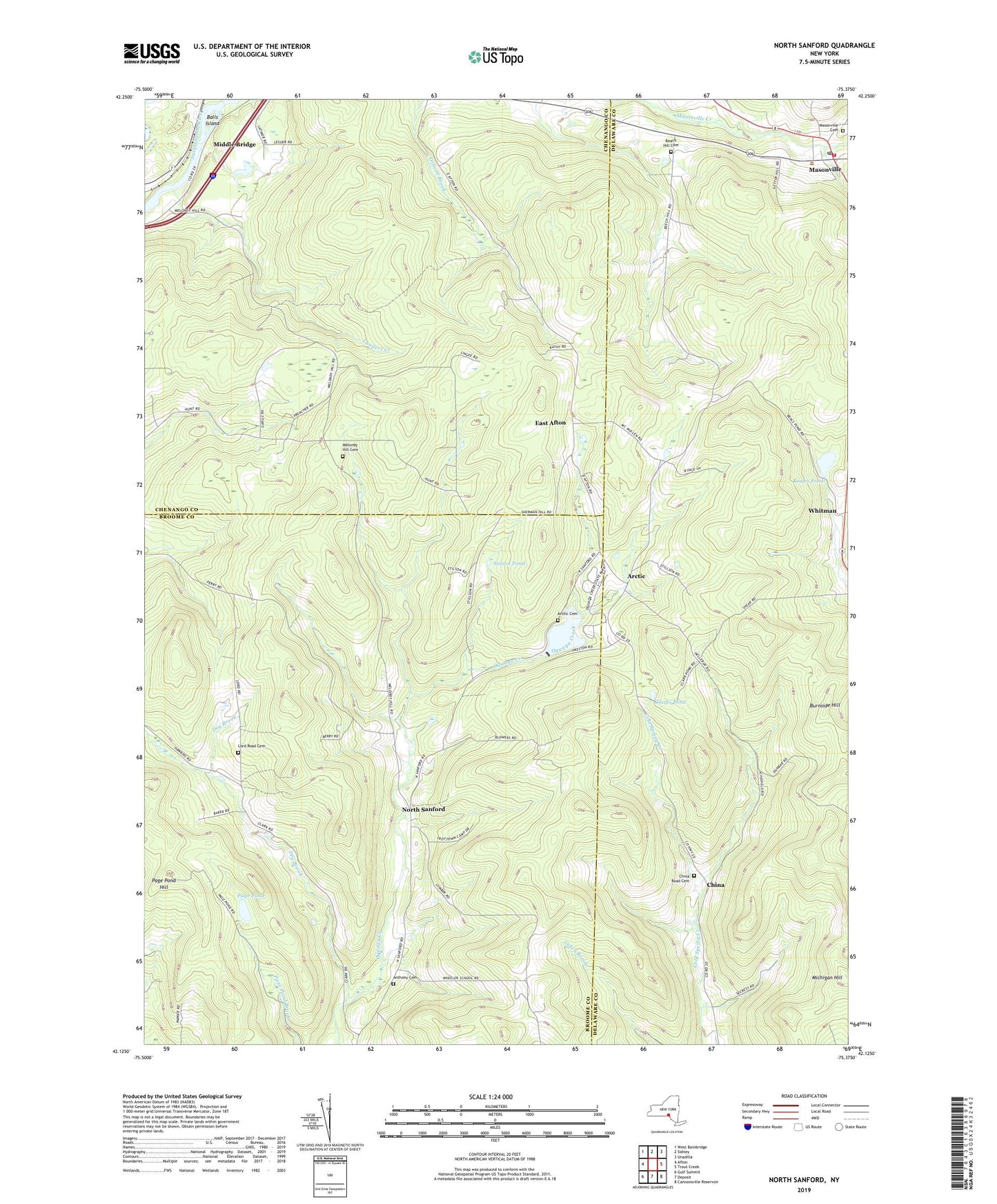
2023 topographic map quadrangle North Sanford in the state of New York. Scale: 1:24000. Based on the newly updated USGS 7.5' US Topo map series, this map is in the following counties: Delaware, Broome, Chenango. The map contains contour data, water features, and other items you are used to seeing on USGS maps, but also has updated roads and other features. This is the next generation of topographic maps. Printed on high-quality waterproof paper with UV fade-resistant inks.
Quads adjacent to this one:
West: Afton
Northwest: West Bainbridge
North: Sidney
Northeast: Unadilla
East: Trout Creek
Southeast: Cannonsville Reservoir
South: Deposit
Southwest: Gulf Summit
This map covers the same area as the classic USGS quad with code o42075b4.
Contains the following named places: Anthony Cemetery, Arctic, Arctic Cemetery, Balls Island, Baxters Tree Farm And Nursery, Beach Hill Cemetery, Beales Pond, Broome State Forest, Burnside Hill, Camp Amahami, Chenango State Forest, China, China Road Cemetery, Clarks Pond, Dry Brook, East Afton, Federated Church of Masonville, Landers Creek, Lord Road Cemetery, Masonville, Masonville Cemetery, Masonville Elementary School, Masonville Fire Department, Masonville Post Office, Melondy Hill Cemetery, Michigan Hill, Middle Bridge, North Sanford, North Sanford United Methodist Church, Page Pond, Page Pond Hill, Sidney Memorial Public Library Masonville Branch, Stilson Pond, Whitman, ZIP Code: 13804