
MyTopo
Victory New York US Topo Map
Couldn't load pickup availability
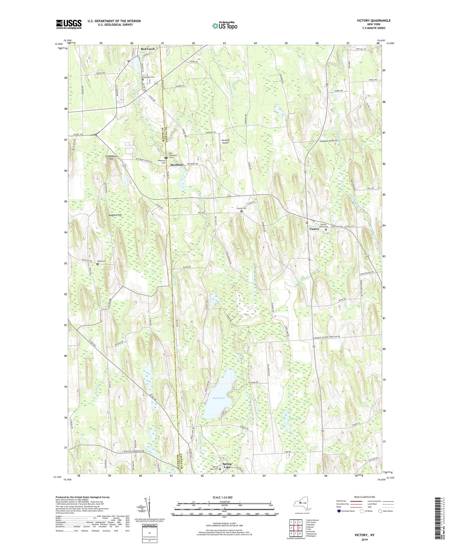
2019 topographic map quadrangle Victory in the state of New York. Scale: 1:24000. Based on the newly updated USGS 7.5' US Topo map series, this map is in the following counties: Cayuga, Wayne. The map contains contour data, water features, and other items you are used to seeing on USGS maps, but also has updated roads and other features. This is the next generation of topographic maps. Printed on high-quality waterproof paper with UV fade-resistant inks.
Quads adjacent to this one:
West: Wolcott
Northwest: North Wolcott
North: Fair Haven
Northeast: Hannibal
East: Cato
Southeast: Weedsport
South: Montezuma
Southwest: Savannah
Contains the following named places: Armour of Light Baptist Church, Butler Correctional Facility, Butler Quarry, Cuddeback Hill, Duck Lake, French Cemetery, Hogback Hill, Joyful Acres, Little Sodus Creek, Margaret W Cuyler Elementary School, Mud Pond, Old Westbury Cemetery, Paradise Airport, Red Creek, Red Creek Free Library, Red Creek High School, Red Creek Middle School, Red Creek Post Office, School Number 10, School Number 12, School Number 4, School Number 8, School Number 9, Snyders Tree Farm, Southside Cemetery, Spring Lake, Spring Lake Cemetery, Spring Lake Church, Town of Victory, Victory, Victory Fire Department, Victory Union Cemetery, Village of Red Creek, Westbury, Westbury Cemetery, Wood Cemetery, Yellow Red Corners, ZIP Code: 13143


