MyTopo
Bakers North Carolina US Topo Map
Couldn't load pickup availability
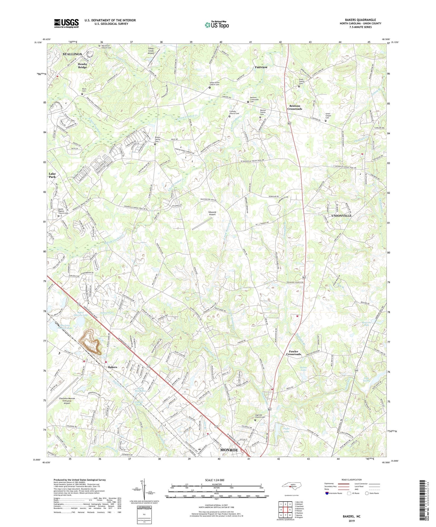
2019 topographic map quadrangle Bakers in the state of North Carolina. Scale: 1:24000. Based on the newly updated USGS 7.5' US Topo map series, this map is in the following counties: Union. The map contains contour data, water features, and other items you are used to seeing on USGS maps, but also has updated roads and other features. This is the next generation of topographic maps. Printed on high-quality waterproof paper with UV fade-resistant inks.
Quads adjacent to this one:
West: Matthews
Northwest: Mint Hill
North: Midland
Northeast: Stanfield
East: Watson
Southeast: Wingate
South: Monroe
Southwest: Waxhaw
Contains the following named places: Baker Quarry Lake, Baker Quarry Lake Dam, Bakers, Bakers Quarry, Bakers Volunteer Fire and Rescue, Baucom Lake, Baucom Lake Dam, Benton Family Cemetery, Bentons Crossroads, Bentons Crossroads Cemetery, Briarwood Acres, Broadview Acres, Broom Family Cemetery, Calvary Church, Camelot, Catfish Pond, Cedar Grove Church, Charlotte Plastics Lake, Charlotte Plastics Lake Dam, Charlotte-Monroe Executive Airport, City of Monroe, Clubview Acres, Crestview Acres, Dogwood Acres, East Fork Stewarts Creek, Ebenezer Church, Edwards Airport, Faith Church, Fowler Crossroads, Friendly Church, Friendly Church Cemetery, Goose Creek Airport, Grace Church, Helms Lake, Helms Lake Dam, Helms Park, Hemby Bridge Elementary School, Hemby Bridge Fire Station No 23, High Hill Church, High Hill Church Cemetery, Hillcrest Church, Hillsdale, Horsepen Branch, Kimberly Courts, Lake Minehaha, Lick Branch, Mill Grove Church, Mill Grove Church Cemetery, Monroe Annex Post Office, Monroe Fire Department Station 3, Monroe Fire Department Station 4, Monroe Fire Department Station 5, Monroe Mall, Monroe Shopping Center, Morning Star Church, New Salem Church, North Carolina State Highway Patrol Troop H District 3, North Carolina State Highway Patrol Troop H Headquarters, North Fork Crooked Creek, Olde Farm, Paddle Branch, Pinedell, Plyler Lake, Plyler Lake Dam, Ritch Cemetery, Roanoke Church, Rolling Hills, Rolling Hills Church, Rolling Hills Country Club, Sardis Baptist Church Cemetery, Sardis Church, Scott Family Cemetery, Shiloh Church, Shiloh School, Simmons Airport, South Fork Crooked Creek, Stephenson Church, Stumplick Branch, Town of Unionville, Township of Goose Creek, Union Chapel, Union Chapel Cemetery, Union Emergency Medical Services, Union Grove Church, Union Grove Church Cemetery, Union Springs Church, Unionville, Unionville School, Unionville Volunteer Fire Department Station 21, Unionville Volunteer Fire Department Station 22, Watts Grove Church, ZIP Codes: 28079, 28110