MyTopo
Watson North Carolina US Topo Map
Couldn't load pickup availability
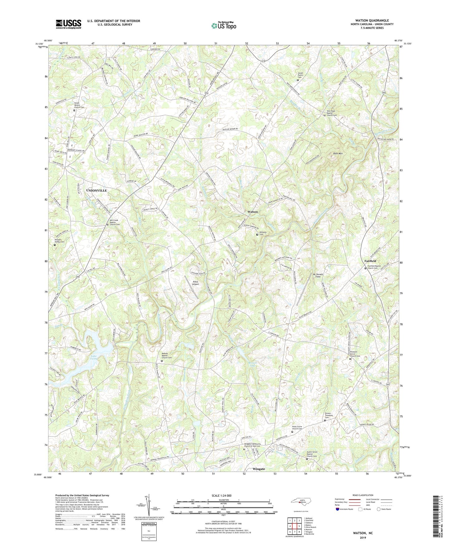
2022 topographic map quadrangle Watson in the state of North Carolina. Scale: 1:24000. Based on the newly updated USGS 7.5' US Topo map series, this map is in the following counties: Union. The map contains contour data, water features, and other items you are used to seeing on USGS maps, but also has updated roads and other features. This is the next generation of topographic maps. Printed on high-quality waterproof paper with UV fade-resistant inks.
Quads adjacent to this one:
West: Bakers
Northwest: Midland
North: Stanfield
Northeast: Oakboro
East: Olive Branch
Southeast: Marshville
South: Wingate
Southwest: Monroe
This map covers the same area as the classic USGS quad with code o35080a4.
Contains the following named places: Arant Airport, Austin Branch, Austin Grove Baptist Church Cemetery, Austin Grove Church, Brandon Branch, Brewer Lake, Brewer Lake Dam, Buck Branch, Bull Branch, Chinkapin Creek, Fairfield, Fairfield Baptist Church Cemetery, Flag Branch, Gold Branch, Haw Branch, Josiah Austin Cemetery, Lake Twitty, Little Mill Creek, Mc Donald Field, Meadow Branch, Midway Baptist Church Cemetery, Midway Church, Mill Creek, Mill Creek Baptist Church Cemetery, Mill Creek Church, New Hope Baptist Church Cemetery, New Hope Church, Piedmont High School, Piney Grove Church, Piney Grove Church Cemetery, Pleasant Grove Church, Pleasant Grove Church Cemetery, Polk Mountain, Presson - Shelby Cemetery, Rays Fork, Shiloh Advent Church Cemetery, Shiloh Church, Spring Branch, Stewarts Creek, Strawn - Treadway Cemetery, Twitty Dam, Watson, Watson Creek, Williams Cemetery, Wingate Community Church of God Cemetery