MyTopo
Bethlehem North Carolina US Topo Map
Couldn't load pickup availability
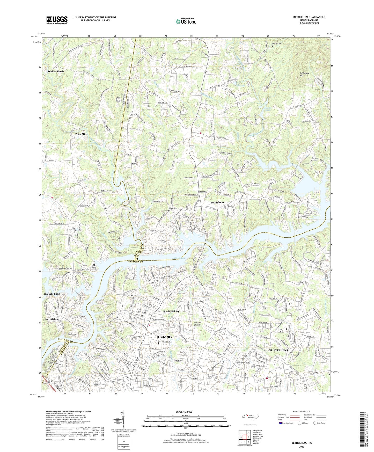
2019 topographic map quadrangle Bethlehem in the state of North Carolina. Scale: 1:24000. Based on the newly updated USGS 7.5' US Topo map series, this map is in the following counties: Alexander, Catawba, Caldwell, Burke. The map contains contour data, water features, and other items you are used to seeing on USGS maps, but also has updated roads and other features. This is the next generation of topographic maps. Printed on high-quality waterproof paper with UV fade-resistant inks.
Quads adjacent to this one:
West: Granite Falls
Northwest: Kings Creek
North: Ellendale
Northeast: Taylorsville
East: Millersville
Southeast: Newton
South: Hickory
Southwest: Longview
Contains the following named places: Alexander County Emergency Medical Services - Bethlehem Base, Bentley Cemetery, Bethlehem, Bethlehem Census Designated Place, Bethlehem Community Fire and Rescue, Bethlehem Elementary School, Clyde Campbell Elementary School, Concord, Corinth Church, Dudley Shoals Baptist Church, Dudley Shoals Elementary School, Falling Creek, Fellowship Church, Fox Dam, Fox Lake, Good Shepherd Church, Grace Chapel Volunteer Fire Department, Gunpowder Creek, Harry M Arnot Middle School, Hickory Fire Department Station 6 Viewmont, Horseford Creek, Isaac Creek, Isaac Creek Church, Jenkins Elementary School, Jumping Run, Lake Hickory, Lake Hickory Country Club, Little River Dam, Middle Little River, Mill Creek, Moretz Dam, Moretz Lake, Mount Bethel Church, Mount Olive Church, Mountain Creek, Mountain Creek Farm, NC Noname Two-Hundred Thirty-Nine Dam, North Hickory, North Pointe Shopping Center, Northgate Plaza, Northlakes Census Designated Place, Petra Mills, Pisgah Cemetery, Propst Store, Rink Dam, Rink Lake, Rock Creek, Rocky Mount Cemetery, Saint Matthews Church, Saint Stephens, Saint Stephens Census Designated Place, Saint Stephens Fire Department Station 4 Base 1, Saint Stephens High School, Sal Teague Hill, Sandy Ridge Church, Shiloh Church, Shuford Pond, Sims Pond, Snow Creek, The Colonnade, Township of Wittenburg, Trinity Church, Upper Little River, Viewmont Elementary School, West Junior High School, Woodlawn Memorial Gardens, ZIP Code: 28601