MyTopo
Ellendale North Carolina US Topo Map
Couldn't load pickup availability
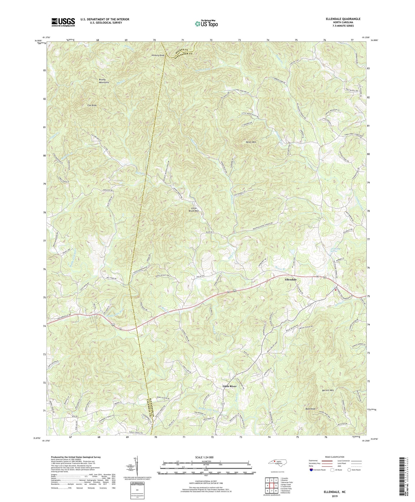
2022 topographic map quadrangle Ellendale in the state of North Carolina. Scale: 1:24000. Based on the newly updated USGS 7.5' US Topo map series, this map is in the following counties: Alexander, Caldwell, Wilkes. The map contains contour data, water features, and other items you are used to seeing on USGS maps, but also has updated roads and other features. This is the next generation of topographic maps. Printed on high-quality waterproof paper with UV fade-resistant inks.
Quads adjacent to this one:
West: Kings Creek
Northwest: Grandin
North: Boomer
Northeast: Moravian Falls
East: Taylorsville
Southeast: Millersville
South: Bethlehem
Southwest: Granite Falls
This map covers the same area as the classic USGS quad with code o35081h3.
Contains the following named places: All Healing Springs, Antioch Church, Bald Knob, Cox Knob, Dover Church, Downsville, Duck Creek, Ellendale, Ellendale Community Volunteer Fire Department, Ellendale Elementary School, Ginger Creek, Hickory Knob, Holsclaw Creek, Little Brush Mountain, Little River, Mountain Ridge Church, Never Mountain, Oxford Memorial Church, Poplar Creek, Poplar Springs Church, Township of Ellendale, Township of Little River, White Creek