MyTopo
Boiling Springs South North Carolina US Topo Map
Couldn't load pickup availability
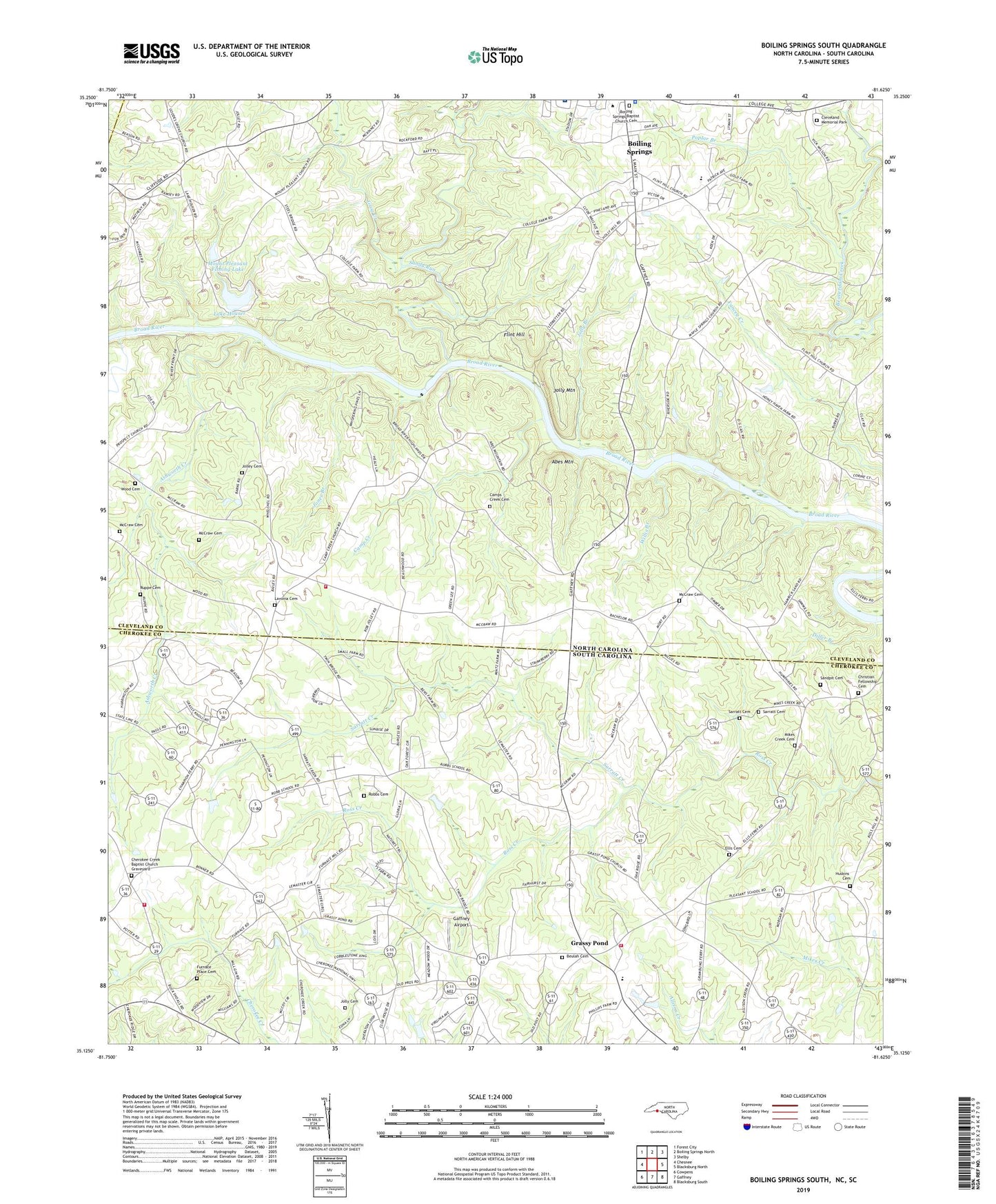
2019 topographic map quadrangle Boiling Springs South in the states of North Carolina, South Carolina. Scale: 1:24000. Based on the newly updated USGS 7.5' US Topo map series, this map is in the following counties: Cleveland, Cherokee, Rutherford. The map contains contour data, water features, and other items you are used to seeing on USGS maps, but also has updated roads and other features. This is the next generation of topographic maps. Printed on high-quality waterproof paper with UV fade-resistant inks.
Quads adjacent to this one:
Northwest: Forest City
North: Boiling Springs North
Northeast: Shelby
Southeast: Blacksburg South
South: Gaffney
Southwest: Cowpens
Contains the following named places: Abes Mountain, Asevorts School, Ashworth Creek, Assembly of God Church, Beulah Cemetery, Boiling Springs Baptist Church, Boiling Springs Baptist Church Cemetery, Boiling Springs Elementary School, Boiling Springs Rural Volunteer Fire Department Station 2, Boiling Springs Township 2, Byersville, Camp Creek, Camp Creek Baptist Church, Camps Creek Baptist Church Graveyard, Cherokee Baptist Church, Cherokee Creek Baptist Church Graveyard, Cherokee Creek Volunteer Fire Department, Christian Fellowship Cemetery, Cleveland County Emergency Medical Services Station 4, Cleveland Memorial Park, Crawley Memorial Hospital, Diller Branch, Ellis Cemetery, Flint Hill, Flint Hill Church, Flint Hill School, Freewill Church, Furnace Place Cemetery, Gaffney Airport, Gardner - Webb University, Goforth Cross Road, Grassy Pond, Grassy Pond Baptist Church, Grassy Pond School, Grassy Pond Volunteer Fire Department, Grog Creek, Holly Springs School, Houser Dam, Humphrey Gin, Huskins Cemetery, Island Creek School, Island Ford, Jolley Cemetery, Jolley Store, Jolly Branch, Jolly Cemetery, Jolly Mountain, Jones Branch, Jones Ferry, Lake Houser, Lavonia Baptist Church, Lavonia Cemetery, Maud, McCraw Cemetery, McGraw Store, Mike Creek School, Mikes Creek Baptist Church, Mikes Creek Baptist Church Graveyard, Mount Joy Church, Mount Pleasant Baptist Church, Mount Pleasant Fishing Lake, Mount Pleasant Fishing Lake Dam, New Pleasant School, Nicholsville, Palmer School, Poplar Branch, River Township 1, Robbs Cemetery, Robbs School, Ruppe Cemetery, Sandpit Cemetery, Sandy Run, Sarratt Cemetery, Sarratt Creek, Simmons Ford, Suck Creek, Sugar Branch, Willis Branch, Wood Cemetery, ZIP Codes: 28017, 28114