MyTopo
Bonnetsville North Carolina US Topo Map
Couldn't load pickup availability
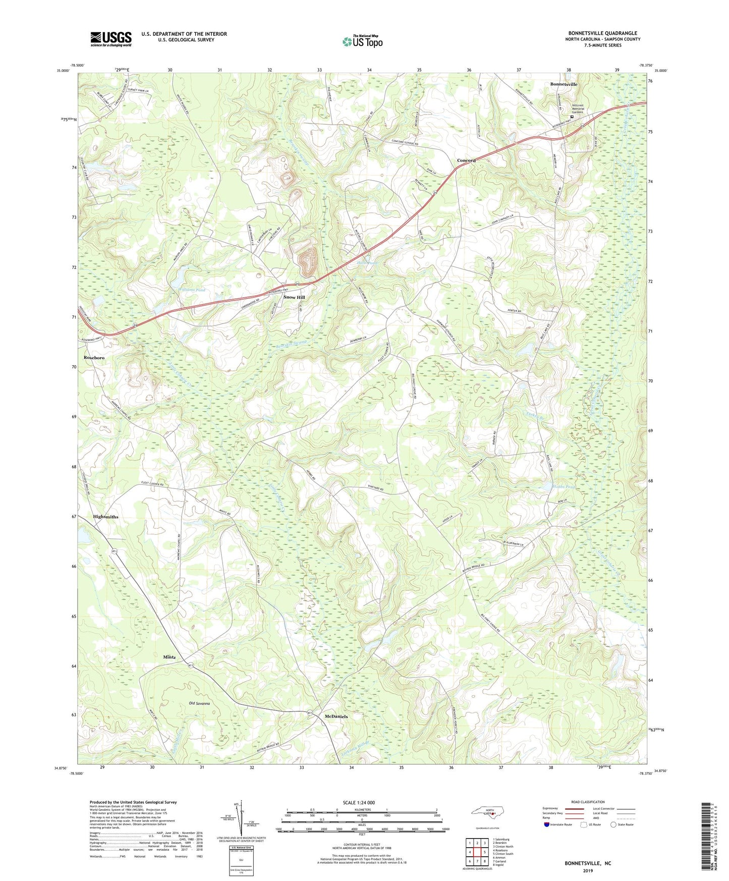
2019 topographic map quadrangle Bonnetsville in the state of North Carolina. Scale: 1:24000. Based on the newly updated USGS 7.5' US Topo map series, this map is in the following counties: Sampson. The map contains contour data, water features, and other items you are used to seeing on USGS maps, but also has updated roads and other features. This is the next generation of topographic maps. Printed on high-quality waterproof paper with UV fade-resistant inks.
Quads adjacent to this one:
West: Roseboro
Northwest: Salemburg
North: Bearskin
Northeast: Clinton North
East: Clinton South
Southeast: Ingold
South: Garland
Southwest: Ammon
Contains the following named places: Andrews Chapel, Bearskin Swamp, Big Piney Grove Church, Bonnetsville, Bonnetsville Census Designated Place, Carrs Chapel, Concord, Cooper Chapel, Elizabeth Church, Fox Lake, Fox Lake Dam, Halls Pond, Halls Pond Dam, Harmony Church, Highsmiths, Hillcrest Memorial Park, Hobbs Pond, Lakewood Country Club, Lockamy Mill Branch, McDaniels, Mintz, Moccasin Branch, Old Savanna, Robinson Chapel, Roseboro Industrial Park, Snow Hill, Springs Church, Township of McDaniels, Turkey Branch, Upper Jb Williams Pond Dam, Williams Pond