MyTopo
Roseboro North Carolina US Topo Map
Couldn't load pickup availability
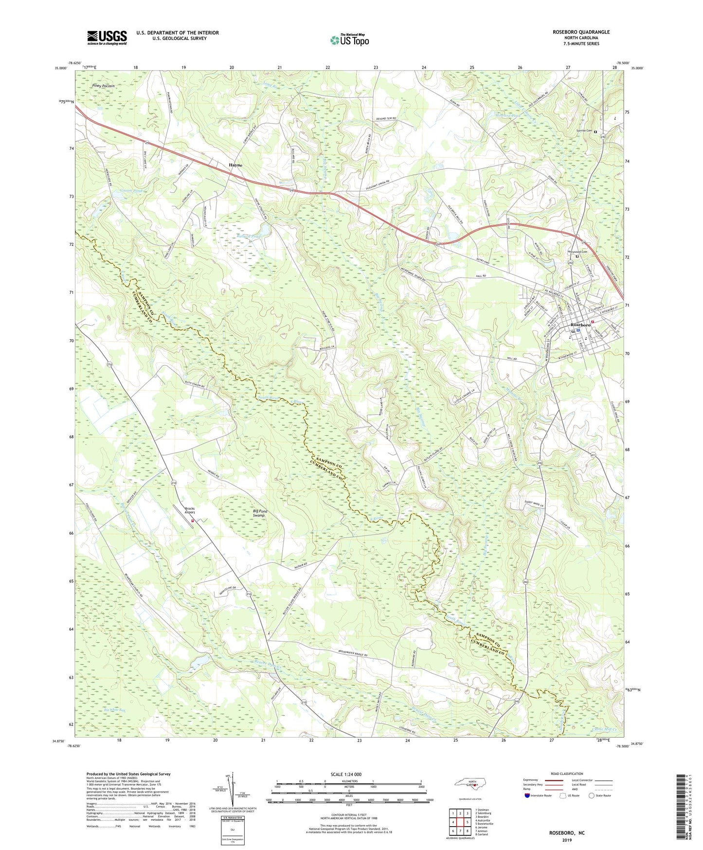
2022 topographic map quadrangle Roseboro in the state of North Carolina. Scale: 1:24000. Based on the newly updated USGS 7.5' US Topo map series, this map is in the following counties: Sampson, Cumberland. The map contains contour data, water features, and other items you are used to seeing on USGS maps, but also has updated roads and other features. This is the next generation of topographic maps. Printed on high-quality waterproof paper with UV fade-resistant inks.
Quads adjacent to this one:
West: Autryville
Northwest: Stedman
North: Salemburg
Northeast: Bearskin
East: Bonnetsville
Southeast: Garland
South: Ammon
Southwest: Jerome
This map covers the same area as the classic USGS quad with code o34078h5.
Contains the following named places: Beaver Dam Church, Beaver Dam School, Beaver Dam Volunteer Fire Department, Big Pond Swamp, Big Swamp, Brick Mill Church, Brocks Airport, Bullard Pond, Castle Mill Creek, Evergreen Church, Hayne, Hollywood Cemetery, Howard Pond, Lakewood High School, Long Branch, Mill Creek Church, Mulatto Branch, Perry School, Piney Pocosin, Pleasant Union Church, Roseboro, Roseboro Fire Department, Roseboro Middle School, Roseboro Police Department, Roseboro Post Office, Roseboro Rescue Squad, Rye Swamp, Sunrise Cemetery, Town of Roseboro, Township of Beaver Dam, Township of Little Coharie, Universal Church, Vinson Pond, ZIP Code: 28382