MyTopo
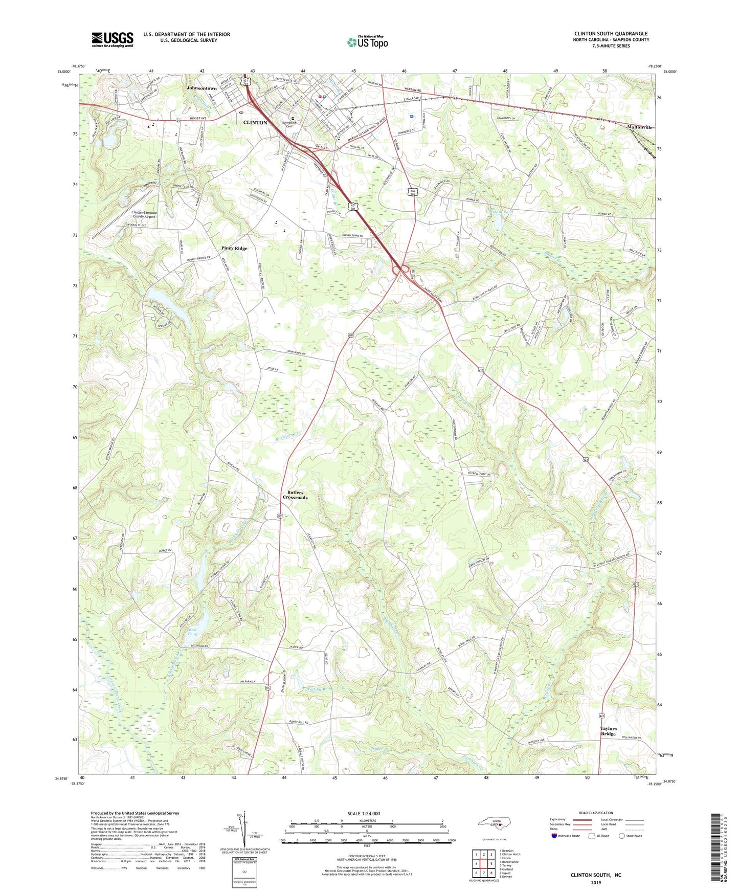
Clinton South North Carolina US Topo Map
Couldn't load pickup availability
2019 topographic map quadrangle Clinton South in the state of North Carolina. Scale: 1:24000. Based on the newly updated USGS 7.5' US Topo map series, this map is in the following counties: Sampson. The map contains contour data, water features, and other items you are used to seeing on USGS maps, but also has updated roads and other features. This is the next generation of topographic maps. Printed on high-quality waterproof paper with UV fade-resistant inks.
Quads adjacent to this one:
West: Bonnetsville
Northwest: Bearskin
North: Clinton North
Northeast: Faison
East: Turkey
Southeast: Delway
South: Ingold
Southwest: Garland
Contains the following named places: Andrews Chapel, Best Pond, Best Pond Dam, Bethany Church, Beulah, Boney Pond, Bridge Branch, Butlers Crossroads, Chestnut Pond, Clinton, Clinton - Sampson Rescue and Emergency Medical Services, Clinton Chapel African Methodist Episcopal Zion Church, Clinton City Hall, Clinton Family Worship Center, Clinton Fire Department, Clinton High School, Clinton Lookout Tower, Clinton Police Department, Clinton Post Office, Clinton-Sampson County Airport, Coharie Country Club, Collage Street School, Colonial Heights Church, Epworth Church, Federal Bureau of Investigation, First United Methodist Church, Forest Trail Retirement Center, Graves Memorial Presbyterian Church, Holy Grove Church, Immaculate Conception Catholic Church, Johnsontown, Jump and Run Branch, Kirtwood Park, Mary Gran Nursing Center, Moltonville, Mount Carmel Church, Mount Gilead Church, Mount Sinai United Holiness Church, New Life Baptist Church, Pentecostal Holiness Church, Piney Ridge, Red Hill Church, Red Hill Missionary Baptist Church, Rocky Marsh Creek, Rowan Church, Royal Lane Park, Saint Paul Church, Saint Pauls Episcopal Church, Sampson College, Sampson County, Sampson County Narcotics, Sampson County Sheriff's Office, Sampson Middle School, Shamrock Plaza, South Clinton Mobile Home Park, Spirit of Life Church of God, Springdale Cemetery, Taylors Bridge, The Church of Jesus Christ of Latter Day Saints, Township of South Clinton, Tyndall Grove Church, Union Chapel, Union Grove Church, Union Star Original Free Will Baptist Church, United Chapel African Methodist Episcopal Zion Church, Wolf Pit Branch, WRRZ-AM (Clinton), WRRZ-FM (Clinton)