MyTopo
Faison North Carolina US Topo Map
Couldn't load pickup availability
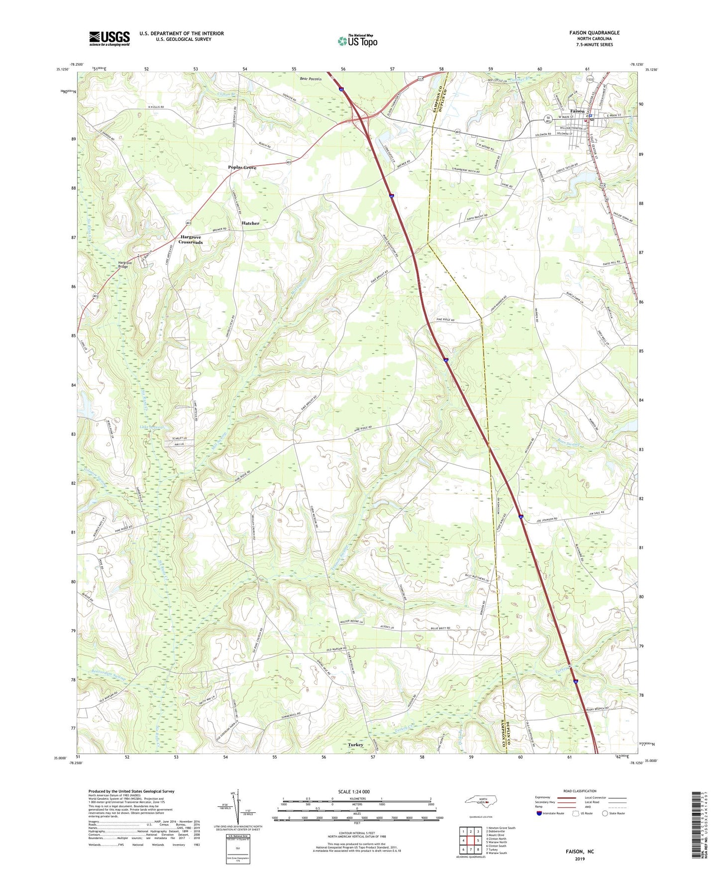
2022 topographic map quadrangle Faison in the state of North Carolina. Scale: 1:24000. Based on the newly updated USGS 7.5' US Topo map series, this map is in the following counties: Sampson, Duplin. The map contains contour data, water features, and other items you are used to seeing on USGS maps, but also has updated roads and other features. This is the next generation of topographic maps. Printed on high-quality waterproof paper with UV fade-resistant inks.
Quads adjacent to this one:
West: Clinton North
Northwest: Newton Grove South
North: Dobbersville
Northeast: Mount Olive
East: Warsaw North
Southeast: Warsaw South
South: Turkey
Southwest: Clinton South
This map covers the same area as the classic USGS quad with code o35078a2.
Contains the following named places: Beaverdam Swamp, Bethlehem Church, Beulah Church, Burning Bush Church, Carolina Fish Hatchery, Faison, Faison Baptist Church, Faison Fire and Rescue, Faison Post Office, Faison Sheriff's Department Substation, Faison United Methodist Church, Gilmore Swamp, Hargrove Bridge, Hargrove Crossroads, Hargrove School, Hatcher, Hicks Branch, Hills Chapel, Lake Artesia, Line Academy, Mill Swamp, Millers Chapel, Moore School, Moses Chapel, Poplar Grove, Poplar Grove Baptist Church, Saint Gabriels Church, Six Runs Church, Tenmile Swamp, Town of Faison, ZIP Code: 28341