MyTopo
Garner North Carolina US Topo Map
Couldn't load pickup availability
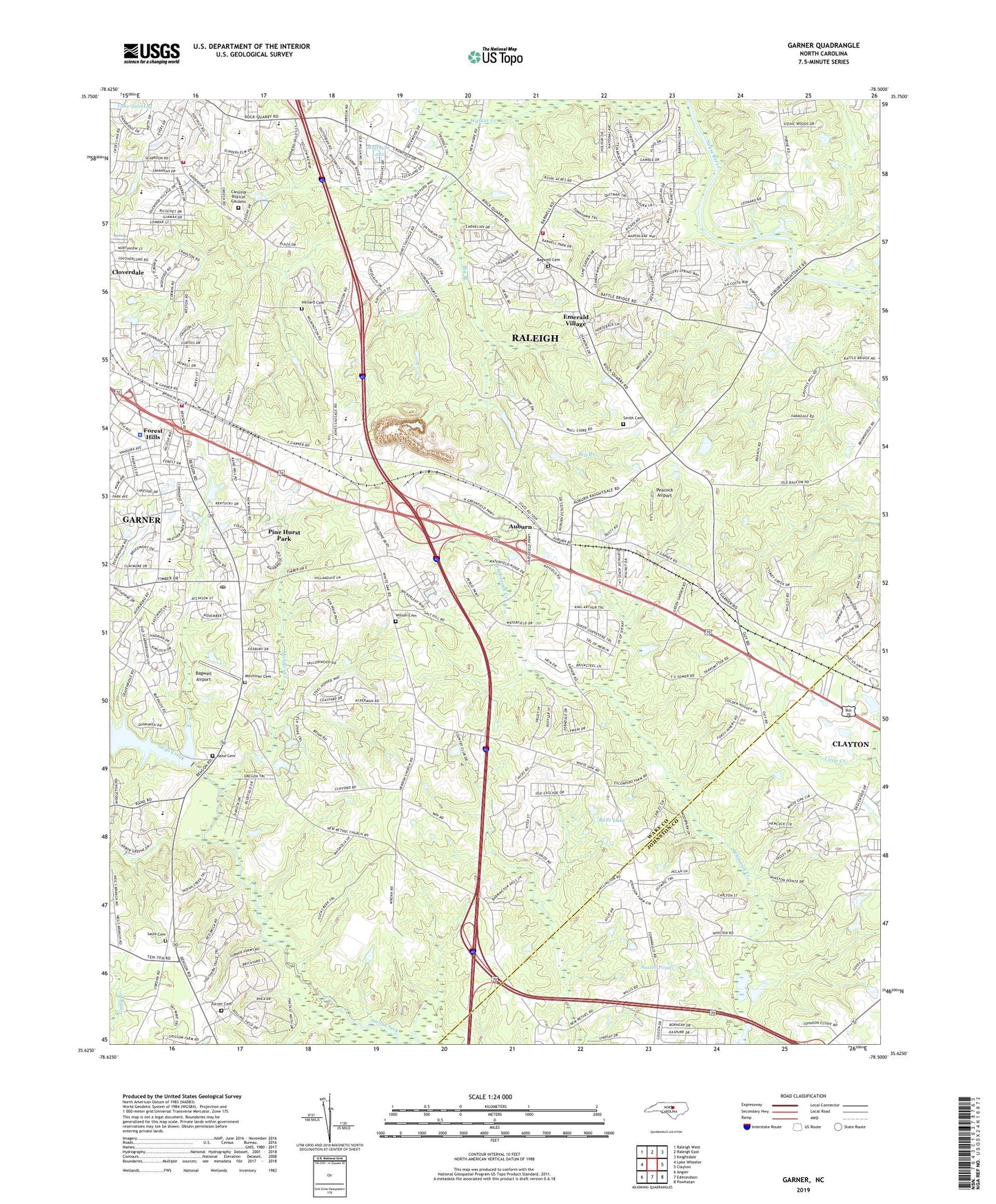
2019 topographic map quadrangle Garner in the state of North Carolina. Scale: 1:24000. Based on the newly updated USGS 7.5' US Topo map series, this map is in the following counties: Wake, Johnston. The map contains contour data, water features, and other items you are used to seeing on USGS maps, but also has updated roads and other features. This is the next generation of topographic maps. Printed on high-quality waterproof paper with UV fade-resistant inks.
Quads adjacent to this one:
West: Lake Wheeler
Northwest: Raleigh West
North: Raleigh East
Northeast: Knightdale
East: Clayton
Southeast: Powhatan
South: Edmondson
Southwest: Angier
Contains the following named places: Auburn, Aversboro Elementary School, Bagwell Airport, Bagwell Cemetery, Bagwell Pond Dam, Bainbridge, Bells Lake, Bethel Church, Big Branch, Carolina Biblical Gardens, Cloverdale, Creech Road Elementary School, Dunhaven by the Lake, Eagle Crest Golf Course Dam, East Garner Middle School, Ebenezer Church, Emerald Village, First Congregational Church, Forest Hills, Forest Landing, Garner, Garner Consolidated School, Garner Elementary School, Garner Fire Department Station 1 Headquarters, Garner Mobile Estates, Garner Police Department, Garner Post Office, Garner Quarry, Gethsemane Seventh Day Adventist Day Care Center, Good Samaritan Church, Hayes Chapel, Heather Hills, Heatheridge, Hillandale, Hilliard Cemetery, Hoffman Lake, Immanuel Apostolic Church of Christ, Kingdom Hall of Jehovah's Witnesses, Lake Benson Dam, Lake Johnson, Legend Hills, Mahlers Creek, Malibu Valley, Meadowbrook Country Club, Mitchiner Cemetery, Mount Auburn School, Mount Calvary Holy Church, Mount Herman Church, Mount Moriah Church, Mount Pleasant Church, Neal Branch, New Bethel Church, North Carolina State University Central Research Station, North Garner Intermediate School, Peacock Airport, Penny Pond, Penny Pond Dam, Pine Hurst Park, Progressive Missionary Baptist Church, Raleigh Fire Department Station 10, Raleigh Fire Department Station 26, Raleigh Police Department Southeast District, Rand Cemetery, Sauls Cemetery, School Acres, Smith Cemetery, Solid Rock Baptist Church, Southeast Raleigh High School, Springfield Baptist Church, Town of Garner, Township of Saint Marys, Truevine Apostolic Temple International, Turner Cemetery, Turner Memorial Church, Upper Room Church of God in Christ, Van Story Hills, Village of White Oak, White Oak, WHPY-AM (Clayton), Wilson Cemetery, WKBQ-AM (Garner), Word of God Christian Day Care Center, Word of God Fellowship Church, WRAL-FM (Raleigh), WRAL-TV (Raleigh), WTVD-TV (Durham), Young Missionary Temple, Young Missionary Temple Day Care and Learning Center, ZIP Codes: 27529, 27610