MyTopo
Granite Falls North Carolina US Topo Map
Couldn't load pickup availability
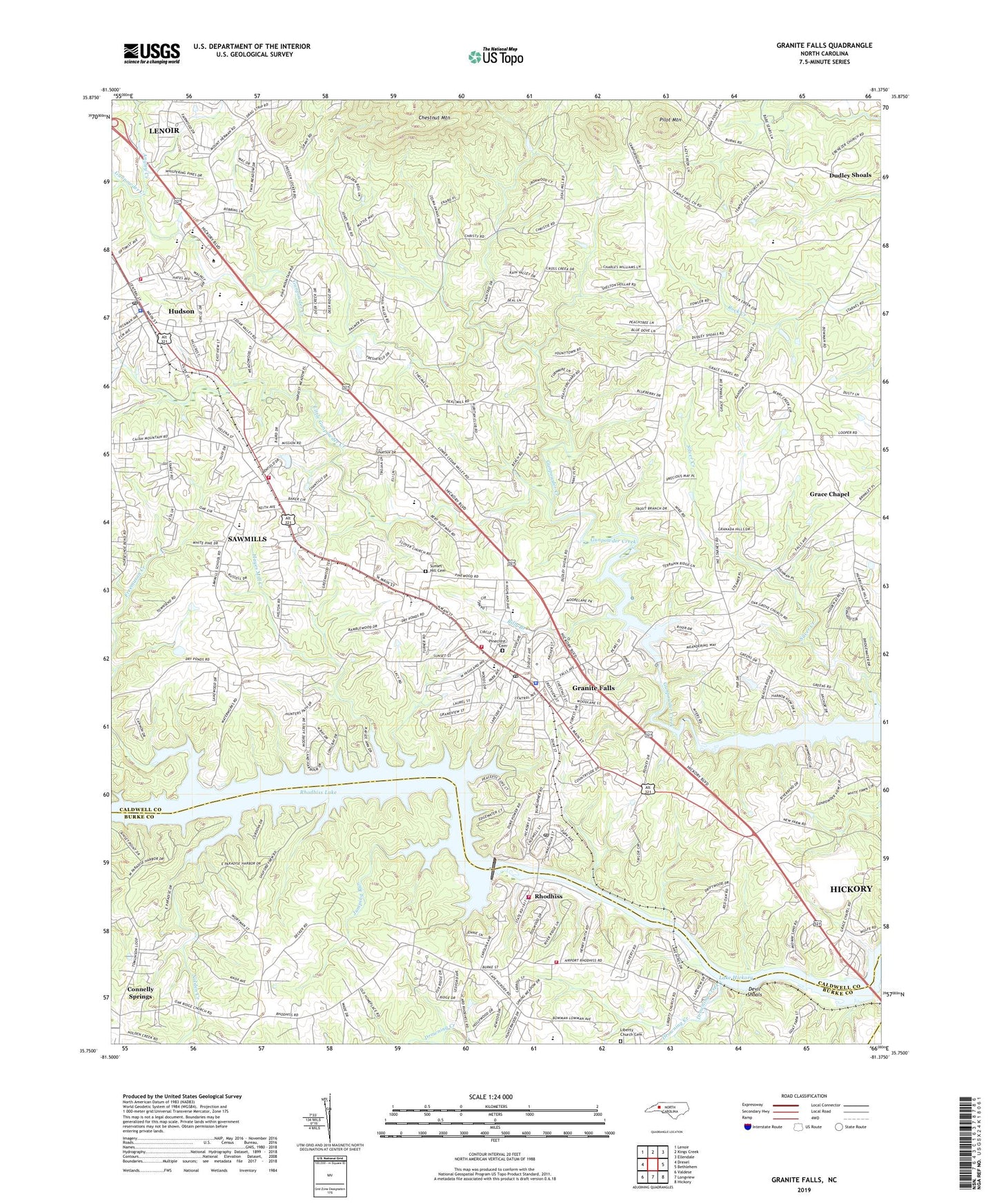
2019 topographic map quadrangle Granite Falls in the state of North Carolina. Scale: 1:24000. Based on the newly updated USGS 7.5' US Topo map series, this map is in the following counties: Caldwell, Burke, Catawba. The map contains contour data, water features, and other items you are used to seeing on USGS maps, but also has updated roads and other features. This is the next generation of topographic maps. Printed on high-quality waterproof paper with UV fade-resistant inks.
Quads adjacent to this one:
West: Drexel
Northwest: Lenoir
North: Kings Creek
Northeast: Ellendale
East: Bethlehem
Southeast: Hickory
South: Longview
Southwest: Valdese
Contains the following named places: Angley Creek, Baird, Bethel Church, Billy Branch, Brushy Fork, Caldwell Community College, Caldwell County Fairgrounds, Center Grove Church, Chestnut Mountain, Clove Church, Concord Baptist Church, Devil Shoals, Drowning Creek, Dry Pond Union Church, Dudley Shoals, East Hudson Church, Ebenezer Church, Fellowship Church, Freemason Creek, Friendship Church, Grace Chapel, Granada Golf Course, Granite Falls, Granite Falls Elementary School, Granite Falls Fire Department, Granite Falls First Baptist Church, Granite Falls Middle School, Granite Falls Police Department, Granite Falls Post Office, Granville Terrace, Hayes Mill Creek, Hudson, Hudson Drag Strip, Hudson Elementary School, Hudson Fire Department, Hudson First Baptist Church, Hudson Middle School, Hudson Police Department, Hudson Post Office, Jumping Run, Liberty Church Cemetery, Little Dam, Little Gunpowder Creek, Lovelady Church, Lovelady Rescue Squad, Mayfield, Mount Zion Church, Mountain View Development, Nolden Creek, North Lakes, Northlakes, Oak Grove Church, Oak Ridge Church, Old Mill Pond, Old Mill Pond Dam, Old Millpond, Pilot Mountain, Pine Mountain Campground, Pinecrest Cemetery, Pinewood, Poovey Chapel, Pooveys Grove Church, Rhodhiss, Rhodhiss Dam, Rhodhiss Police Department, Rhodhiss Post Office, Rhodhiss Volunteer Fire Department, Rhodiss Baptist Church, Sardis, Sawmills, Sawmills School, Sawmills Volunteer Fire and Rescue Department, Shady Grove Church, Silver Creek, South Caldwell High School, Sunrise Baptist Church, Sunset Hill Cemetery, Temple Hill Church, Town of Connelly Springs, Town of Granite Falls, Town of Hudson, Town of Rhodhiss, Town of Sawmills, Township of Hudson, Township of Lovelady, WKJK-AM (Granite Falls), ZIP Codes: 28630, 28638, 28667