MyTopo
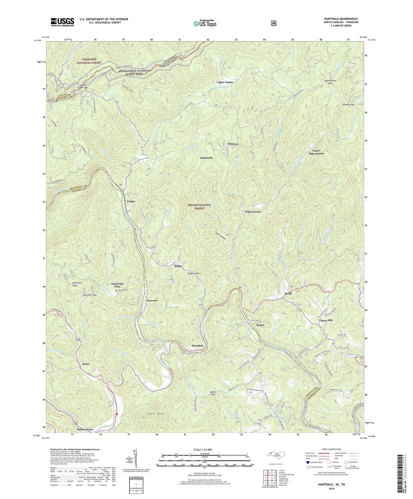
Huntdale North Carolina US Topo Map
Couldn't load pickup availability
2019 topographic map quadrangle Huntdale in the states of North Carolina, Tennessee. Scale: 1:24000. Based on the newly updated USGS 7.5' US Topo map series, this map is in the following counties: Mitchell, Yancey, Unicoi. The map contains contour data, water features, and other items you are used to seeing on USGS maps, but also has updated roads and other features. This is the next generation of topographic maps. Printed on high-quality waterproof paper with UV fade-resistant inks.
Quads adjacent to this one:
West: Chestoa
Northwest: Erwin
North: Unicoi
Northeast: Iron Mountain Gap
East: Bakersville
Southeast: Micaville
South: Burnsville
Southwest: Bald Creek
Contains the following named places: Allan Branch, Bailey, Bearwallow Creek, Bearwallow Gap, Beauty Spot, Beauty Spot Gap, Beauty Spot Observation Spot, Bee Branch, Bee Branch School, Big Creek, Big Creek School, Big Ridge, Big Rock Creek, Bird Creek, Bowling Green Creek, Bradshaw Volunteer Fire Station Rescue Service, Brandy Gap, Brummett Creek, Brummett Creek Church, Cane River, Christian Church, Clinchfield Church, Cooper Branch, Deep Gap, Devils Nest, Egypt - Ramseytown Volunteer Fire Department Station 2, Elkwallow Knob, Firescald Branch, Flat Branch, Fork Ridge, Freewill Church, Green Mountain, Griffith Branch, Harmiller Gap, Hollow Poplar Creek, Horton Hill, Horton Hill Church, Howell Branch, Hughes Creek, Hughes Gap, Huntdale, Indian Grave Gap, Indian Grave Trailhead, Jackies Mill Branch, Jacks Creek, Jake Hollow, Julius Knob, Laurel Ridge, Leathermans Fork, Locust Grove Church, Lower Poplar School, Mc Kinney Branch, McHill Gap, Miller Branch, North Bend Church, North Cox Creek, North Toe River, Pate Creek, Peterson, Peterson Ridge, Pigeonroost, Pigeonroost Creek, Pigpen Creek, Pine Knob, Poplar, Poplar Boat Ramp, Poplar Hunt Camp, Pounding Mill Branch, Raccoon Creek, Ramseytown, Relief, Rich Mountain, Richlands, Right Fork Pigeonroost Creek, Sams Branch, Shinbone Creek, Shop Branch, Sid Hill, Sioux, Tipton Hill, Tipton Hill Elementary School, Township of Bradshaw, Township of Poplar, Unaka Mountains, Union Hill Church, Upper Pigeonroost, Upper Poplar, Valhalla Dome, Warrick Branch, Webb, Whiteoak Creek, Whiteoak Flats, Whitson, Whitson Branch, Worrick Cemetery, ZIP Code: 28740