MyTopo
Jamesville North Carolina US Topo Map
Couldn't load pickup availability
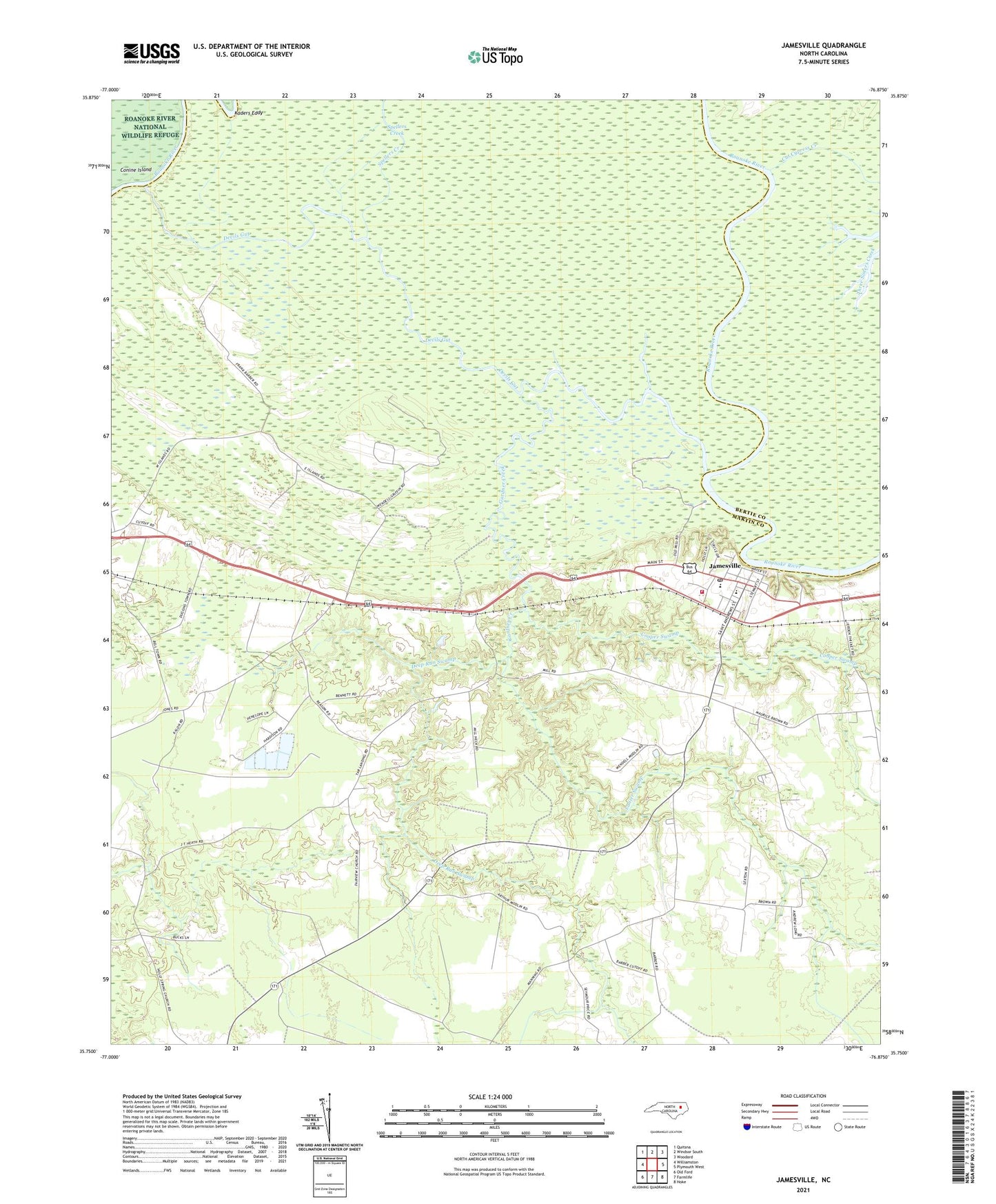
2021 topographic map quadrangle Jamesville in the state of North Carolina. Scale: 1:24000. Based on the newly updated USGS 7.5' US Topo map series, this map is in the following counties: Martin, Bertie. The map contains contour data, water features, and other items you are used to seeing on USGS maps, but also has updated roads and other features. This is the next generation of topographic maps. Printed on high-quality waterproof paper with UV fade-resistant inks.
Quads adjacent to this one:
West: Williamston
Northwest: Quitsna
North: Windsor South
Northeast: Woodard
East: Plymouth West
Southeast: Hoke
South: Farmlife
Southwest: Old Ford
Contains the following named places: Cedar Branch Church, Cooper Swamp, Cut Cypress Creek, Deep Run Swamp, Devils Gut, Fairview Church, Friends Church, Gardner Creek, Goddard Hill Church, Jamesville, Jamesville Baptist Church, Jamesville Church, Jamesville Community Emergency Medical Services and Rescue, Jamesville Community Volunteer Fire Department, Jamesville Post Office, Jamesville Union School, Jamesville United Methodist Church, Kaders Eddy, Lanier Swamp, Lower Deadwater Creek, Saint James Church, Siloam Church, Spellers Creek, Tar Landing, Town of Jamesville, Township of Williams, ZIP Code: 27846