
MyTopo
Jarvisburg North Carolina US Topo Map
Couldn't load pickup availability
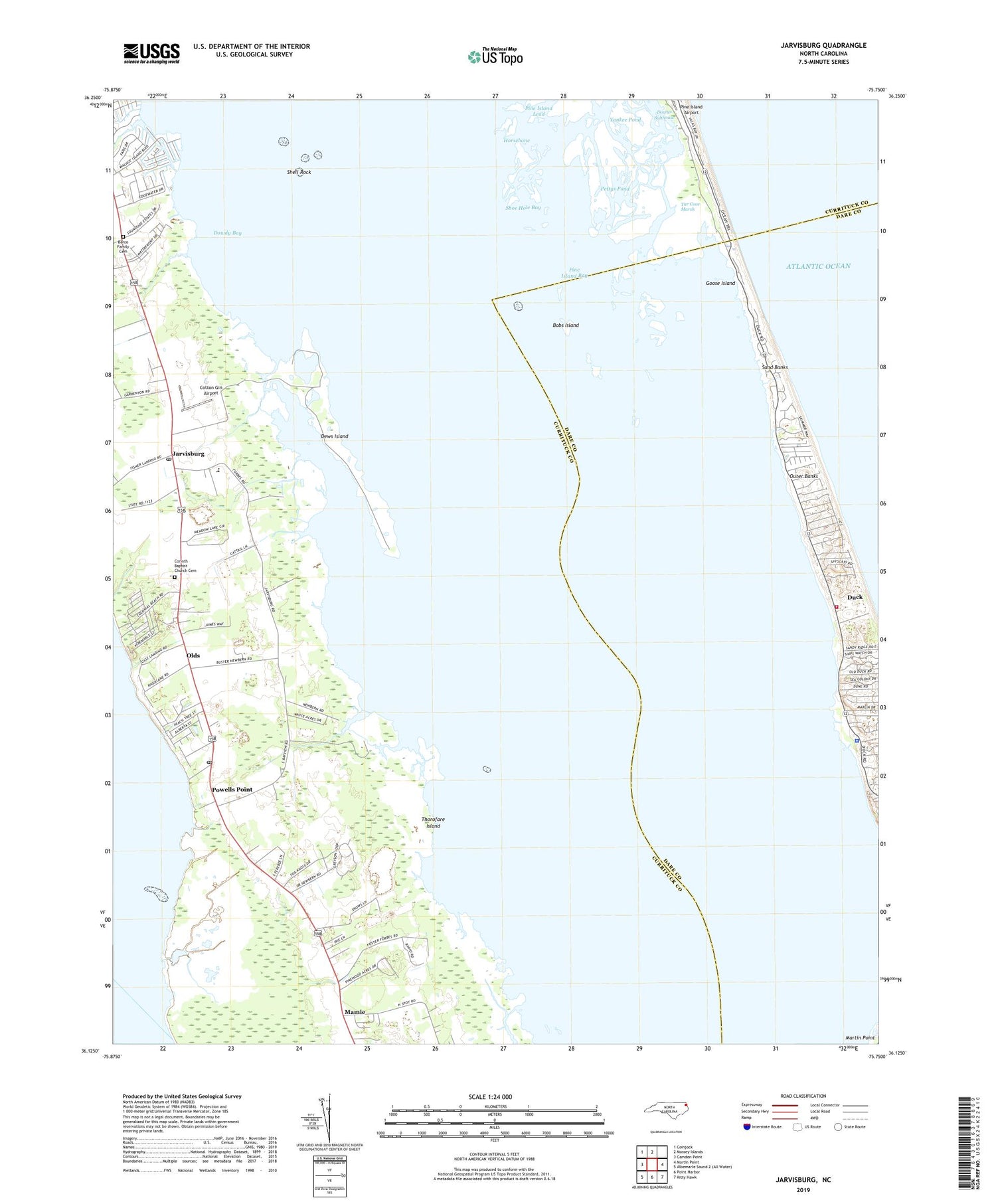
2019 topographic map quadrangle Jarvisburg in the state of North Carolina. Scale: 1:24000. Based on the newly updated USGS 7.5' US Topo map series, this map is in the following counties: Currituck, Dare. The map contains contour data, water features, and other items you are used to seeing on USGS maps, but also has updated roads and other features. This is the next generation of topographic maps. Printed on high-quality waterproof paper with UV fade-resistant inks.
Quads adjacent to this one:
West: Camden Point
Northwest: Coinjock
North: Mossey Islands
East: Martin Point
Southeast: Kitty Hawk
South: Point Harbor
Contains the following named places: Barco Family Cemetery, Bayberry Bluffs, Beach Creek, Bobs Island, Caffeys Inlet, Caffys Inlet Hamlet, Carolina Dunes, Corinth Baptist Church Cemetery, Corinth Church, Cotton Gin Airport, Currituck County Sheriffs Office, Dews Island, Dodge, Dowdy Bay, Doxeys Salthouse, Duck, Duck Fire Department Station 11, Duck Police Department, Gallop Landing, Goose Island, Gulls Flight, Hebron Church, Horsebone, Jarvisburg, Jarvisburg Post Office, Mamie, Martin Point, Newbern Landing, North Point, Ocean Pines, Olds, Osprey, Pettys Pond, Pine Island Bay, Pine Island Lead, Pleasant Branch Church, Poplar Branch Landing, Port Trinitie, Powells Point, Powells Point Post Office, Saltaire, Sand Banks, Sanderling, Sandy Ridge, Scarborough Faire Shopping Center, Schooner Ridge, Sea Ridge, Sheep Creek, Shell Rock, Shipswatch, Shoe Hole Bay, Snow Geese Dunes, Snow Geese South, Straight Creek, Thorofare Island, Town of Duck, Trinite Harbor, Waltons Landing, Webster Creek, Wild Duck Dunes, Yankee Pond, ZIP Codes: 27939, 27966


