MyTopo
Kitty Hawk North Carolina US Topo Map
Couldn't load pickup availability
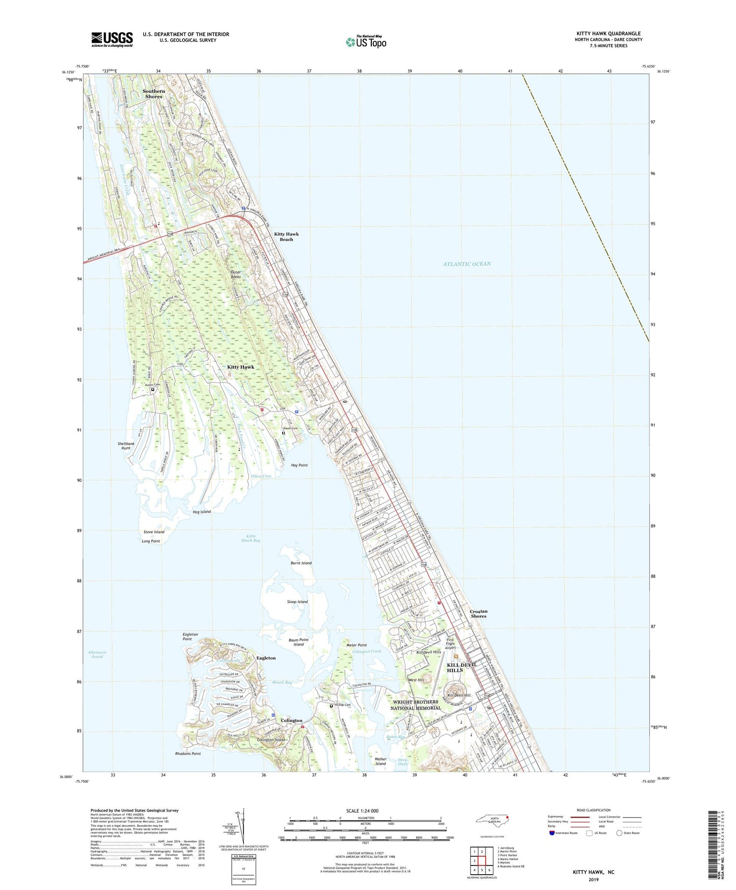
2022 topographic map quadrangle Kitty Hawk in the state of North Carolina. Scale: 1:24000. Based on the newly updated USGS 7.5' US Topo map series, this map is in the following counties: Dare. The map contains contour data, water features, and other items you are used to seeing on USGS maps, but also has updated roads and other features. This is the next generation of topographic maps. Printed on high-quality waterproof paper with UV fade-resistant inks.
Quads adjacent to this one:
West: Point Harbor
Northwest: Jarvisburg
North: Martin Point
Southeast: Roanoke Island NE
South: Manteo
Southwest: Manns Harbor
This map covers the same area as the classic USGS quad with code o36075a6.
Contains the following named places: Alcohol Law Enforcement, Austin Cemetery, Avalon Beach, Avalon Pier, Baum Bay, Baum Cemetery, Baum Point Island, Blount Bay, Burnt Island, Colington, Colington Church, Colington Creek, Colington Fire Department, Colington Island, Colony Lake, Croatan Shores, Dare County Sheriff Civil Division, Dare County Sheriff's Office - Colington, Deep Ditch, Duck Pond Creek, Eagleton, Eagleton Point, East Albemarle Regional Library - Kill Devil Hills Branch, First Flight Airport, Hay Point, Hilltop Cemetery, Hog Island, Holy Redeemer Church, Kill Devil Hill, Kill Devil Hill Reverse Osmosis Water Treatment Plant, Kill Devil Hills, Kill Devil Hills Fire Department Station 14, Kill Devil Hills Police Department, Kill Devil Hills Post Office, Kill Devil Hills Water Tank, Kitty Hawk, Kitty Hawk Bay, Kitty Hawk Beach, Kitty Hawk Fire Department Station 13, Kitty Hawk Landing, Kitty Hawk Pier, Kitty Hawk Police Department, Kitty Hawk Post Office, Kitty Hawk School, Long Point, Meter Point, North Carolina State Highway Patrol Troop A District 1, Poor Ridge Landing, Rhodoms Point, Rock Church, Shellbank Point, Sloop Island, Sound Landing, Southern Shores Fire Department Station 12, Southern Shores Police Department, Stove Island, Tillets Cove, Town of Kill Devil Hills, Town of Kitty Hawk, Town of Southern Shores, Township of Atlantic, Vistor County/Outer Banks Chamber of Commerce, Walker Island, WBNM Tower, West Hill, Wright Brothers National Memorial, Wright Brothers National Memorial Visitor Center, ZIP Code: 27948