MyTopo
McDaniel Bald North Carolina US Topo Map
Couldn't load pickup availability
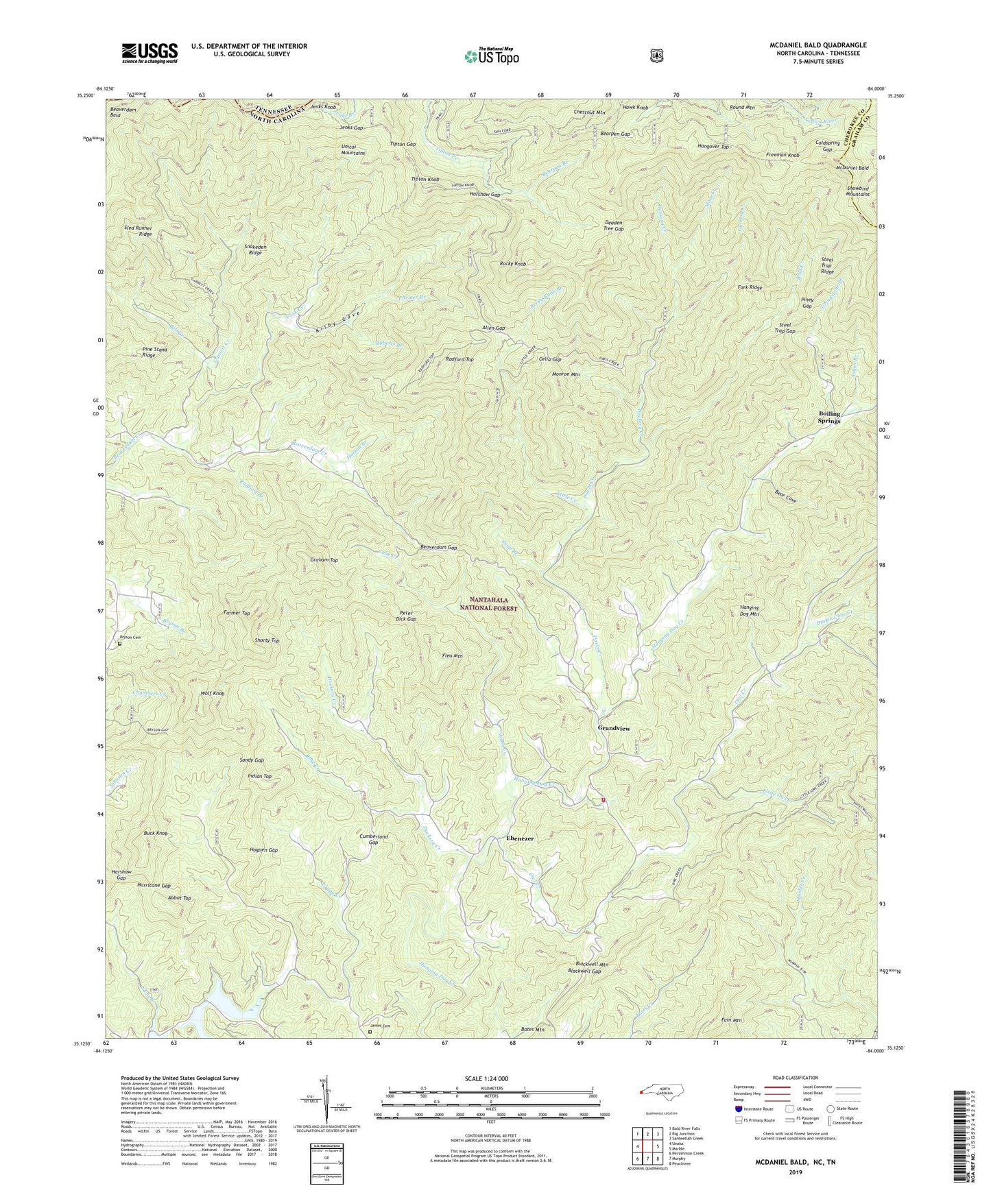
2019 topographic map quadrangle McDaniel Bald in the states of Tennessee, North Carolina. Scale: 1:24000. Based on the newly updated USGS 7.5' US Topo map series, this map is in the following counties: Cherokee, Graham, Monroe. The map contains contour data, water features, and other items you are used to seeing on USGS maps, but also has updated roads and other features. This is the next generation of topographic maps. Printed on high-quality waterproof paper with UV fade-resistant inks.
Quads adjacent to this one:
West: Unaka
Northwest: Bald River Falls
North: Big Junction
Northeast: Santeetlah Creek
East: Marble
Southeast: Peachtree
South: Murphy
Southwest: Persimmon Creek
Contains the following named places: Abbot Top, Allen Gap, Augen Branch, Bald Creek, Bear Cove, Bearpen Branch, Bearpen Gap, Beaverdam Gap, Bell Creek, Blackwell Gap, Blackwell Mountain, Boiling Spring Church, Boiling Springs, Bryson Cemetery, Buck Knob, Celia Gap, Cherokee County, Cherokee County Community, Cherokee Indian Land Henson Donation, Chestnut Mountain, Coldspring Gap, Cook Creek, Cumberland Gap, Davis Creek, Deaden Tree Gap, Dinkin Cove Creek, Dockery Creek, Ebenezer, Fain Mountain, Farmer Branch, Farmer Top, Flea Mountain, Fork Ridge, Freeman Knob, Garrett Creek, Graham Top, Grandview, Grindstone Branch, Gumlog Creek, Hanging Dog Church, Hanging Dog Volunteer Fire Department, Hangover Top, Harshaw Gap, Hawk Knob, Hogpen Gap, Horton Branch, Hurricane Gap, Indian Top, James Cemetery, Jenks Gap, Jenks Knob, Kilby Cove, Little Creek, Little Owl Creek, McDaniel Bald, Monroe Mountain, Mose Creek, Mount Nebo Church, Owl Creek, Owl Creek Church, Peter Dick Gap, Piney Gap, Radford Branch, Radford Top, Roberts Branch, Rocky Knob, Rocky Knob Branch, Rose Creek, Round Mountain, Sandy Gap, Shorty Top, Sled Runner Ridge, Snakeden Ridge, Snap Branch, Steel Trap Gap, Steel Trap Ridge, Tipton Gap, Tipton Knob, West Prong Grape Creek, White Church School, Wolf Knob