MyTopo
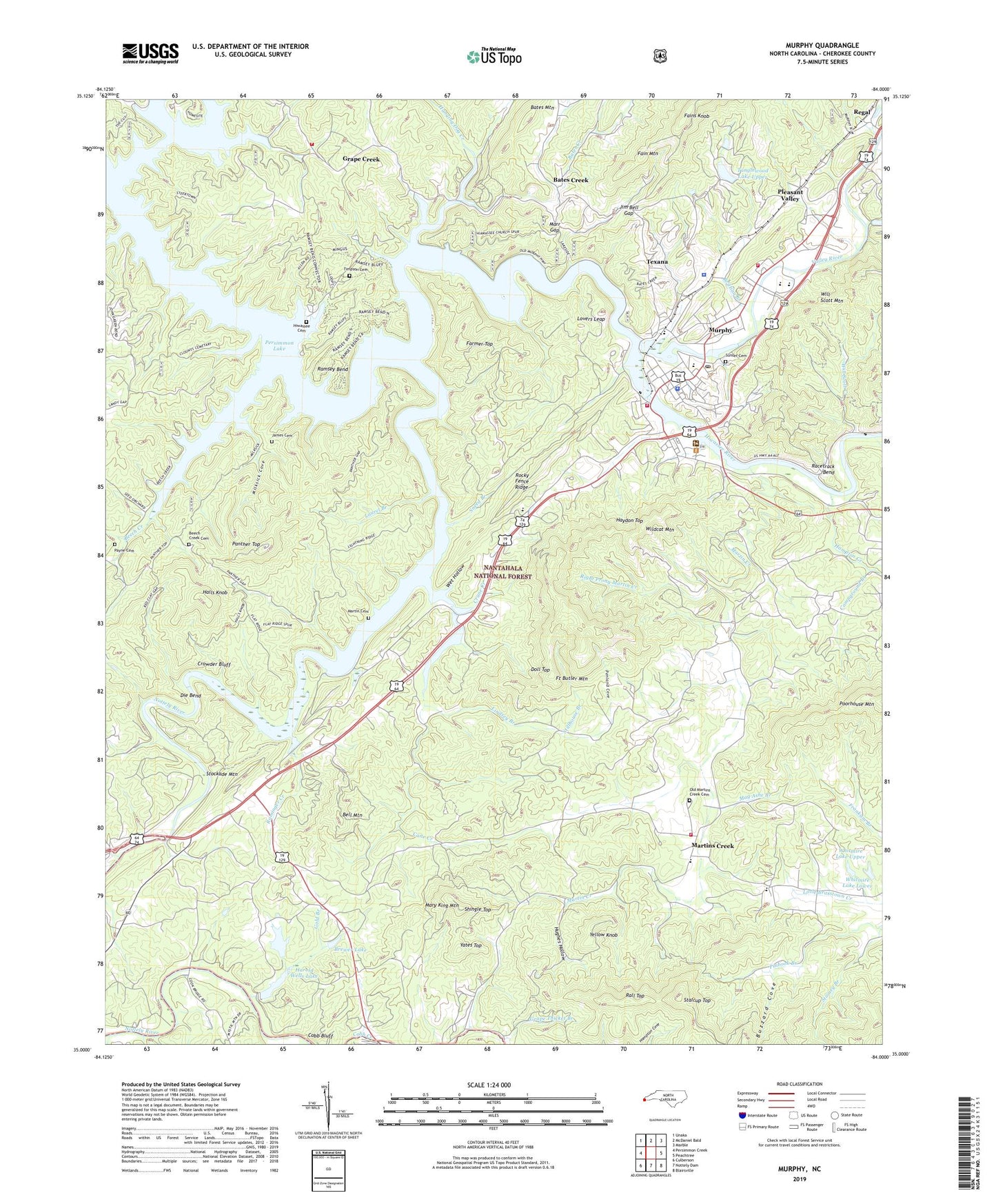
Murphy North Carolina US Topo Map
Couldn't load pickup availability
Also explore the Murphy Forest Service Topo of this same quad for updated USFS data
2022 topographic map quadrangle Murphy in the state of North Carolina. Scale: 1:24000. Based on the newly updated USGS 7.5' US Topo map series, this map is in the following counties: Cherokee. The map contains contour data, water features, and other items you are used to seeing on USGS maps, but also has updated roads and other features. This is the next generation of topographic maps. Printed on high-quality waterproof paper with UV fade-resistant inks.
Quads adjacent to this one:
West: Persimmon Creek
Northwest: Unaka
North: McDaniel Bald
Northeast: Marble
East: Peachtree
Southeast: Blairsville
South: Nottely Dam
Southwest: Culberson
This map covers the same area as the classic USGS quad with code o35084a1.
Contains the following named places: Bates Creek, Bates Mountain, Beaver Gap, Beech Creek, Beech Creek Cemetery, Beech Creek Seed Orchard, Bell Mountain, Birch, Blue Quarry, Brewer Lake, Brewer Lake Dam, Brittian Branch, Buzzard Cove, Campground Branch, Cane Creek, Cherokee County Emergency Medical Services Station 1, Cherokee County Rescue Squad, Cherokee County Sheriff's Office, Cherokee Indian Land Tract Number 2, Cherokee Indian Land Tract Number 7, Clarks Store, Cobb Bluff, Crane Creek, Crowder Bluff, Die Bend, Doll Top, Dukes Lodge, Fains Knob, Farmer Top, Fort Butler Mountain, Gold Branch, Grape Creek, Grape Creek Volunteer Fire Department, Grape Thicket Branch, Halls Knob, Hampton Creek, Hampton Memorial Church, Hanging Dog Creek, Hanging Dog Recreation Site, Harmony Church, Harold Wells Dam, Harold Wells Lake, Haydon Top, Hiwassee Cemetery, Hiwassee Church, Hughes Hollow, James Cemetery, Jim Bell Gap, Laurel Branch, Lindsey Branch, Little Glade Church, Lovers Leap, Mag Ashe Branch, Marble Creek, Marr Gap, Martin Cemetery, Martin Creek, Martins Creek, Martins Creek Elementary School, Martins Creek Volunteer Fire Department, Mary King Mountain, Milksick Cove, Mount Liberty Church, Murphy, Murphy Elementary School, Murphy Fire Department Station 1, Murphy Fire Department Substation, Murphy High School, Murphy Police Department, Murphy Post Office, New Martins Creek Church, Notla Church, Nottely River, Old Martins Creek Cemetery, Old Martins Creek Church, Palmer Branch, Panther Top, Panther Top Lookout, Payne Cemetery, Penland Cove, Pleasant Valley, Racetrack Bend, Rall Top, Ramsey Bend, Ranger, Regal, Right Prong Martin Creek, Rocky Fence Ridge, Rominger Creek, Shingle Top, Sneed Branch, Snow Hill Church, Song Branch, Stalcup Top, Stillhouse Branch, Stockade Mountain, Sunset Cemetery, Tanglewood Dam Number Two, Tanglewood Dam Upper, Tanglewood Lake Number Two, Tanglewood Lake Upper, Texana, Timpson Cemetery, Town of Murphy, Township of Murphy, Township of Notla, Tusquitee Airport, Tusquitee Ranger District Office, Valley River, Valley Village Shopping Center, Walker Mill Creek, Wet Hollow, Whitmire Dam Lower, Whitmire Dam Upper, Whitmire Lake Lower, Whitmire Lake Upper, Wildcat Mountain, Will Scott Church, Will Scott Creek, WKRK-AM (Murphy), Yates Top, Yellow Knob