MyTopo
Plymouth West North Carolina US Topo Map
Couldn't load pickup availability
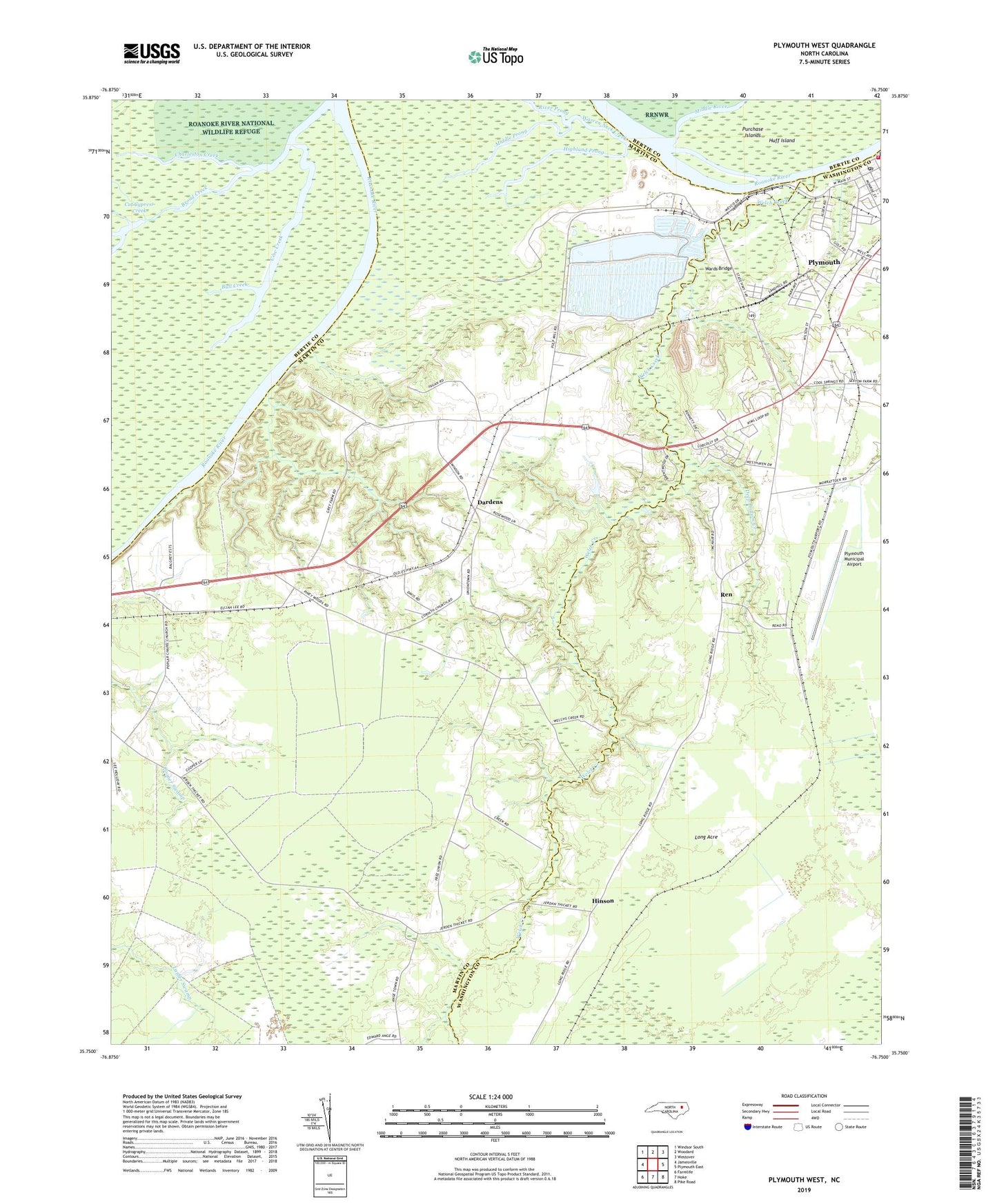
2019 topographic map quadrangle Plymouth West in the state of North Carolina. Scale: 1:24000. Based on the newly updated USGS 7.5' US Topo map series, this map is in the following counties: Martin, Washington, Bertie. The map contains contour data, water features, and other items you are used to seeing on USGS maps, but also has updated roads and other features. This is the next generation of topographic maps. Printed on high-quality waterproof paper with UV fade-resistant inks.
Quads adjacent to this one:
West: Jamesville
Northwest: Windsor South
North: Woodard
Northeast: Westover
East: Plymouth East
Southeast: Pike Road
South: Hoke
Southwest: Farmlife
Contains the following named places: Ausbon, Broad Creek, Bull Creek, Charleston Creek, Corinth Church, Cow Creek, Dardens, Deep Bottom Creek, Gospel Light Church, Grace Church, Highland Prong, Hinson, Hoof Inn, Long Acre, Middle Prong, Moratuc, Mount Olive Church, Plymouth Municipal Airport, Plymouth Post Office, Poplar Chapel, Promise Land Church, Promised Land Church of Christ, Ren, River Prong, Snells Mobile Home Park, Three Sisters Creek, Township of Jamesville, Union Town Church, Wards Bridge, Wares Chapel, Warren Neck Creek, Welch Creek, WKLX-FM (Plymouth), WPNC-AM (Plymouth)