MyTopo
Quitsna North Carolina US Topo Map
Couldn't load pickup availability
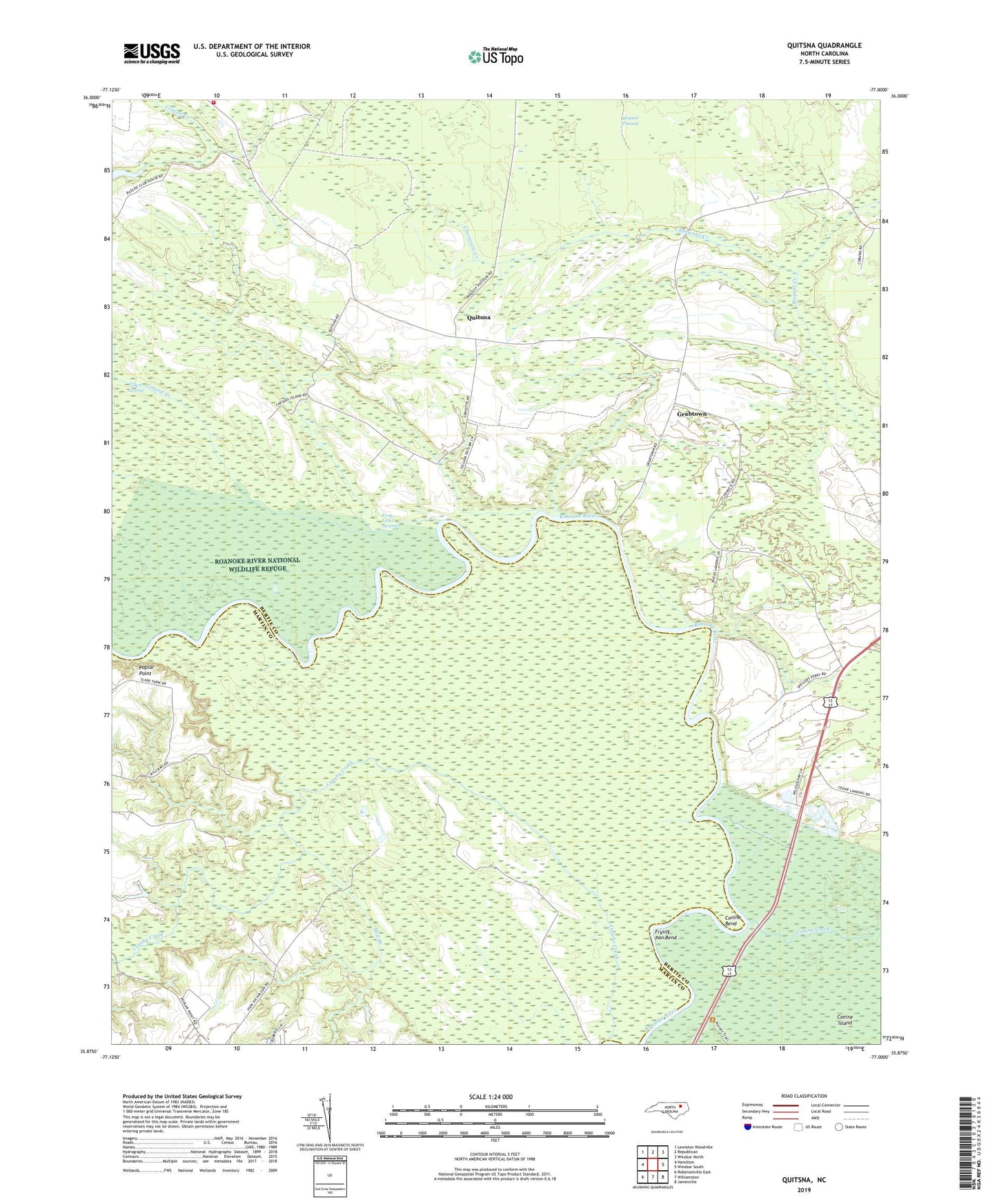
2019 topographic map quadrangle Quitsna in the state of North Carolina. Scale: 1:24000. Based on the newly updated USGS 7.5' US Topo map series, this map is in the following counties: Bertie, Martin. The map contains contour data, water features, and other items you are used to seeing on USGS maps, but also has updated roads and other features. This is the next generation of topographic maps. Printed on high-quality waterproof paper with UV fade-resistant inks.
Quads adjacent to this one:
West: Hamilton
Northwest: Lewiston Woodville
North: Republican
Northeast: Windsor North
East: Windsor South
Southeast: Jamesville
South: Williamston
Southwest: Robersonville East
Contains the following named places: Beacon Light Church, Blue Jay Volunteer Fire Company, Choowatic Creek, Conine Bend, Conine Island, Coniott Creek, Coniott Landing, Conoho Creek, Frog Level Swamp, Frying Pan Bend, Grabtown, Indian Woods Church, Macedonia Church, Mill Branch, Old Mill Landing, Poplar Point, Poplar Point Landing, Quitsna, Quitsna Landing, Saint Francis Church, Siloam Church, Spellers Ferry Landing, Township of Indian Woods