MyTopo
Windsor North North Carolina US Topo Map
Couldn't load pickup availability
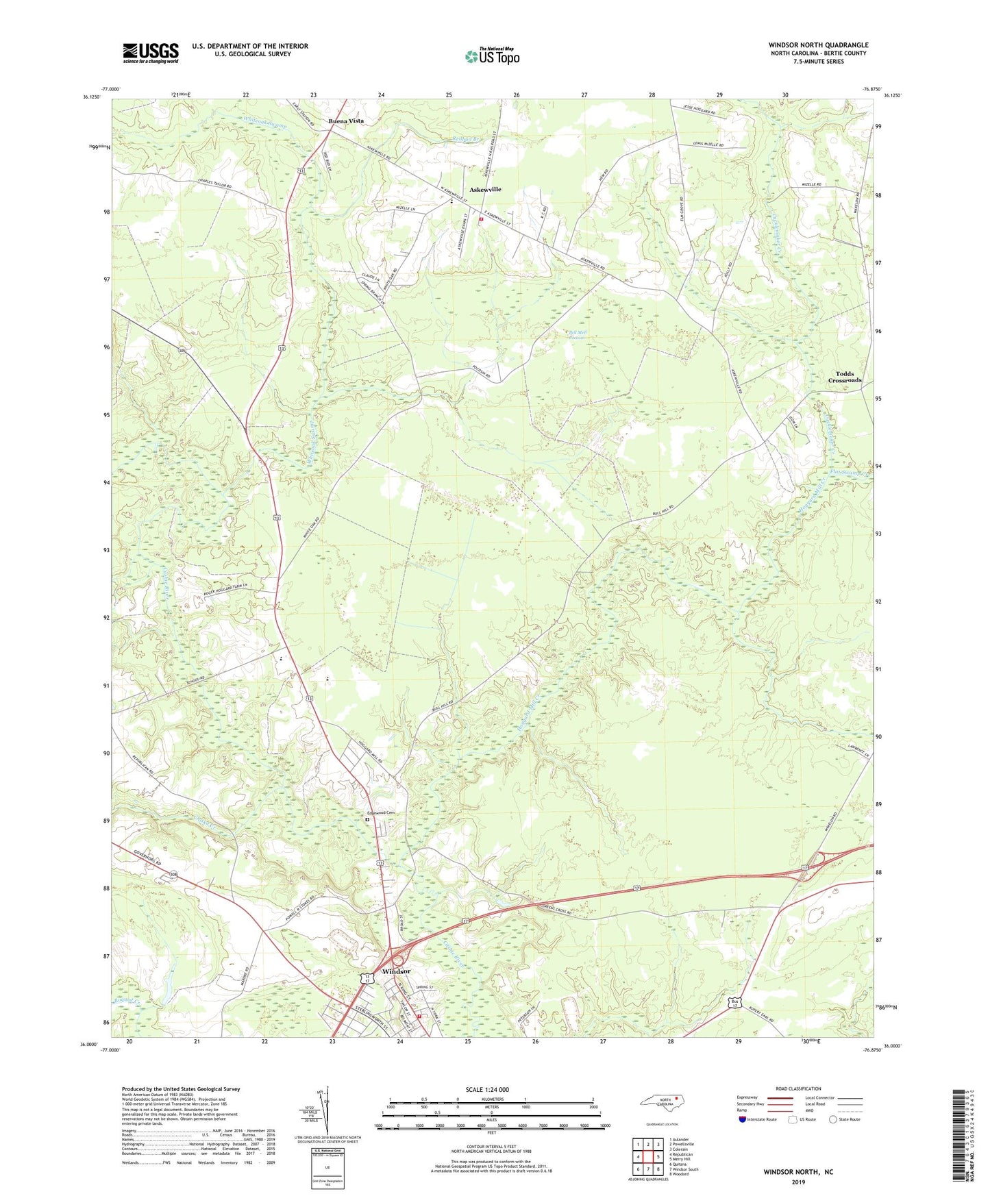
2022 topographic map quadrangle Windsor North in the state of North Carolina. Scale: 1:24000. Based on the newly updated USGS 7.5' US Topo map series, this map is in the following counties: Bertie. The map contains contour data, water features, and other items you are used to seeing on USGS maps, but also has updated roads and other features. This is the next generation of topographic maps. Printed on high-quality waterproof paper with UV fade-resistant inks.
Quads adjacent to this one:
West: Republican
Northwest: Aulander
North: Powellsville
Northeast: Colerain
East: Merry Hill
Southeast: Woodard
South: Windsor South
Southwest: Quitsna
This map covers the same area as the classic USGS quad with code o36076a8.
Contains the following named places: Askewville, Askewville School, Askewville Volunteer Fire Department, Bertie County, Bertie High School, Bethel Church, Buena Vista, Butlers, Cedar Fork Church, Chiska Creek, Cucklemaker Creek, Davis Park, Edgewood Cemetery, Edgewood Church, Flat Swamp Creek, Greens Cross Church, Hoggard Mill Creek, Lea Lumber Company Airport, Pell Mell Pocosin, Redbud Branch, Ross Church, Saint Matthews Church, Todds Crossroads, Town of Askewville, WDJB-FM (Windsor), Whiteoak Swamp, Windsor Fire Department, Wolfington